Reka (Kozarska grapa) - Črvov vrh (via Poliška grapa (Poličanka))
Starting point: Reka (Kozarska grapa) (232 m)
| Latitude/Longitude: | 46,11830°N 13,91720°E |
| |
Route name: via Poliška grapa (Poličanka)
Walking time: 3 h 5 min
Difficulty: very difficult pathless terrain
Elevation gain: 742 m
Elevation difference along the route: 780 m
Map:
Recommended equipment (summer): helmet
Recommended equipment (winter): helmet, ice axe, crampons
Views: 1.600
 | 2 people like this post |
Access to starting point:
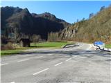
A) From Idrija or Cerkno we drive towards Tolmin, where in the settlement Reka we pay attention to the approaching start of the path. When we arrive at the bridge, where the main road crosses the stream Kozarska grapa and where on the right we notice a carpentry workshop, we turn left and park on the widened asphalt alongside the main road.
B) We drive to Bača pri Modreju (to here from Most na Soči or Podbrdo), and then we continue driving towards Idrija. In the settlement Reka, right behind the bridge, where we cross the stream Kozarska grapa, we turn right and park on the widened asphalt alongside the main road.
Route description:
From the starting point, we cross the stream Kozarska grapa (also Kazarska grapa) and continue along the main road in the direction of Most na Soči. We walk for a few minutes along the main road, then at the less noticeable crossing of the stream Poličanka we leave it and continue right, on the road alongside which there is a gate. After the gate we continue for a short time on the macadam road, then through a nicely maintained meadow we walk to the beginning of Poliška grapa. At first, we can easily follow the footpath which leads along the stream, then by feel a little on the left and a little on the right side of the stream. When we arrive at the first waterfall, we bypass it on the right side, where with the help of pegs we climb over brown scree, then we continue directly along the stream.
Also the second waterfall we bypass on the right side with the help of pegs, the next one also with the help of a few pegs, on the left side. Further on, on the steeper sections, occasional pegs still help us, for orientation also prusiks. The path ahead leads us along the right side of the stream (left bank), during the path we can admire views of waterfalls, rapids and pools. Follows a scenic, quite steep ascent through a chute, above the chute another wonderful view opens up on one of the waterfalls. Higher we arrive at a pipeline, alongside which we continue for a short time, then gradually return to the stream. We continue in and somewhat above the bed, where a prusik helps with orientation, the headwall of Poliška grapa we leave to the right, where with the help of pegs we begin to ascend steeply. From here a view also opens up on the last waterfall, named Hudičeva cerkev, and we ascend from the gully with orientational help from prusiks, which also serve as markers, where we encounter a footpath.
We follow the footpath to the left (if we cross it we ascend to the ridge, from which we can cross into Kozarska grapa, if we follow it to the right along the ridge rising above the gorge of Poličanka we return to the starting point - pictures of this descent section are added at the end of the description) and along it we descend somewhat to the bed of the stream, on the other side along visible old footpaths we ascend to a meadow, then to the plateau, from where only a short walk separates us from the church.
From the church we continue along a gently sloping asphalt road, which leads us with nice views across fairly flat terrain, where we pass a chapel and the stone Počivalec. Somewhat further we arrive at a smaller junction, where a road branches sharply to the right towards the valley, we continue straight into the village, where from the left the path through the neighbouring gully Sjaunk (Sejalnik) joins, one of the descent options into the valley. At the smaller junction we continue slightly left, at the next slightly right in the direction of Šentviška Gora (slightly left Police houses no. 20-23).
Here the asphalt ends, and already after a few steps we arrive at the next fork, where along the lower path (cart track) the marked path to Šentviška Gora continues, we continue along the upper path and along the macadam road. Follows mostly a traversing ascent on the slopes of Košarica (961 m), from where nice views occasionally open up, the path also leads past two streams, at the second there is also a nicely arranged trough where we can refill water. Further from the slope we arrive at the plateau and past a few houses to the asphalt road Šentviška Gora - Bukovski Vrh.
We follow the road to the left (right Bukovski Vrh) and in a few steps arrive at the next junction from which we continue right in the direction of Gorskega Vrha.
Behind the junction the road descends slightly, then begins to ascend more steeply and leads us past the Travnikar homestead, a bit higher it brings us to the next junction.
To the left the road continues towards the settlement Ponikve, to the right towards the settlement Bukovski Vrh, we continue straight on a beaten unmarked footpath which first ascends across a meadow, then transitions into the forest, where we cross the first grazing fence, when we exit the forest we cross the fence two more times.
Here we join the path from the village Ponikve, we continue straight towards Črvov vrh, where we already see the antenna tower on it. Follows another few minutes of moderate ascent, after crossing the grazing fence only a few steps of easy walking separate us from the summit.
We can descend through the neighbouring gully of the stream Sjaunk (Sejalnik), through which a followable footpath leads, or along the ridge mentioned in the description at the exit from Poliška grapa, or also along the access asphalt road.
Starting point - church in Policah 1:30, church in Policah - Črvov vrh 1:35.
Description and pictures refer to the condition in December 2019 and February and March 2020.
Author of photos no. 1 to 31 and 69 to 72 is Tadeja Črv.

Along the route: Cerkev Marijinega rojstva v Policah (526m), Police (550m), Gorski Vrh (827m)
Photos:
 1
1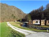 2
2 3
3 4
4 5
5 6
6 7
7 8
8 9
9 10
10 11
11 12
12 13
13 14
14 15
15 16
16 17
17 18
18 19
19 20
20 21
21 22
22 23
23 24
24 25
25 26
26 27
27 28
28 29
29 30
30 31
31 32
32 33
33 34
34 35
35 36
36 37
37 38
38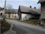 39
39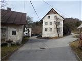 40
40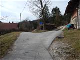 41
41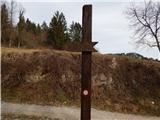 42
42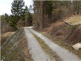 43
43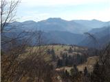 44
44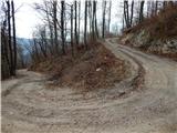 45
45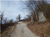 46
46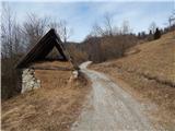 47
47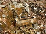 48
48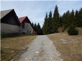 49
49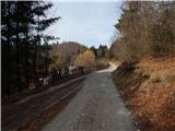 50
50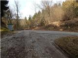 51
51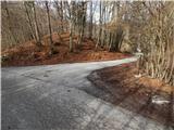 52
52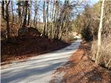 53
53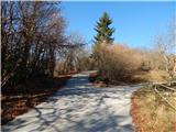 54
54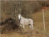 55
55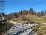 56
56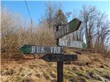 57
57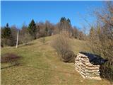 58
58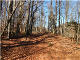 59
59 60
60 61
61 62
62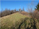 63
63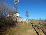 64
64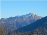 65
65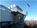 66
66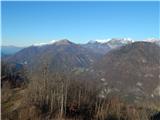 67
67 68
68 69
69 70
70 71
71 72
72
Discussion about the trip Reka (Kozarska grapa) - Črvov vrh (via Poliška grapa (Poličanka))
To post a comment you must log in:
If you do not yet have a username, you must first
register.