Reka - Sveti Ivan above Divje babe
Starting point: Reka (253 m)
| Latitude/Longitude: | 46,11750°N 13,92140°E |
| |
Walking time: 1 h
Difficulty: partly demanding marked way
Elevation gain: 320 m
Elevation difference along the route: 320 m
Map: Škofjeloško in Cerkljansko hribovje 1:50.000
Recommended equipment (summer): helmet
Recommended equipment (winter): helmet, ice axe, crampons
Views: 5.947
 | 2 people like this post |
Access to starting point:
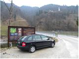
A) First, we drive to Idrija, and then we continue driving towards Tolmin. After a time the road brings us to a crossroad, where the road to Cerkno branches off to the right, and we here still continue straight, but we need to pay attention because we will soon get to the settlement Reka. Immediately after the end of the settlement, we first notice signs for Kojca and a few 10 meters ahead also for Šebrelje. Here a narrower road branches off to the left, which over a bridge through the river Idrijca brings us to a smaller parking lot by information boards for Archaeological park Divje babe.
B) From Most na Soči or Podbrdo we drive to the settlement Bača pri Modreju, and then we continue driving towards Idrija. Only a few 10 meters before the settlement Reka starts we turn right over a bridge through the river Idrijca and then park on a smaller parking lot by information boards.
Route description:
From the very starting point we can already see the church of St. Ivan, which stands on the top of a quite steep ridge and can serve for better orientation. From the starting point, we continue on the road which at first turns to the left and quickly brings us to a crossing at a hayrack. We continue right on the road to the last house where we then continue left and start ascending steeper on a grassy slope. Higher, the path brings us into the forest and continues to ascend. Occasionally a view opens up towards the peaks north from us and the path soon brings us to a smaller saddle. Further, the path runs on the southeastern side of the mountain and brings us on a steep and on some spots also precipitous slopes. The path is otherwise nice and quite wide, but some caution is recommended. Further, the path becomes less demanding and brings us on the road.
We continue right and only a shorter walk on a gentle road to the church of St. Ivan follows.
Photos:
 1
1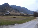 2
2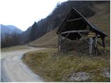 3
3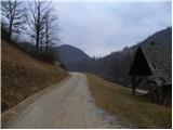 4
4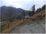 5
5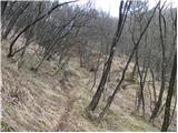 6
6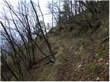 7
7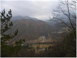 8
8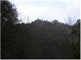 9
9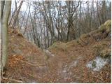 10
10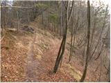 11
11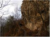 12
12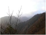 13
13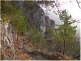 14
14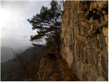 15
15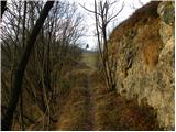 16
16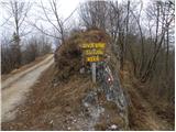 17
17 18
18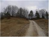 19
19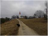 20
20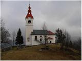 21
21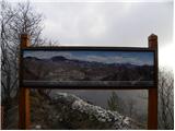 22
22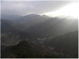 23
23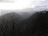 24
24
Discussion about the trip Reka - Sveti Ivan above Divje babe
|
| valerija11217. 08. 2014 |
Please, knowledgeable ones, for an explanation. If I'm standing at the church and looking left of Kojca, do I see the Rodica ridge or is it something closer? Thank you kindly.
|
|
|
|
| miri17. 08. 2014 |
On the left you have the village Police, straight ahead with a little church, Bukovo, behind the Rodica ridge.
|
|
|
|
| valerija11217. 08. 2014 |
Miri, thank you, I was counting on you. They wanted to convince me that that (Rodica) is just some little hill.
|
|
|
To post a comment you must log in:
If you do not yet have a username, you must first
register.