Reklanska dolina - Sart / Žrd
Starting point: Reklanska dolina (700 m)
| Latitude/Longitude: | 46,39370°N 13,44050°E |
| |
Walking time: 5 h 15 min
Difficulty: difficult marked way
Elevation gain: 1624 m
Elevation difference along the route: 1750 m
Map: Julijske Alpe - zahodni del 1:50.000
Recommended equipment (summer): helmet
Recommended equipment (winter): helmet, ice axe, crampons
Views: 8.649
 | 1 person like this post |
Access to starting point:
From Kranjska Gora over the border crossing Rateče we drive to Trbiž / Tarvisio. In Trbiž we continue left in the direction of Bovec and we follow the road to the crossroad near Rabeljsko jezero. Here we continue right in the direction of Nevejski preval / Sella Nevea. From the saddle, we descend on the road through numerous tunnels and galleries on the Reklanska side. Approximately 1 km after the last tunnel or gallery we park on one of the parking lots by the road.
From Bovec, we drive to the border crossing Predel, from which we descend to the Italian side. Only a little after Rabeljsko jezero we come to the crossroad, where we continue left in the direction of Nevejski preval / Sella Nevea. Further, follow the above description.
Route description:
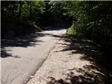
From the parking lot by the road we then descend a few dozen meters to the spot, where on the left side of the road we notice signposts for mountain pasture Gorjuda (Casera Goriuda). The path immediately leads into the forest, where it first gently then steeper and steeper ascends. After a good 20 minutes of walking, the path brings us to the first more demanding part, where with the help of steel cable we cross a wide and secured artificial ledge. A similar passage then repeats two more times, on all passages we are accompanied by dripping of water drops, so that we are pretty wet. The path then even steeper ascends on a steep and in wet slippery-dangerous slope. All key spots, mainly passages over gullies, are well secured. The problem arises only if we go on the path after heavy rain or thaw, when the gullies are full of water and then crossing is impossible. The steepness then decreases a little and a quite overgrown path then through the forest brings us below rocky cliffs, where the path turns sharply left. With the help of steel cable we cross one more short slightly exposed spot, after that problems vanish. Further, the path quickly brings us out of the forest and in front of us we notice old shepherd hut (converted into bivouac) on mountain pasture Gorjuda, where there is a path junction. We continue on the right side of the hut in the direction of bivouac Marussich on a quite overgrown path, which after a short ascent brings us back into the forest. A quite overgrown path a little further with the help of a small bridge crosses a torrent stream and then brings us into a thin mostly larch forest. Here the path gets very close to mighty limestone pavement slabs, and then it avoids them slightly to the right and ascends parallel with them. When the path for a short time flattens, on the right side we notice entrance into an ice cave. Here we can cool down a little, ascent into the cave because of the ice can be deadly dangerous. Further, a more and more scenic path over a series of valleys brings us to the high-mountain world of Kanin mountains. After a few more minutes of walking on plateau terrain we come to a poorly marked junction, where we continue left (right Tamaroz). The path ahead ascends on karst terrain full of limestone pavements and sinkholes so we carefully follow the path, which after a good 20 minutes of ascent from the junction brings us to the path Rifugio Giberti - Žrd. Here we continue right and follow the relatively gentle path to bivouac Marussich, which we reach after a few minutes. Only a few steps from the bivouac we come to saddle Peravo, where there is the next junction.
We continue straight in the direction of M.Sart on the path which starts ascending towards the west. Soon the path flattens and turns to the right northern side of Vrh Grubij. A quite gentle path then brings us to a nice high-mountain meadow (Škrbina v Senožečah), where we leave the mule track. We continue the ascent right and on a poorly visible path ascend to the ridge, where we continue the ascent. The path ahead steeply ascends on locally somewhat exposed ridge. After half-hour ascent, when we already think that we are on the summit we step on the forepeak of Žrd (in fog many think that this is the summit), from which a nice view opens up on our goal. A slight descent follows on barely visible path which still runs on partly exposed ridge. The ridge then slowly widens from the left side and the path after further few minutes of ascent brings us to a panoramic summit.
Starting point - mountain pasture Gorjuda 2:00, mountain pasture Gorjuda - bivouac Marussich 2:00, bivouac Marussich - Žrd 1:15.

Photos:
 1
1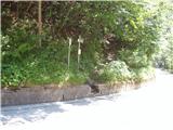 2
2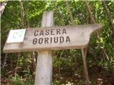 3
3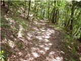 4
4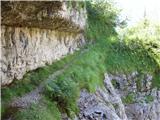 5
5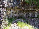 6
6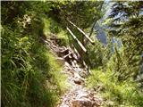 7
7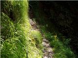 8
8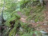 9
9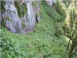 10
10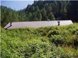 11
11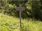 12
12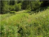 13
13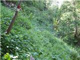 14
14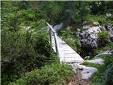 15
15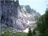 16
16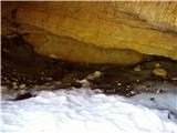 17
17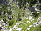 18
18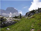 19
19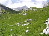 20
20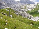 21
21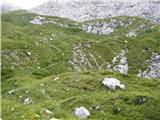 22
22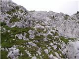 23
23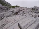 24
24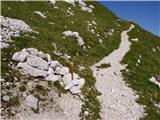 25
25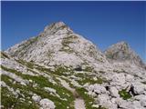 26
26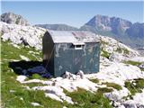 27
27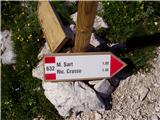 28
28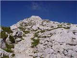 29
29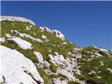 30
30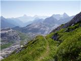 31
31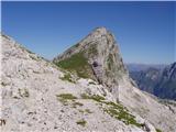 32
32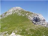 33
33 34
34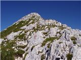 35
35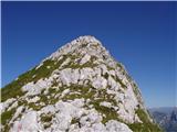 36
36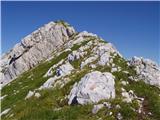 37
37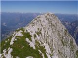 38
38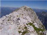 39
39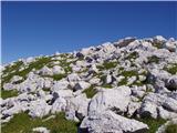 40
40 41
41
Discussion about the trip Reklanska dolina - Sart / Žrd
|
| mirank9. 11. 2017 |
We finished the tour to Žrd a couple of years ago with a descent along this path to planina Zg gorjuda and then in the area of the planina turned right and crossed on a path to the saddle where we had the car at the cable car. This path stuck in my memory because of the nasty slippery rocks before you reach the mentioned planina (similar to Koti above Lengarjev rout) and specifically the interesting path to N saddle, which draaaags on...
|
|
|
|
| darinka423. 08. 2023 22:45:50 |
Not long ago Marijan and I turned back at bivouac Marušič because it clouded over at 12 o'clock although forecast was only late afternoon. Then we took the lower path from Selle Neveje. Descended in rain past Rifugio Gilberti to the starting point. Today all three of us decided to go to Žrd from Solbice. By motorway to Tolmzza and then on that narrow road to the starting point. Nice path. To bivouac Igor Crasso. Which is exemplary maintained. Then along the marked path to the top. Those thunderstorms with pop tv that were forecast yesterday somehow disappeared. We had great weather. True though that this path is long and demanding in terms of fitness. Even more adrenaline was the drive back on the narrow road to Učje. I really don't recommend that. Somehow we survived it.
|
|
|
To post a comment you must log in:
If you do not yet have a username, you must first
register.