Remšendol - Rifugio Cinque Punte (via 518)
Starting point: Remšendol (880 m)
| Latitude/Longitude: | 46,48330°N 13,61210°E |
| |
Route name: via 518
Walking time: 2 h
Difficulty: partly demanding marked way
Elevation gain: 640 m
Elevation difference along the route: 640 m
Map: Julijske Alpe - zahodni del 1:50.000
Recommended equipment (summer): helmet
Recommended equipment (winter): helmet, ice axe, crampons
Views: 7.881
 | 1 person like this post |
Access to starting point:
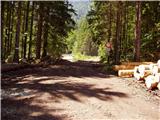
Over the border crossing Rateče we drive towards Trbiž/Tarvisio. Only a few meters before the mentioned town (immediately after the longer underpass under the railway track) a road branches off sharply to the left towards the village Koprivnik/Ortigara and Male Rovte/Rutte piccolo. We head onto this road, which through Male Rovte brings us to a crossroad above the mentioned village. We continue left (right Pliči/Plezzut) on an even somewhat narrower road, which lies higher up, and after a short descent brings us to the next crossroad, where near it we park (we park so that we do not hinder forestry work).
Access is also possible over the border crossing Predel (in the place Pliči/Plezzut we turn right, and then we join the road from the above description).
Route description:
From the crossroad, we head right onto the forest road closed to traffic in the direction of "Bivio, La Portella and Cave del Predil". The road, which barely noticeably ascends, brings us after approximately 15 minutes of walking to a crossroad, where path no. 511 branches off to the right (ascent also possible on this path), while we continue straight on the "main" road, which a little further brings us out of the forest onto the extensive scree fields of the Remšendol valley.
Across the scree fields we continue along the right side (here the blazes are less frequent due to torrent deposits), then we notice the blazes that direct us slightly right onto an initially gentle mountain path (path no. 518).
The path ahead ascends gently parallel to the valley, then after crossing a gully it enters the forest belt. A short steep ascent through the forest follows, then the path brings us to the foot of steep cliffs (danger of falling rocks), where we step onto an indistinct and exposed ledge along which we continue the ascent. A gentle traversing ascent follows on an occasionally exposed slope (in wet conditions great risk of slipping), then the path brings us to a mighty gully. We cross the mentioned gully (at high water level the crossing is impossible!) and then on the other side we begin to ascend very steeply alongside the gully upwards (great risk of slipping). Higher up the steepness eases and the path, which runs through the forest the whole time, brings us after approximately 2 hours of walking from the starting point to the hut or bivouac Rifugio Cinque Punte, from which a fine view opens onto the walls of the Rabeljske špice.

Photos:
 1
1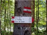 2
2 3
3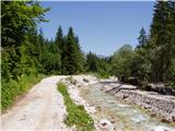 4
4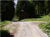 5
5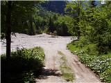 6
6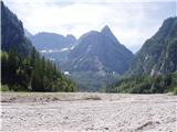 7
7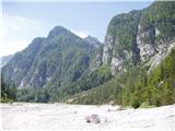 8
8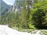 9
9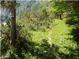 10
10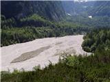 11
11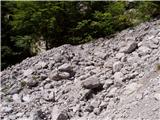 12
12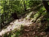 13
13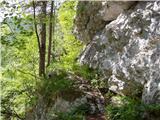 14
14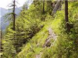 15
15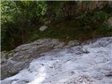 16
16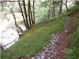 17
17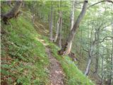 18
18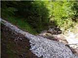 19
19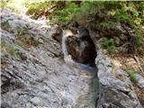 20
20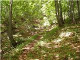 21
21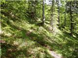 22
22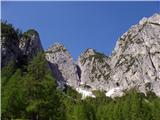 23
23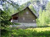 24
24
Discussion about the trip Remšendol - Rifugio Cinque Punte (via 518)
To post a comment you must log in:
If you do not yet have a username, you must first
register.