Resnica / Ressnig - Aussicht Petelinz
Starting point: Resnica / Ressnig (425 m)
| Latitude/Longitude: | 46,54520°N 14,29740°E |
| |
Walking time: 1 h
Difficulty: easy marked way
Elevation gain: 179 m
Elevation difference along the route: 200 m
Map: Karavanke - osrednji del 1:50.000
Recommended equipment (summer):
Recommended equipment (winter): crampons
Views: 1.924
 | 1 person like this post |
Access to starting point:
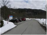
From the Ljubljana - Jesenice highway, take the Ljubelj (Tržič) exit, then continue driving in the direction of Celovec / Klagenfurt. After the Ljubelj tunnel, the road starts descending, and we follow it to the village Podgora / Unterbergen (Podgora is the first village after the village Podljubelj / Unterloibl). In the middle of the village Podgora, pay attention because we will turn right in the direction of "zum Hofer". After a short descent, we quickly arrive in Borovlje / Ferlach, where a little further on we join the main road, which we follow to the right. On the main road we drive only about 10 meters, then just before the bridge over Ljubeljska Borovnica / Grießbach we turn left towards the village Resnica / Ressnig. At the following crossroads we continue straight, and we drive along the road to the marked parking lot in front of the hydropower plant Borovlje.
Route description:
Before the parking lot, a somewhat narrower asphalt road branches off to the left, on which we start our hike. We walk about 10 steps on the mentioned road, then signs for "pohod miru v Rožu" direct us right onto the asphalt path, on which we quickly ascend to HE Borovlje. From here, a nice view opens up on the central Karawanks and the Borovlje dam lake / Ferlacher Stausee and towards the castle Humberk / Hollenburg. We continue across the dam over the river Drau, then on the other side to the left, where we ascend briefly along the edge of the lake. The path then turns slightly to the right and splits into two parts. We continue right on the wide path, which moderately ascends through the forest. A little higher, a path branches off to the right to a chapel a few minutes away, but we continue left and follow the wide path to the next marked junction, where we turn sharply right in the direction of "Petelinz" (straight to Žihpolje / Maria Rain).
The poorer road gradually turns into a wide cart track, which mostly continues through the forest. A little higher, another path from Žihpolje joins from the left. Here we continue straight, then a little further we arrive at the next junction, where we continue slightly right (slightly left to Št. Urh / St. Ulrich (marked on signs only as Rosentalmarsch)).
A few minutes further, we arrive at the first viewpoint with a bench, from which the view due to nearby trees is nothing special. From the first bench, we continue in the direction of "Petelinz" and begin to descend moderately to steeply towards the second, more scenic viewpoint with a bench, from which a nice view opens towards the river Drau, Borovlje, and the Karawanks.

Photos:
 1
1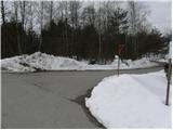 2
2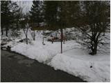 3
3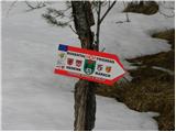 4
4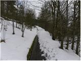 5
5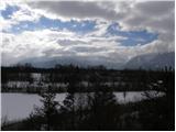 6
6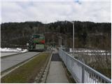 7
7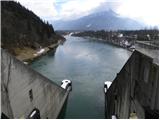 8
8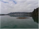 9
9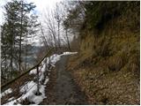 10
10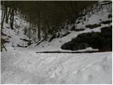 11
11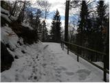 12
12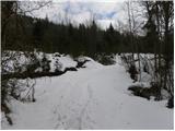 13
13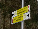 14
14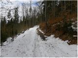 15
15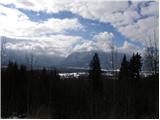 16
16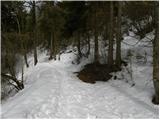 17
17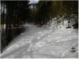 18
18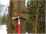 19
19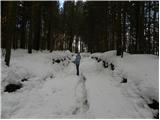 20
20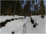 21
21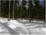 22
22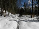 23
23 24
24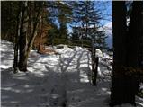 25
25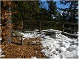 26
26 27
27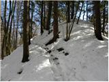 28
28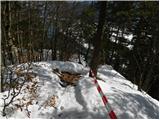 29
29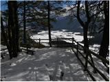 30
30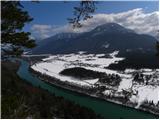 31
31 32
32
Discussion about the trip Resnica / Ressnig - Aussicht Petelinz
To post a comment you must log in:
If you do not yet have a username, you must first
register.