Rezman - Ruš (on northeast ridge)
Starting point: Rezman (950 m)
| Latitude/Longitude: | 46,39130°N 14,46880°E |
| |
Route name: on northeast ridge
Walking time: 2 h 15 min
Difficulty: very difficult pathless terrain
Elevation gain: 664 m
Elevation difference along the route: 740 m
Map: Karavanke - osrednji del 1:50.000
Recommended equipment (summer):
Recommended equipment (winter): ice axe, crampons
Views: 3.683
 | 1 person like this post |
Access to starting point:
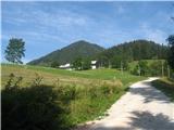
From the highway Ljubljana - Jesenice, take the exit Kranj - east and follow the road ahead in the direction of "Zgornje Jezersko". Just a few hundred meters ahead from the inn Kanonir, we will notice on the left side of the main road signposts for Stegovnik, which direct us onto a steep macadam road. We then follow this ascending road past the farm Rezman to the beginning of the footpath to Stegovnik. We can park already a little lower on one of the parking lots by the road, which is maybe even wiser.
Route description:
If we've parked a little below the farm Rezman, we continue on the road further and to the farm it won't be far.
Above the farm Rezman, signposts for Stegovnik point us to the right on a wide ascending cart track, which we then follow past transmitters to a marked crossing. We continue right in the direction of Stegovnik on a somewhat narrower cart track, which further ascends diagonally on the northeastern slopes of Bukovec. Higher, the path flattens, and then in a gentle descent brings us to a smaller abandoned mountain pasture, by the edge of which there is a hunting cottage.
From the hunting cottage, we continue on a marked path, which after the mountain pasture turns slightly to the left and then starts ascending towards Močnikovo sedlo, which we reach after 15 minutes of additional ascent.
A few steps below the saddle, to the right steeply downwards (towards the north) an overgrown cart track descends, which we follow to a crossroad, where a somewhat better cart track turns steeply right downwards, and our even worse one continues horizontally across the slopes. This one ends very quickly and suddenly, and right at its end, towards Spodnji Ruš, a worse but eventually clearly visible footpath continues, which through the spruce forest slightly upwards across the slopes brings us to the NE ridge of Ruš. Here our footpath turns steeply downwards, but we turn right towards the southwest onto the NE ridge of Ruš. At the beginning, one might still sense an extremely faint footpath, which quickly disappears. At the beginning, the terrain is still nicely walkable and forested, but gradually increasingly rocky and craggy and harder to pass. The ridge narrows more and more, on the right precipices begin to gape, and the terrain is still forested or larches prevail, with some grass as well. The terrain is in places also scenic, partly panoramic but also demanding. When sometimes it really doesn't go along the ridge, we retreat to the left into steep forested pathless terrain. Eventually, the ridge becomes easier to pass and flattens. When we step onto a smaller meadow and spot a partly grassy summit, we are right below the summit.

Photos:
 1
1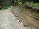 2
2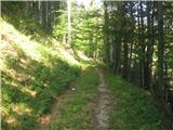 3
3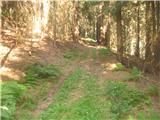 4
4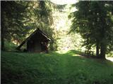 5
5 6
6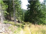 7
7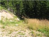 8
8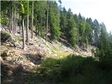 9
9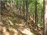 10
10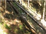 11
11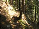 12
12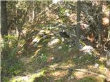 13
13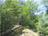 14
14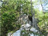 15
15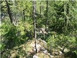 16
16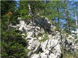 17
17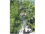 18
18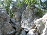 19
19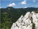 20
20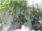 21
21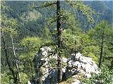 22
22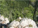 23
23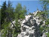 24
24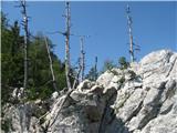 25
25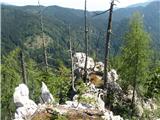 26
26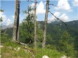 27
27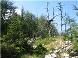 28
28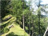 29
29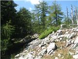 30
30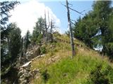 31
31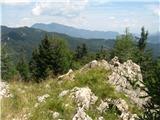 32
32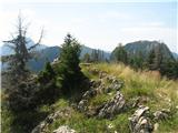 33
33 34
34
Discussion about the trip Rezman - Ruš (on northeast ridge)
|
| ljubitelj gora18. 10. 2015 |
Afternoon via the NE ridge to Ruš. I started below Robnik, before the barrier, at the sharp right bend I leave the cart track and head along the hunting path, pathless to the start of the ridge (Komatevra).
|
|
|
To post a comment you must log in:
If you do not yet have a username, you must first
register.