Ribnica na Pohorju - Ribniška koča
Starting point: Ribnica na Pohorju (714 m)
| Latitude/Longitude: | 46,53320°N 15,26690°E |
| |
Walking time: 2 h 10 min
Difficulty: easy marked way
Elevation gain: 793 m
Elevation difference along the route: 793 m
Map: Pohorje 1:50.000
Recommended equipment (summer):
Recommended equipment (winter):
Views: 25.580
 | 1 person like this post |
Access to starting point:
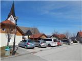
A) From the road Maribor - Dravograd, before the settlement Brezno we turn left in the direction of Podvelka, Ribnica na Pohorju and Ribniška koča. After the bridge over the river Drava we arrive in Podvelka, but we follow the road further in the direction of Ribnica na Pohorju. After approximately 10 km from the bridge over the Drava we arrive at the center of Ribnica na Pohorju, where we go left and then a little further ahead park on the parking lot in the center of the settlement. The parking lot is located a little ahead from the parish church of St. Jernej.
B) From Dravograd we drive towards Maribor, after Radlje ob Dravi at the roundabout we leave the main road towards Maribor and continue driving in the direction towards Vuhred, Ribnica na Pohorju and Ribniška koča. After the bridge over the river Drava we arrive in Vuhred, but we follow the road further in the direction of Ribnica na Pohorju. After approximately 10 km from the bridge over the Drava we arrive at the center of Ribnica na Pohorju, where we go right and then a little further ahead park on the parking lot in the center of the settlement. The parking lot is located a little ahead from the parish church of St. Jernej.
Route description:
From the center of Ribnica na Pohorju we first continue on an ascending asphalt road, from which we soon go right in the direction of Koča na Pesniku. We quickly arrive at the foot of the ski slope, where we leave the road and continue the ascent left along the edge of the ski slope. When we ascend to the top of the ski slope, we cross a strip of forest, then we reach the macadam road, where the path flattens. We continue for some time on the road which leads through the forest, higher we arrive at a junction from which we continue straight on the footpath in the direction of Koča na Pesniku. There follows approximately 15 minutes of moderate ascent and the path brings us out of the forest, where we already see the mountain hut ahead of us, to which only a few minutes of easy walking remain.
From the hut we walk to the road which leads to Ribniška koča, which we follow to the left, but walk only a few steps on it, since from the nearby junction we continue on the footpath which ascends between both roads. There follows an ascent on a cart track which higher has quite a few junctions, where we follow the fairly frequent blazes. Higher the cart track, which for most of the time runs through the forest, changes into a footpath which begins to ascend more steeply. During the ascent the path leads us past the hunting hut, above it we arrive at the ski slope of the ski resort Ribniško Pohorje. We continue along the edge of the ski slope and the increasingly panoramic path brings us to Ribniška koča on Pohorje.
Ribnica na Pohorju - Koča na Pesniku 1:05, Koča na Pesniku - Ribniška koča 1:05.

Photos:
 1
1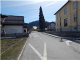 2
2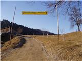 3
3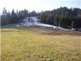 4
4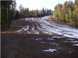 5
5 6
6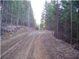 7
7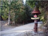 8
8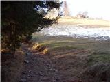 9
9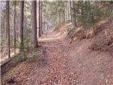 10
10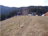 11
11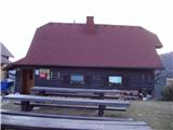 12
12 13
13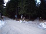 14
14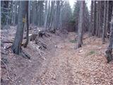 15
15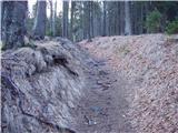 16
16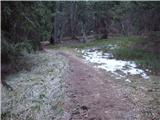 17
17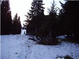 18
18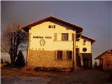 19
19
Discussion about the trip Ribnica na Pohorju - Ribniška koča
|
| pohodnik3823. 01. 2012 |
On Sunday 22 January I did this trail partly on the road, half on the marked path...little snow on the path but icy in places...nice day and nice views from Črni vrh-highest point of Pohorje...some pictures at this link.
|
|
|
|
| jprim24. 01. 2012 |
Congratulations on the excellent site.
LP!
|
|
|
|
| izidor226. 01. 2012 |
Tomorrow I'll set out on this trail!
|
|
|
|
| izidor227. 01. 2012 |
Today dragged my heels to Črni vrh, weather was wonderful no wind, path nicely trodden only last 100m before Ribniška koča the wind blew some snow and it was crusty so I sank to my knees which cost me my last strength. Otherwise it was a nice hike.
|
|
|
|
| krpak30. 08. 2021 12:50:06 |
Very well marked path from Ribnica to Ribniška koča
|
|
|
|
| Mašika18. 12. 2022 18:25:27 |
Was there today, the path is really well marked - it has to be, at least for winter conditions...snow on the path, but it's trampled down. Hut renovated, nice, modern.
|
|
|
|
| felix19. 12. 2022 16:18:23 |
What about the Ribniška - Kope path, is it trodden at all?
|
|
|
|
| Amadej21. 12. 2022 23:19:49 |
Does anyone know if there's snow on Črni vrh? Thanks for the reply.
|
|
|
|
| mornar3. 10. 2023 17:23:29 |
Please provide information on where the stamp from the hut is located, as it is not always open. Thank you and best regards.
|
|
|
|
| turbo3. 10. 2023 20:34:26 |
|
|
|
To post a comment you must log in:
If you do not yet have a username, you must first
register.