Ribnica na Pohorju - Ribniška koča (by road)
Starting point: Ribnica na Pohorju (714 m)
| Latitude/Longitude: | 46,53320°N 15,26690°E |
| |
Route name: by road
Walking time: 2 h 50 min
Difficulty: easy marked way
Elevation gain: 793 m
Elevation difference along the route: 800 m
Map: Pohorje 1:50.000
Recommended equipment (summer):
Recommended equipment (winter):
Views: 10.550
 | 1 person like this post |
Access to starting point:
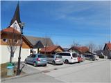
A) From the road Maribor - Dravograd, before the settlement Brezno we turn left in the direction of Podvelka, Ribnica na Pohorju and Ribniška koča. After the bridge over the river Drava we get to Podvelka, and we follow the road further in the direction of Ribnica na Pohorju. After approximately 10 km from the bridge over the river Drava we get to the center of Ribnica na Pohorju, where we go left and then a little ahead we park on a parking lot in the center of the settlement. The parking lot is located a little ahead from the parish church of St. Jernej.
B) From Dravograd we drive towards Maribor, after Radlje ob Dravi at the roundabout we leave the main road towards Maribor and we continue driving in the direction towards Vuhred, Ribnica na Pohorju and Ribniška koča. After the bridge over the river Drava we get to Vuhred, and we follow the road further in the direction of Ribnica na Pohorju. After approximately 10 km from the bridge over the river Drava we get to the center of Ribnica na Pohorju, where we go right and then a little ahead we park on a parking lot in the center of the settlement. The parking lot is located a little ahead from the parish church of St. Jernej.
Route description:
From the center of Ribnica na Pohorju we continue on an ascending asphalt road, from which soon to the right a marked path branches off, and we continue on the road which above the settlement passes into the forest. Next follows an ascent through the forest, where we cross the stream Ribniški potok, and the road which turns left a little further brings us to a crossroad from which we continue on the right road in the direction of the mountain hut Ribniška koča (left - homesteads Jakob, Kop and Gosak). Next follows a diagonal ascent towards the right, where the road crosses some streams, and then it slowly starts turning more and more to the left, where we also cross a marked path.
We continue straight through a large clearing, and then also through a strip of forest. When we again step out of the forest from the crossroad we continue left in the direction of the mountain hut Koča na Pesniku, to which only a short walk separates us.
From the mountain hut we return to the main road, and at the nearby crossroad we continue slightly left in the direction of the driving road to Ribniška koča. A little further we continue on the slightly right road, a little higher straight on. After the mentioned crossroad we soon get to the parking lot at the foot of the ski slope Ribniško Pohorje. Next follows crossing of ski runs, and then the road turns sharply right and brings us higher to the saddle between Jezerski vrh on the left and Mali Črni vrh on the right.
Here from the road to the left a marked path branches off, which over Jezerski vrh leads further towards Rogla, and we continue right and on the road which runs parallel with the marked path, after approximately 10 minutes of additional walking with increasingly beautiful views we get to the mountain hut Ribniška koča.
Ribnica na Pohorju - Pesnik 1:25, Pesnik - Ribniška koča 1:25.

Photos:
 1
1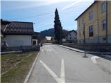 2
2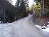 3
3 4
4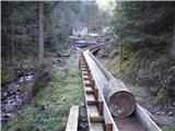 5
5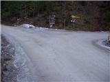 6
6 7
7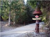 8
8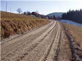 9
9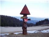 10
10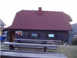 11
11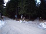 12
12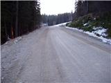 13
13 14
14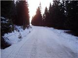 15
15 16
16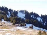 17
17 18
18
Discussion about the trip Ribnica na Pohorju - Ribniška koča (by road)
|
| klavdy610. 01. 2009 |
very nice, especially when there is fog in the valley
|
|
|
To post a comment you must log in:
If you do not yet have a username, you must first
register.