Ribniška koča - Ostruščica (via Lovrenška jezera)
Starting point: Ribniška koča (1507 m)
| Latitude/Longitude: | 46,49740°N 15,25550°E |
| |
Route name: via Lovrenška jezera
Walking time: 3 h 15 min
Difficulty: easy marked way
Elevation gain: -9 m
Elevation difference along the route: 380 m
Map: Pohorje 1:50.000
Recommended equipment (summer):
Recommended equipment (winter): ice axe, crampons
Views: 175
 | 1 person like this post |
Access to starting point:
A) From the road Maribor - Dravograd, before the settlement Brezno we turn left in the direction of Podvelka, Ribnica na Pohorju and Ribniška koča. After the bridge over the river Drava we arrive in Podvelka, and we follow the road further in the direction of Ribnica na Pohorju. After approximately 10 km from the bridge over the Drava we arrive in the center of Ribnica na Pohorju, where we go left. Follows approximately 8 km of ascent, mostly on the macadam road, to Ribniška koča, where we park.
B) From Dravograd we drive towards Maribor, after Radlje ob Dravi at the roundabout we leave the main road towards Maribor and continue driving in the direction of Vuhred, Ribnica na Pohorju and Ribniška koča. After the bridge over the river Drava we arrive in Vuhred, and we follow the road further in the direction of Ribnica na Pohorju. After approximately 10 km from the bridge over the Drava we arrive in the center of Ribnica na Pohorju, where we go right. Follows approximately 8 km of ascent, mostly on the macadam road, to Ribniška koča, where we park.
Route description:
From Ribniška koča we take the path in the direction of Jezerski vrh and Ribniško jezero and initially walk on the road by which we arrived at the starting point, which leads us in a gentle descent to the saddle between Mali Črni vrh and Jezerski vrh. On the saddle, where it is also possible to park, we leave the road and head for the marked footpath, which first gently and then more steeply ascends to the monument on Jezerski vrh, which we reach in approximately 10 minutes of ever more panoramic ascent.
From Jezerski vrh we continue slightly left in the direction of Lovrenška jezera and Rogla (left: Ribniško jezero 5 minutes) and begin descending through thin forest. Soon a path joins from the left that leads past Ribniško jezero; we continue first with a moderate descent through thin forest, then pass into dense forest, and the path descends a bit more steeply. During the descent a short path branches off to the left to the memorial for the unfortunate aviators, and we continue the descent to the saddle Šiklarica. After the saddle we start ascending again, and at a few smaller junctions we follow the blazes. A little further we pass a spring, after which we ascend quite steeply for a few minutes. Higher the path levels out and leads us from the forest onto the meadow Planinka, across which we ascend mostly gently to moderately amid ever finer views. Higher the path turns right, and shortly after a path joins from the left from Lovrenc na Pohorju. There follows some more traversing with fine views, then the path enters thin forest, where it runs below the plateau of Lovrenška jezera, consequently crossing a greater number of small streams. After a few minutes of traversing we reach a marked junction, where we continue left towards Lovrenška jezera and Rogla (slightly right: Rogla - path bypassing Lovrenška jezera) and begin to ascend along wooden walkways. After a few minutes of ascent we meet the eastern path from Rogla, go left, and soon reach the viewpoint tower at Lovrenška jezera.
From the tower a fine view opens onto the plateau where the lakes lie, and from the tower we continue on wooden walkways that lead us through dwarf pines to the lakes.
From the lakes we return to the last junction and continue towards Rogla and Koča na Pesku.
Follows a descent through partly thin forest, where we first mostly walk on wooden walkways, lower on a cart track that with a few shorter ascents and descents traverses slopes to the left. During the traverse the path also leads us over several streams, and on the level section we reach a marked junction, from which we continue straight towards Rogla (left downhill: Koča na Pesku and Mašin žaga). There follows some easy traversing and we arrive at the saddle Komisija, where we meet the path bypassing Lovrenška jezera.
We continue straight towards Rogla and ascend in moderate ascent to the indistinct summit of Ostruščica.
Ribniška koča - Jezerski vrh 0:15, Jezerski vrh - Lovrenška jezera 1:50, Lovrenška jezera - Ostruščica 1:10.
Description refers to the condition in October 2022, pictures are from various periods.

Photos:
 1
1 2
2 3
3 4
4 5
5 6
6 7
7 8
8 9
9 10
10 11
11 12
12 13
13 14
14 15
15 16
16 17
17 18
18 19
19 20
20 21
21 22
22 23
23 24
24 25
25 26
26 27
27 28
28 29
29 30
30 31
31 32
32 33
33 34
34 35
35 36
36 37
37 38
38 39
39 40
40 41
41 42
42 43
43 44
44 45
45 46
46 47
47 48
48 49
49 50
50 51
51 52
52 53
53 54
54 55
55 56
5657
 58
58 59
59 60
60 61
61 62
62 63
63 64
64 65
65 66
66 67
67 68
68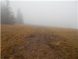 69
69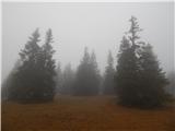 70
70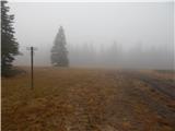 71
71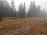 72
72 73
73
Discussion about the trip Ribniška koča - Ostruščica (via Lovrenška jezera)
To post a comment you must log in:
If you do not yet have a username, you must first
register.