Rifugio Auronzo - Lastron dei Scarperi / Schusterplatte
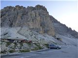
Starting point: Rifugio Auronzo (2320 m)
| Latitude/Longitude: | 46,61220°N 12,29410°E |
| |
Walking time: 4 h 10 min
Difficulty: difficult pathless terrain
Elevation gain: 637 m
Elevation difference along the route: 800 m
Map: Tabacco 10 1:25.000
Recommended equipment (summer): helmet
Recommended equipment (winter): helmet, ice axe, crampons
Views: 1.710
 | 4 people like this post |
Access to starting point:
Access from Gorenjska: Via the border crossing at Rateče, we drive to Trbiž / Tarvisio, where we turn onto the motorway in the direction of Udine. We leave the motorway at the Tolmezzo exit and follow the road to the mentioned town. From Tolmezzo, we continue in the direction of the town of Ampezzo and the mountain pass Passo della Mauria. The road then starts descending and brings us into the Cadore valley, where we continue right (left Belluno and Cortina d'Ampezzo) in the direction of the town of Auronzo. After a few additional km of driving, we come to the next larger intersection, where we turn right towards the Misurina pass and Tre Cime (left Tre Crocci pass). From the Misurina pass, the road starts descending and quickly brings us to an intersection where the signs for Tre Cime direct us right onto the toll mountain road, which after 7 km brings us to the large parking lot near the Rifugio Auronzo hut.
From the Primorska side: We drive on the motorway towards Venice / Venezia. Near Portogruaro, we leave the motorway towards Venice and continue right on the motorway towards Pordenone. At the next motorway junction near Conegliano, we continue right towards Belluno. Near Belluno, the motorway ends, and we continue in the direction of Cortina d'Ampezzo and Auronzo. When the road brings us into the Cadore valley, we come to a larger intersection, where the road to Cortina d'Ampezzo goes left, and to Auronzo right. Here we continue right towards Auronzo. Further, we follow the above description.
Route description:
At the Auronzo hut, we head onto the gravel road towards the Lavaredo hut, slightly eastwards. The very scenic, gently sloping road leads us below the mighty walls of the Tre Cime. To the right downwards, path 1104 soon branches off into the Val Marzon valley, while we continue on the wide and gentle path, which then leads past the Maria Ausiliatrice chapel. The path then turns slightly left and we soon reach the Lavaredo hut, located on the eastern side of the Tre Cime.
A few tens of metres before the hut, we can turn left onto a footpath, which then ascends transversely across the scree below the Tre Cime. The second option is to continue from the hut on the wide path, which is also used by vehicles supplying the Locatelli hut. Both paths then reunite at the Forcella Lavaredo notch.
At the notch, a poorly marked path branches off to the right upwards towards Monte Paterno, while we continue on the wide path towards the Locatelli hut, which we can already see. From the notch, we begin a slight descent all the way to the junction just before the hut. At the mentioned junction, the path to the Langalm Hütte hut and down the valley to Lago di Landro lake branches off left. Here we continue right, followed only by a short ascent to the Locatelli hut.
From the hut, we continue north on path 102, which begins a slight descent. The path leads past a cross, next to which there is also a small bench and table. Just after the mentioned cross, we reach a junction. We turn left following the signs for «Lastron dei Scarperi». The path then crosses mostly grassy slopes on the eastern side of the Torre di Toblin peak and brings us to the Forcella di San Candido notch on the north-eastern side of the said peak.
At the notch, the signpost directs us right, and then in ascent we cross the slopes on the right south side of the ridge. The path soon turns left and brings us to a smaller notch. Here we continue to the north side on the path, which in descent crosses a fairly steep and crumbly slope. On this section, some caution is required. Further on, the path ascends through the valley on the western side of the Crodon di San Candido peak. The path is relatively well-trodden, aided by cairns and some faded markers. Here we first ascend the scree, then a somewhat steeper rocky section follows, where the climbing does not exceed grade I. After the rocky section, scree ascent resumes, bringing us to an unmarked junction.
At the junction, we continue left; right leads the path to the Crodon di San Candido summit. Further, we continue ascending the scree, and just before reaching the ridge, the path brings us to the entrance of a gully through which the passage to the summit slopes of the mountain leads.
On the ascent through the gully, a helmet is mandatory, as there is quite a lot of scree on the path. We ascend the gully upwards for a while longer, but when it becomes very narrow, the cairns direct us left upwards. The first few metres out of the gully are somewhat steeper and require extra caution. The path then leads above the gully and, just before the notch, turns decisively left. The path becomes somewhat less steep and brings us to the south side of the peak. Here we continue slightly right and soon reach the ridge. Along the scenic and easy ridge, we soon reach the summit.
We descend along the ascent path.

Photos:
 1
1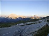 2
2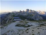 3
3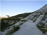 4
4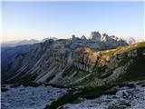 5
5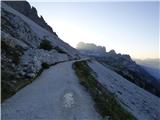 6
6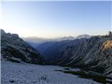 7
7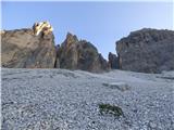 8
8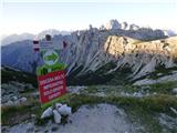 9
9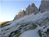 10
10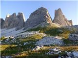 11
11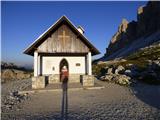 12
12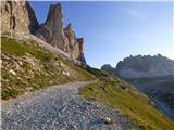 13
13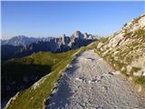 14
14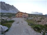 15
15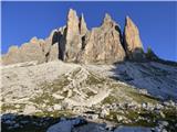 16
16 17
17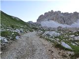 18
18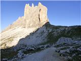 19
19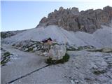 20
20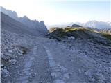 21
21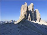 22
22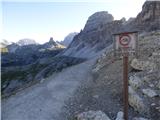 23
23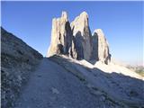 24
24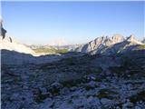 25
25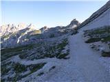 26
26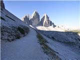 27
27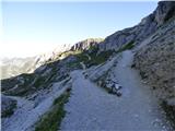 28
28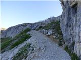 29
29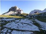 30
30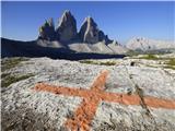 31
31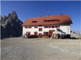 32
32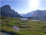 33
33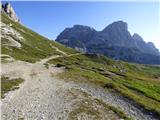 34
34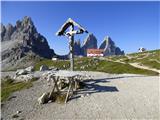 35
35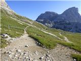 36
36 37
37 38
38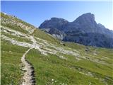 39
39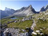 40
40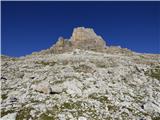 41
41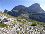 42
42 43
43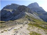 44
44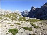 45
45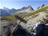 46
46 47
47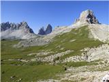 48
48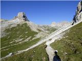 49
49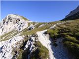 50
50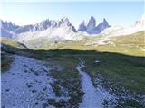 51
51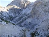 52
52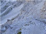 53
53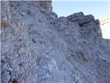 54
54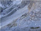 55
55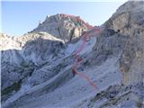 56
56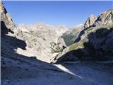 57
57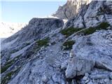 58
58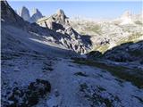 59
59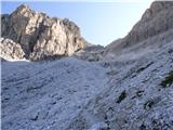 60
60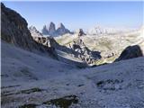 61
61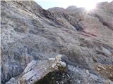 62
62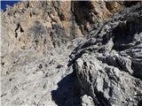 63
63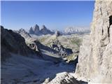 64
64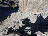 65
65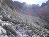 66
66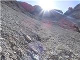 67
67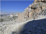 68
68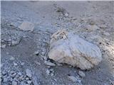 69
69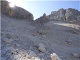 70
70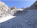 71
71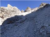 72
72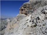 73
73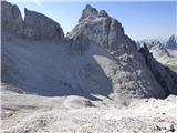 74
74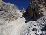 75
75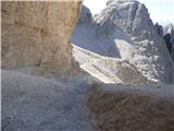 76
76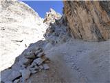 77
77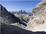 78
78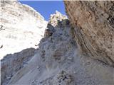 79
79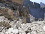 80
80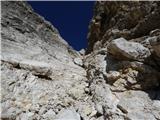 81
81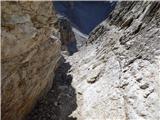 82
82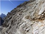 83
83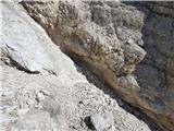 84
84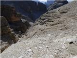 85
85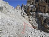 86
86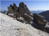 87
87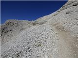 88
88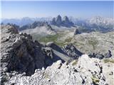 89
89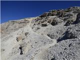 90
90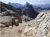 91
91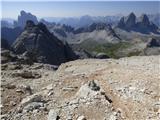 92
92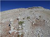 93
93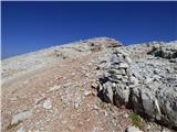 94
94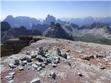 95
95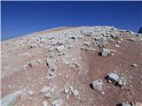 96
96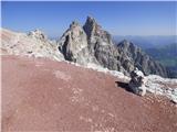 97
97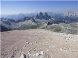 98
98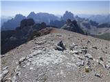 99
99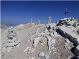 100
100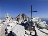 101
101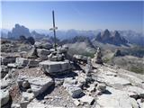 102
102 103
103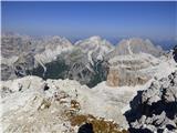 104
104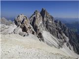 105
105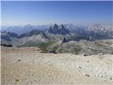 106
106
Discussion about the trip Rifugio Auronzo - Lastron dei Scarperi / Schusterplatte
|
| mirank13. 09. 2017 |
Very panoramic summit; access is not demanding orientation-wise, nor technically a big bogeyman. If you decide to ascend, I recommend also a quick hop to the adjacent Crodon di S Candido-everything clearly visible on pic 74. This one is slightly more demanding but only from the clearly visible gap upwards. Most passages there should be sought to the right (don't let the wires from WW1 mislead you). This addition extends the affair by less than an hour....
|
|
|
|
| mirank11. 11. 2021 09:34:27 |
In the access description, it would be worth changing that the nicest and fastest way to Auronzo is via Sappada.
That road via Forni and Mauria Pass is worse and more boring, and also longer.
|
|
|
|
| felix11. 11. 2021 16:57:25 |
For Styrians, the fastest is via Austria to Lienz and along the Drava valley to Italy - maybe also for Upper Carniolans.
|
|
|
|
| mirank11. 11. 2021 18:07:20 |
I only commented on the above description with access via the town of Auronzo! If you access via Lienz, you have nothing to seek there, because there is direct access from Toblach to Misurina. If you access via Lienz, you have nothing to seek there, because there is direct access from Toblach to Misurina.
|
|
|
To post a comment you must log in:
If you do not yet have a username, you must first
register.