Rifugio Auronzo - Monte Paterno (via east ridge)
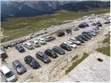
Starting point: Rifugio Auronzo (2320 m)
| Latitude/Longitude: | 46,61220°N 12,29410°E |
| |
Route name: via east ridge
Walking time: 2 h
Difficulty: very difficult marked way
Elevation gain: 424 m
Elevation difference along the route: 600 m
Map: Tabacco 10 1:25.000
Recommended equipment (summer): helmet, self belay set
Recommended equipment (winter): helmet, self belay set, ice axe, crampons
Views: 13.024
 | 1 person like this post |
Access to starting point:
Access from Gorenjska: Through the border crossing Rateče we drive to Trbiž / Tarvisio, where we head onto the motorway in the direction of Vidma / Udine. We leave the motorway at the exit for Tolmezzo and follow the road to the mentioned settlement. From Tolmezzo we continue in the direction of the settlement Ampezzo and mountain pass Passo della Mauria. The road then starts descending and brings us into Cadore valley, where we continue right (left Belluno and Cortina d'Ampezzo) in the direction of the settlement Auronzo. After a few additional km of driving we come to the next bigger junction, where we go right in the direction of Austria and Tre Cime / Tre Cime (left Cortina d'Ampezzo). We leave the road towards Austria after another few 100m, because signs for Tre Cime point us right onto a payable mountain road which after 7km brings us to a large parking lot near the mountain hut rifugio Auronzo.
From Primorska side: We drive on the motorway which leads over the border crossing Sežana to Trst / Trieste. Further we drive on the Italian motorway in the direction of Padova, but only to the motorway junction, where we continue in the direction of Veneto and Belluno. Near Belluno the motorway ends, and we continue in the direction of Cortina d'Ampezzo and Auronzo. When the road brings us into Cadore valley we will come to a bigger junction, where the road to Cortina d'Ampezzo goes left, towards Auronzo right. Here we continue right towards Auronzo. Further, follow the above description.
Route description:
At the mountain hut Auronzo we head onto the macadam road which leads towards the mountain hut Lavaredo slightly towards the east. After approximately 20 minutes of walking on a very panoramic road which leads below the mighty walls of Tre Cime we arrive at the hut Lavaredo.
From the hut we continue on the road, which quickly brings us to a junction, where we continue right in the direction of Piani di Lavaredo. The path, which further runs along a mule track, descends past a smaller lake and then after crossing scree brings us to extensive meadows, where we can especially in the morning and evening time observe numerous marmots. Here we turn left onto the path which leads slightly to the left and starts quite steeply ascending on the scree (northeast direction). The wide mule track leads further towards the east. After the ascent over the scree we join a somewhat better beaten footpath which leads from the mountain hut Rifugio Pian di Cengia.
At the junction we turn left and in a gentle ascent cross the slope below Pian di Cengia. The path becomes even somewhat flatter and brings us to the notch Forcella dei Laghi. From the notch we continue towards the west and soon enter the climbing part of the path. On the south side of the ridge we descend along the steel cable into a steep gully from which we then also with the help of a short ladder ascend to the other side. The slope again becomes more level for some time, then in a few ascents and descents we cross precipitous slopes towards the west. At the end we also cross a shorter bridge, and then we soon reach the notch Forcella del Camoscio. At the notch, where our path joins with the other two, we turn left. With the help of steel cables we ascend over an almost vertical wall. This part of the path is short but demanding and therefore the use of self-belaying is highly recommended. The path then becomes less demanding and through beautiful passages on the summit slope of the mountain we soon reach a very panoramic summit.

Photos:
 1
1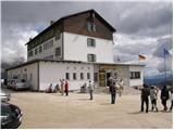 2
2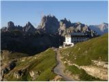 3
3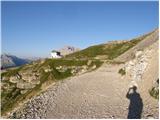 4
4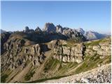 5
5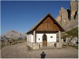 6
6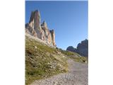 7
7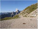 8
8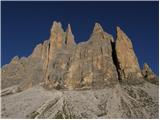 9
9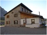 10
10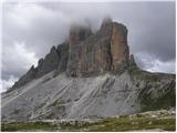 11
11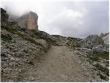 12
12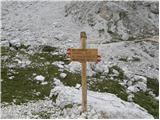 13
13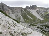 14
14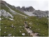 15
15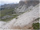 16
16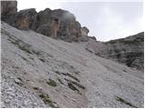 17
17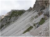 18
18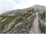 19
19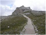 20
20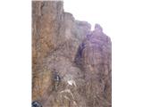 21
21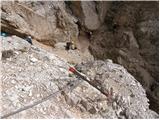 22
22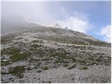 23
23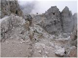 24
24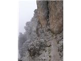 25
25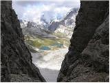 26
26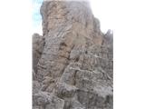 27
27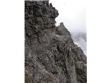 28
28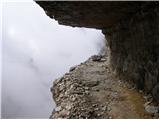 29
29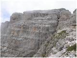 30
30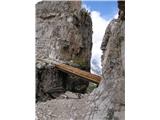 31
31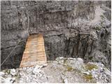 32
32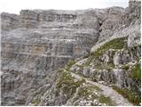 33
33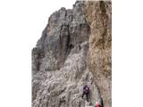 34
34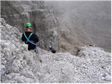 35
35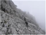 36
36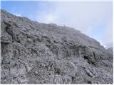 37
37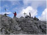 38
38 39
39
Discussion about the trip Rifugio Auronzo - Monte Paterno (via east ridge)
|
| mirank22. 11. 2021 11:29:31 |
The climbing section of the described path is called Ferata delle Forcelle. I remember it as part of one of the most beautiful circular tours. At that time we started in Moss, from Dolomitenhof continued to the Toblin towers past the Locatelli hut into the caverns and onto this via ferrata in the opposite direction and past the Bulele and Zsigmondy huts back to the valley-9h of walking=enjoyment
|
|
|
|
| felix22. 11. 2021 14:03:37 |
I was alone on Paterno for the second time this year, it always attracts me, regardless of which of the three approaches I ascend to the summit (to the saddle - only one path leads to the summit), or descend.
|
|
|
To post a comment you must log in:
If you do not yet have a username, you must first
register.