Rifugio Castiglioni Marmolada - Rifugio Viel del Pan
Starting point: Rifugio Castiglioni Marmolada (2054 m)
| Latitude/Longitude: | 46,46370°N 11,86220°E |
| |
Walking time: 2 h
Difficulty: partly demanding marked way
Elevation gain: 378 m
Elevation difference along the route: 475 m
Map: Tabacco 06, 1:25.000
Recommended equipment (summer):
Recommended equipment (winter): ice axe, crampons
Views: 1.738
 | 1 person like this post |
Access to starting point:
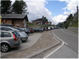
A) From Kranjska Gora over Korensko sedlo to Austria, where at the first larger intersection we continue left towards Podklošter / Arnoldstein and Trbiž / Tarvisio. At the end of the settlement Podklošter signs for Šmohor / Hermagor point us to the right on a regional road, on which past the mentioned settlement we drive to the end of the Gailtal valley, or more precisely to the settlement Kötschach-Mauthen, where we turn right towards the settlement Oberdrauburg. The road ahead leads us over the Alpine pass Gailbergsattel (982 m), after which we descend into the mentioned settlement. After we cross the bridge over the river Drau, we continue left towards the settlement Lienz. In the main roundabout in Lienz we continue "left" in the direction of the settlement Sillian and Italy. Further, we cross the border between Austria and Italy, and we follow the main road to the settlement Dobbiaco / Toblach, where we turn left towards Cortina d'Ampezzo. When we arrive in Cortina d'Ampezzo, we follow the signs for the Alpine pass Passo Falzarego. On the pass Falzarego (2105 m) there is an intersection, where we continue straight downhill in the direction of Marmolada and pass Passo Fedaia. At the next intersections we follow the road in the direction of Marmolada and the mentioned pass. After the pass Fedaia (2057 m), which is located by the artificial lake Lago di Fedaia, more precisely by the mountain hut Rifugio Castiglioni Marmolada, our starting point is situated. We park at the appropriate place near the mentioned mountain hut. From Kranjska Gora to the starting point there is approximately 248 km.
B) From Kranjska Gora over the border crossing Rateče to Trbiž / Tarvisio and further on the highway towards Videm / Udine. We leave the highway at the settlement Tolmezzo, from where we continue driving towards the settlement Ampezzo and further towards the Alpine pass Passo della Mauria (1298 m). The road then starts to descend and brings us into the Cadore valley, where we continue right towards the settlement Auronzo di Cadore. At the next intersections we follow the signs for Cortina d'Ampezzo. When we arrive in Cortina d'Ampezzo, we follow the signs for the Alpine pass Passo Falzarego. On the pass Falzarego (2105 m) there is an intersection, where we continue straight downhill in the direction of Marmolada and pass Passo Fedaia. At the next intersections we follow the road in the direction of Marmolada and the mentioned pass. After the pass Fedaia (2057 m), which is located by the artificial lake Lago di Fedaia, more precisely by the mountain hut Rifugio Castiglioni Marmolada, our starting point is situated. We park at the appropriate place near the mentioned mountain hut. From Kranjska Gora to the starting point there is approximately 238 km.
C) From Nova Gorica we drive into Italy and further on the highway to the settlement Portogruaro, where at the highway junction we turn in the direction of Belluno. We follow the highway to the exit for Belluno, and after the settlement Belluno we follow the road in the direction of the settlement Agordo and then Marmolada and the Alpine pass Passo Fedaia. After the pass Fedaia (2057 m), which is located by the artificial lake Lago di Fedaia, more precisely by the mountain hut Rifugio Castiglioni Marmolada, our starting point is situated. We park at the appropriate place near the mentioned mountain hut. From the border with Slovenia to the starting point there is approximately 235 km.
Route description:
From the parking lot at the mountain hut Rifugio Castiglioni Marmolada we first carefully cross the road, then we head on the footpath in the direction of the mountain hut Rifugio Viel del Pan. The path ahead first ascends transversely to the left, then steeply ascends and brings us to steep and exposed slopes, where some fixed protections help us. At reliable fixed protections we cross some exposed spots, then the path passes to less steep slopes, where it gradually turns a little to the right. With a view of Marmolada and surrounding peaks we quickly arrive at a smaller junction, where from the right a path joins from the saddle Porta Vescovo. Here we continue left, and a little higher another path from the aforementioned saddle joins. Again we continue left and proceed on a wide track in the direction of the mountain hut Rifugio Viel del Pan. The path ahead with nice views crosses the slopes to the left for quite some time, then brings us to the main ridge, where through a notch a view opens to the north, where we can clearly see Piz Boe. The path ahead returns to the left side of the ridge, and with some shorter ascents and descents, after approximately half an hour of further walking, we arrive at the previously mentioned mountain hut.

The trip can be extended to the following destinations: Porta Vescovo
Photos:
 1
1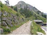 2
2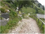 3
3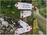 4
4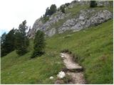 5
5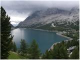 6
6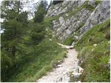 7
7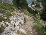 8
8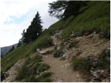 9
9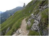 10
10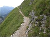 11
11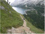 12
12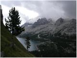 13
13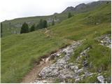 14
14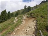 15
15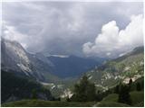 16
16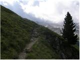 17
17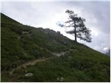 18
18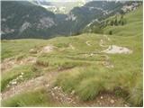 19
19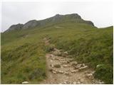 20
20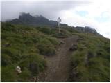 21
21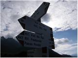 22
22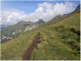 23
23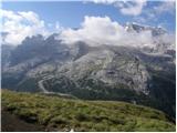 24
24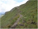 25
25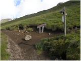 26
26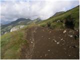 27
27 28
28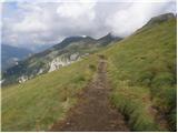 29
29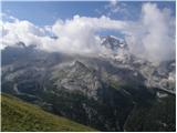 30
30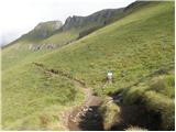 31
31 32
32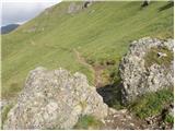 33
33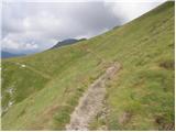 34
34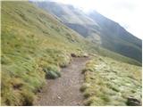 35
35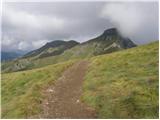 36
36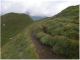 37
37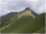 38
38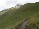 39
39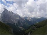 40
40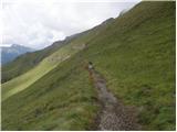 41
41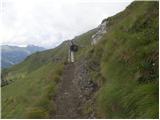 42
42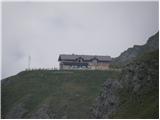 43
43
Discussion about the trip Rifugio Castiglioni Marmolada - Rifugio Viel del Pan
To post a comment you must log in:
If you do not yet have a username, you must first
register.