Rifugio Dibona - Grotta di Tofana
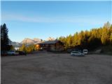
Starting point: Rifugio Dibona (2083 m)
| Latitude/Longitude: | 46,53260°N 12,07030°E |
| |
Walking time: 1 h 15 min
Difficulty: very difficult marked way
Elevation gain: 337 m
Elevation difference along the route: 360 m
Map: Tabacco 03 1:25.000
Recommended equipment (summer): helmet, self belay set, lamp
Recommended equipment (winter): helmet, self belay set, ice axe, crampons, lamp
Views: 1.030
 | 2 people like this post |
Access to starting point:
A) Access from Gorenjska: Through the border crossing at Rateče or Predel to Trbiž / Tarvisio and then on the highway in the direction of Videm / Udine to the exit Tolmezzo. From Tolmezzo we follow the road in the direction of the village Ampezzo and mountain pass Passo della Mauria. The road then descends and brings us to a crossroad, where we continue left (possible also right) in the direction of Cortina d'Ampezzo. At all next crossroads, we follow the signs for Cortina d'Ampezzo. In Cortina d'Ampezzo then we follow the signs for the alpine pass Passo di Falzarego. We then follow this ascending road to the spot where the road in the direction of the mountain hut rifugio Dibona branches off to the right (turn-off at approx. 1700 m altitude). The initially asphalted road brings us higher to a crossroad, where we continue on the lower left road (right mountain hut Duca d'Aosta) and follow it to the parking lot for the mountain hut Dibona.
B) From Primorska: We drive on the highway towards Venice / Venezia. At the town Portogruaro we leave the highway towards Venice and continue right on the highway towards Pordenone. At the next highway junction near Conegliano, we continue right towards Belluno. Near Belluno the highway ends, and at the next crossroads we continue in the direction of Cortina d'Ampezzo. Further, we follow the above description.
Route description:
From the parking lot, we continue on a macadam road past a gate. We follow this road to a crossroad with signposts, where we go left on a footpath following the signs »Via Ferrata Lipella«, and right leads path 403 towards the mountain hut Rifugio Giussani. Already after a few meters, we are again at a junction. This time we go right, also following the signs »Via Ferrata Lipella«. The path then in ascent crosses the slopes below the mighty south wall of Tofana towards the west. At first, we ascend through dwarf pines, which are soon replaced by scree. When we get completely close to the wall, we are again at a junction.
At the junction, we continue straight or slightly left following the signs »Grotta della Tofana« (left Via Ferrata Lipella, right Rifugio Giussani). From the junction, the path ascends along the bastion and brings us to a larger gully. Here we go right into the gully and already after approximately 10 meters we will notice on the left a secured path that leads towards the cave Grotta di Tofana.
The secured path crosses the wall to the left along a narrow ledge. The secured path is otherwise short and technically not overly demanding. Because the path is quite exposed, it is still recommended to use self-belaying. After crossing along the ledge follows a short steeper ascent, which brings us to the entrance of the cave.
In the cave we go straight slightly upwards. From the right side, the path joins on which we will later return. Through the cave indeed leads a circular path. In the initial part, some pegs assist us in the ascent, then follows a short ascent on stirrups. The cave then turns to the right and a descent on steps follows. We continue left and after a short descent the cave narrows. We still descend slightly; in the last part the path turns to the right and a short ascent to the entrance of the cave follows.
We descend along the ascent path.

Photos:
 1
1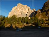 2
2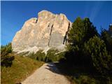 3
3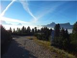 4
4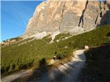 5
5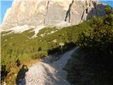 6
6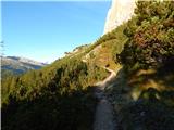 7
7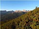 8
8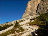 9
9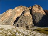 10
10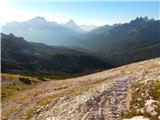 11
11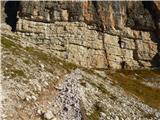 12
12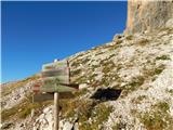 13
13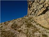 14
14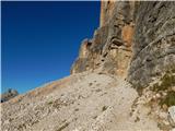 15
15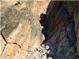 16
16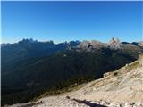 17
17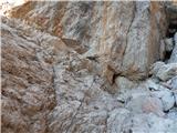 18
18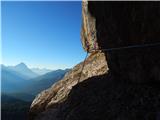 19
19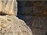 20
20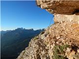 21
21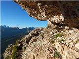 22
22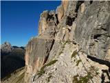 23
23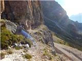 24
24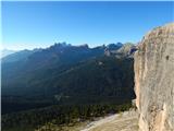 25
25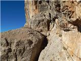 26
26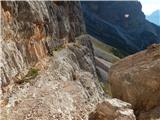 27
27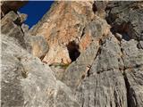 28
28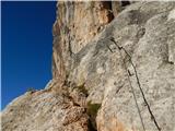 29
29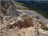 30
30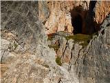 31
31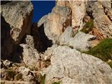 32
32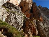 33
33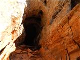 34
34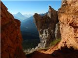 35
35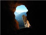 36
36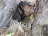 37
37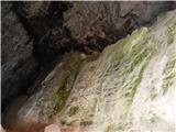 38
38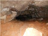 39
39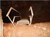 40
40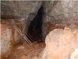 41
41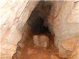 42
42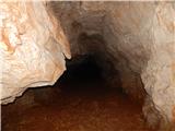 43
43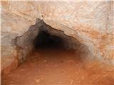 44
44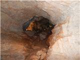 45
45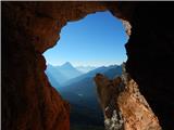 46
46
Discussion about the trip Rifugio Dibona - Grotta di Tofana
To post a comment you must log in:
If you do not yet have a username, you must first
register.