Rifugio Dibona - Torre Aglio (Via Ferrata Gianni Aglio)
Starting point: Rifugio Dibona (2083 m)
| Latitude/Longitude: | 46,53260°N 12,07030°E |
| |
Route name: Via Ferrata Gianni Aglio
Walking time: 4 h 15 min
Difficulty: extremely difficult marked way
Via ferrata: D
Elevation gain: 897 m
Elevation difference along the route: 930 m
Map: Tabacco 03 1:25.000
Recommended equipment (summer): helmet, self belay set
Recommended equipment (winter): helmet, self belay set, ice axe, crampons
Views: 4.542
 | 2 people like this post |
Access to starting point:
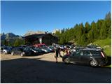
First, we drive to Cortina d'Ampezzo (you can get there via the border crossing Rateče or Predel to Trbiž / Tarvisio and then on the highway in the direction of Udine to the Tolmezzo exit. From Tolmezzo, we follow the road in the direction of the village Ampezzo and the mountain pass Passo della Mauria. The road then descends and brings us to a crossroads, where we continue left (also possible right) in the direction of Cortina d'Ampezzo. At all following crossroads, we follow the signs for Cortina d'Ampezzo. Or from the Primorska side, where we drive on the highway in the direction of Trst / Trieste. Further, we drive on the Italian highway in the direction of Padova, but only to the highway junction, where we continue in the direction of Veneto and Belluno. Near Belluno, the highway ends, and at the next crossroads we continue in the direction of Cortina d'Ampezzo and then follow the signs for the alpine pass Passo di Falzarego. We then follow this ascending road to the place where the road to the hut rifugio Dibona branches off to the right (the turn-off is at approx. 1700 m). The initially asphalted road takes us higher to a crossroads, where we continue on the lower left road (right hut Duca d'Aosta) and follow it to the parking lot for the Dibona hut.
Route description:
From the parking lot, we continue on a macadam road past a gate. We follow this road to a crossroads with signposts, where we turn right onto a wide mule track following the signs »Rif. Camillo Giussani«. The wide path then slowly ascends and brings us in the left bend to a marked junction.
Ahead uphill the path to the hut Camillo Giussani continues, but we turn right towards the hut Pomedes. The path first crosses scree slopes below steep walls to the east and quickly brings us to the start of the secured path Via ferrata Astaldi. The secured path on ledges crosses the south wall of the peak Punta Anna. The path is well secured with a steel cable and technically not overly demanding. The secured path soon ends and from the right the easier path (no. 421) from the hut Dibona joins us. This is followed by an ascent amid dwarf pines and a panoramic path soon brings us to the hut Pomedes.
From the hut, we continue left following the signs »Via Ferrata Punta Anna«. The path leads past the upper station of the cable car and then ascends over scree upwards to the entry into the climbing section of the path.
The climbing path in the first section crosses the wall slightly to the left during the ascent and steeply climbs a few times. Further on, the path becomes somewhat more demanding and ascends almost vertically towards the ridge. This is followed by an ascent along a very panoramic and exposed ridge. The difficulty does not let up and the path continues mostly along the ridge, only at a few points it moves to the left western side of the ridge. Later the ridge becomes somewhat less steep and a somewhat less demanding but unsecured ascent follows to the summit of Punta Anna.
From the summit, we continue along the ridge and soon the path from the hut Camillo Giussani joins from the left. From the junction, we walk along the ridge for a short time, then the path turns right and ascends diagonally up a steep gully. The path then brings us to the eastern less steep slopes, where we soon reach a junction. To the right downhill leads the path Giuseppe Olivieri back to the hut Pomedes and the path to the hut Ra Valles where there is an intermediate station of the gondola cable car.
We continue left onto the Ferrata Gianni Aglio path, directed there by the inscription »cima«. A less demanding ascent towards the ridge follows. On the ridge, we continue right and the path becomes somewhat more demanding again. We ascend vertically a few times and are aided by some pegs and ladders. The path then moves from the ridge to the left side and brings us to the notch below the tower Torre Aglio. From the notch, a demanding vertical ascent follows and then a short exposed traverse on pegs, which brings us to a junction.
Straight ahead the path leads to Tofana di Mezzo, but we continue left steeply upwards along the steel cable. The steep ascent along the cable is not too long and brings us to the very panoramic summit in a few minutes.
The described path is extremely demanding and suitable only for experienced mountaineers with sufficient fitness and mandatory self-belaying.
From the summit, we can descend by going back a little and descending via the Giuseppe Olivieri path back to the hut Pomedes. The other option is to continue to Tofana di Mezzo and descend from there with the help of the gondola cable car.

Photos:
 1
1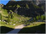 2
2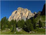 3
3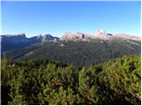 4
4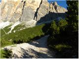 5
5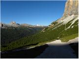 6
6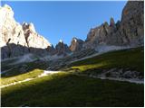 7
7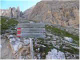 8
8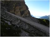 9
9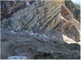 10
10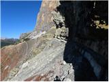 11
11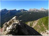 12
12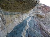 13
13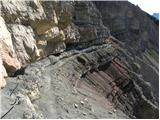 14
14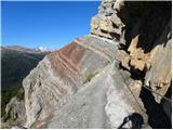 15
15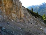 16
16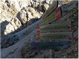 17
17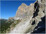 18
18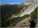 19
19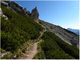 20
20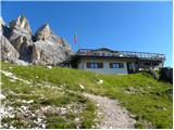 21
21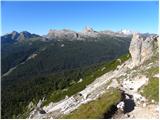 22
22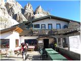 23
23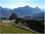 24
24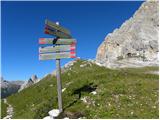 25
25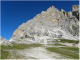 26
26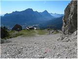 27
27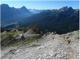 28
28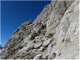 29
29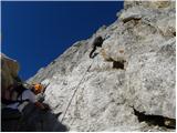 30
30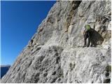 31
31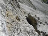 32
32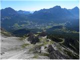 33
33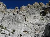 34
34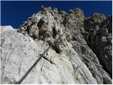 35
35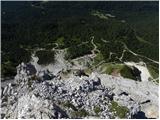 36
36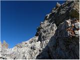 37
37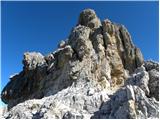 38
38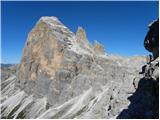 39
39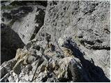 40
40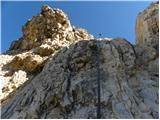 41
41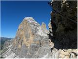 42
42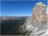 43
43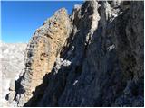 44
44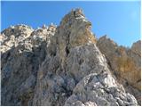 45
45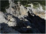 46
46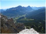 47
47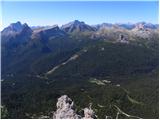 48
48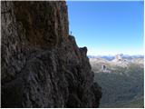 49
49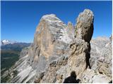 50
50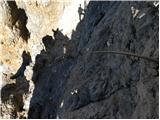 51
51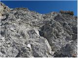 52
52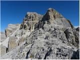 53
53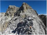 54
54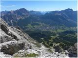 55
55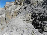 56
56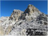 57
57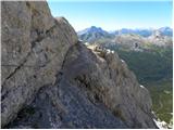 58
58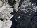 59
59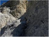 60
60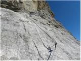 61
61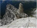 62
62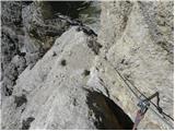 63
63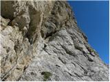 64
64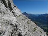 65
65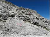 66
66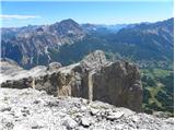 67
67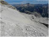 68
68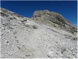 69
69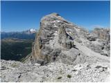 70
70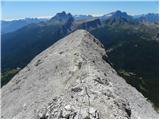 71
71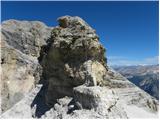 72
72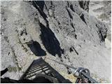 73
73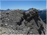 74
74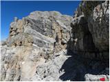 75
75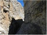 76
76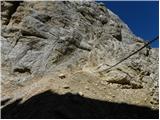 77
77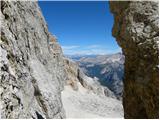 78
78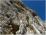 79
79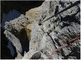 80
80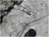 81
81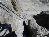 82
82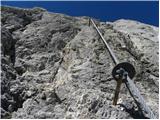 83
83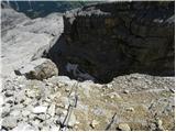 84
84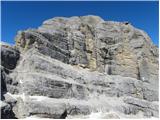 85
85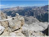 86
86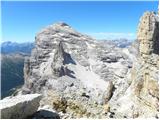 87
87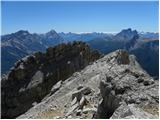 88
88
Discussion about the trip Rifugio Dibona - Torre Aglio (Via Ferrata Gianni Aglio)
|
| zvehar23. 08. 2021 20:57:47 |
A few days ago I happened to be up here - interesting peak, but with somewhat more demanding access. It can be extended up here if going to Tofano di Mezzo, but consequently keep in mind that the ascent (and descent on the same cable) takes some strength we need for later 
|
|
|
To post a comment you must log in:
If you do not yet have a username, you must first
register.