Rifugio Fedare - Monte Pore
Starting point: Rifugio Fedare (2000 m)
| Latitude/Longitude: | 46,48722°N 12,03476°E |
| |
Walking time: 1 h 30 min
Difficulty: easy marked way
Elevation gain: 405 m
Elevation difference along the route: 420 m
Map: Tabacco 03 1:25.000
Recommended equipment (summer):
Recommended equipment (winter): ice axe, crampons
Views: 848
 | 2 people like this post |
Access to starting point:
A) Access from Gorenjska: Through the border crossing at Rateče or Predel to Trbiž / Tarvisio and then on the highway in the direction of Udine to the Tolmezzo exit. From Tolmezzo we follow the road in the direction of the village Ampezzo and mountain pass Passo della Mauria. The road then descends and brings us to a crossroads, where we continue left (also right possible) in the direction of Cortina d'Ampezzo. At all subsequent crossroads we follow the signs for Cortina d'Ampezzo.
In Cortina d'Ampezzo we then follow the signs for the alpine pass Passo di Falzarego. We follow this ascending road to a crossroads at an altitude of approximately 1400m. At the crossroads we continue left in the direction of the alpine pass Passo Giau and Marmolada. From the Passo Giau pass we continue on the main road approximately 2.5 km to the parking lot at the hut Rifugio Fedare, which is located on the right side of the road.
B) From Primorska: We drive on the highway towards Venice / Venezia. At Portogruaro we leave the highway towards Venice and continue right on the highway towards Pordenone. At the next highway junction near Conegliano we continue right towards Belluno. Near Belluno the highway ends and at the next crossroads we continue in the direction of Cortina d'Ampezzo. Further, we follow the description above.
Route description:
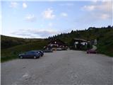
From the parking lot, we head onto a wide path that leads us past the lower station of the chairlift that goes to the hut Rifugio Averau. At the lower station of the chairlift, where there is also a junction, we turn left onto path 463 towards the summit Monte Pore, while right leads path 464 towards the hut Rifugio Averau.
Further on, we walk along a narrow gravel road that crosses grassy slopes in ascent. The road leads us past some shepherd and holiday cottages, and to the right two tracks branch off. On the left side we will soon notice a small church, our path turns decidedly left here and crosses a small stream. At the next cottage the road ends and turns into a narrow track that is mostly paved with stone slabs. The track ascends for some time through bushes and then brings us back to grassy slopes. From the path we have a nice view all the time towards the peaks above the pass Passo Giau. The track then turns slightly right, and to the left across grassy slopes a shortcut branches off.
We continue along the track and at the next cottage the path turns left and brings us to a junction on the saddle Jof de Melei.
At the junction where the track turns into a trail we continue left on path 463 towards the summit Monte Pore, slightly right leads the path towards the village Andraz. Our path is then gentle and leads us across grassy slopes from which the view also opens to the north. The path then turns even more left and brings us along the ridge on the eastern side of the summit Monte Pore. Here the aforementioned shortcut joins from the left.
Further on, we walk along the ridge, which is steeper to the south but still grassy. The path then moves away from the ridge to the right side and begins to ascend somewhat more steeply. The path leads us past a cross and a memorial plaque by which there is also a logbook box. We continue ascending on grassy slopes and the path turns back towards the ridge and brings us to a junction at the notch Forzela de Antersas.
Left leads the path that bypasses the summit on the south side and continues into the valley towards the village La Vila, while we turn right at the junction and continue ascending along the grassy ridge towards the summit Monte Pore. From the path we have here an increasingly beautiful view of a large part of the Dolomites. In the final section the slope on the south side of the ridge is somewhat steeper, our path mostly runs slightly to the right of the ridge. Along the path, which continues along the ridge, we soon reach the panoramic summit on which a large cross is erected.

Along the route: Jof de Melei (2142m), Forzela de Antersas (2247m)
Photos:
 1
1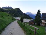 2
2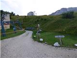 3
3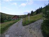 4
4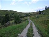 5
5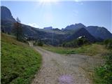 6
6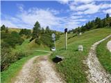 7
7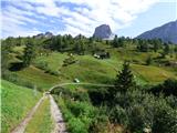 8
8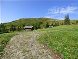 9
9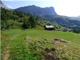 10
10 11
11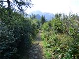 12
12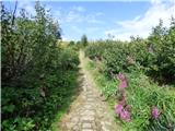 13
13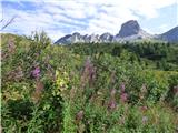 14
14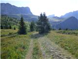 15
15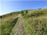 16
16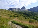 17
17 18
18 19
19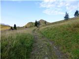 20
20 21
21 22
22 23
23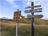 24
24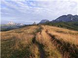 25
25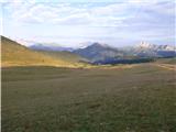 26
26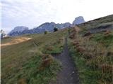 27
27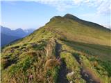 28
28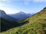 29
29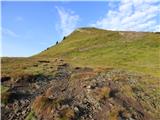 30
30 31
31 32
32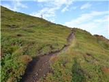 33
33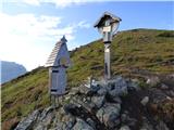 34
34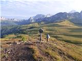 35
35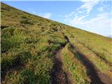 36
36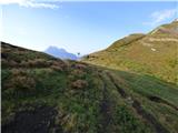 37
37 38
38 39
39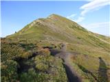 40
40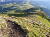 41
41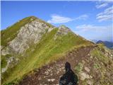 42
42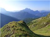 43
43 44
44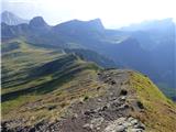 45
45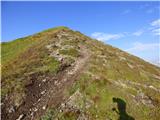 46
46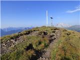 47
47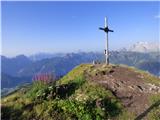 48
48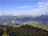 49
49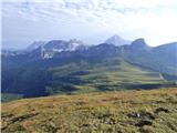 50
50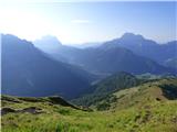 51
51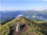 52
52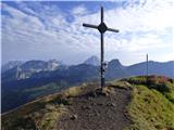 53
53
Discussion about the trip Rifugio Fedare - Monte Pore
To post a comment you must log in:
If you do not yet have a username, you must first
register.