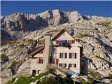
Rifugio Gilberti - Monte Robon
Starting point: Rifugio Gilberti (1850 m)
| Latitude/Longitude: | 46,38740°N 13,47340°E |
| |
Walking time: 2 h 20 min
Difficulty: partly demanding unmarked way
Elevation gain: 130 m
Elevation difference along the route: 300 m
Map: Julijske Alpe - zahodni del 1:50.000
Recommended equipment (summer):
Recommended equipment (winter): ice axe, crampons
Views: 5.682
 | 1 person like this post |
Access to starting point:
From Kranjska Gora over the border crossing Rateče we drive to Trbiž / Tarvisio. In Trbiž we continue left in the direction of Bovec and follow the road to the intersection near Rabeljsko jezero. Here we continue right in the direction of Medvejski preval / Sella Nevea. We follow this road, which is mostly ascending, to the large parking lot at the lower station of the cableway that leads to the Gilberti hut.
Then we buy a ticket and take the cableway to the upper station.
From Bovec we drive to the border crossing Predel, from which we descend to the Italian side. Just a little after Rabeljsko jezero we come to the intersection, where we continue left in the direction of Nevejski preval / Sella Nevea. Further, we follow the above description.
Route description:
From the Gilberti hut we walk to the nearby chapel, then the path continues towards the east. Initially we descend along the transport-rescue road, then when it turns left, we continue straight in the direction of Nevejski preval / Sella Nevea and the saddle Vrh Laških brežičev / Sella Robon. The path then crosses slopes towards the east and continues without major changes in elevation. After approximately 30 minutes of walking from the Gilberti hut, we reach a marked junction where the path to Nevejski preval branches off to the left downwards.
We continue straight on the increasingly panoramic path, which quickly brings us to the next junction. Again we continue straight on the path in the direction of "Sella Robon" (right slightly upwards Prevala).
The still relatively easy path continues over vast plateau-like karst terrain, through which an excellently preserved mulatjera leads us. This is followed by approximately 20 minutes of easy walking on the path, from which we have beautiful views of the Montaževa and Viševa groups on the left and on the right towards Lopa, Hudi vršič and later Velika Črnelska špica. After a while the path brings us to an indistinct saddle, from which the path begins to descend for a longer time. After completing the descent we are 150 meters lower in elevation, and the path brings us to the edge of a high mountain cirque, where another path from Nevejski preval joins from the left.
The path ahead begins to ascend moderately and brings us in a few hairpin turns to the panoramic saddle Vrh Laških brežičev (Italian: Sella Robon), where there is an information board and next to it a table with two benches.
At the saddle we continue left (straight Jerebica 6 hours) and continue the ascent on the well-traceable but henceforth unmarked path. The path ahead ascends transversely across a fairly steep slope, then levels out and brings us to numerous military fortifications. We bypass the mentioned fortifications on the left side along a wide artificial ledge, after which only a short ascent follows and the path brings us to the caving bivouac Modonutti - Savoia.
From the bivouac we continue left on the initially still well-traceable path, which soon crosses a short exposed ledge, then turns right and ascends very steeply through a small notch, where stone steps assist us. Higher up the path levels out and begins to disappear among numerous limestone pavements and abysses, but since numerous cairns indicate the continuation, orientation is at least not difficult in good weather. Higher up the path turns somewhat more to the right and leads us past numerous abysses. A little below the summit we reach a mighty abyss, along whose edge a collapsed path runs on a short section. Here, instead of crossing the exposed passage over rotten wood, it is much safer to climb the solid rock on the right side or to crawl through its lower part. Once we step onto the other side of the mentioned passage, the path levels out and quickly brings us past yet another exposed but wide ledge to the panoramic summit.

Along the route: Vrh Laških brežičev (1884m), Speleološki bivak Modonutti (1908m)
Photos:
 1
1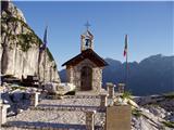 2
2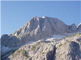 3
3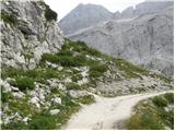 4
4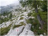 5
5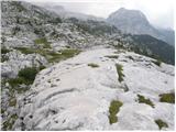 6
6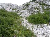 7
7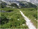 8
8 9
9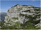 10
10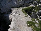 11
11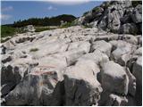 12
12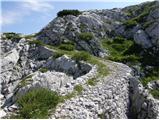 13
13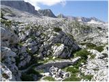 14
14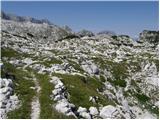 15
15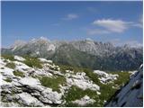 16
16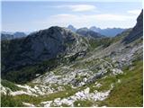 17
17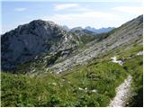 18
18 19
19 20
20 21
21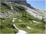 22
22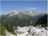 23
23 24
24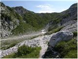 25
25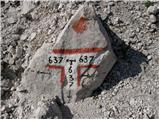 26
26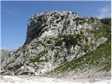 27
27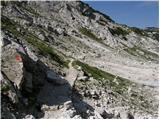 28
28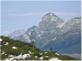 29
29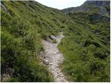 30
30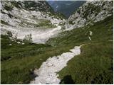 31
31 32
32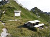 33
33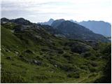 34
34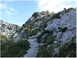 35
35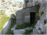 36
36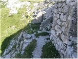 37
37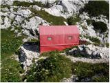 38
38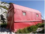 39
39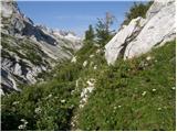 40
40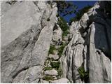 41
41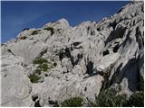 42
42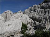 43
43 44
44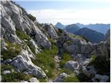 45
45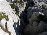 46
46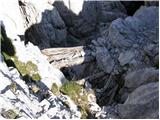 47
47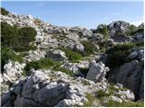 48
48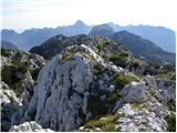 49
49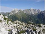 50
50
Discussion about the trip Rifugio Gilberti - Monte Robon
|
| ločanka29. 08. 2017 |
Wonderful path, wonderful mountain, worth repeating multiple times.
It was planned by me for 15 years, and I'd repeat it this year too, e.g. in autumn colors.
One-way gondola ticket is 7.5 eur, beer below at Nevejski preval is 1 eur per dl, max measure 3 dl.
|
|
|
To post a comment you must log in:
If you do not yet have a username, you must first
register.