Rifugio Passo Sella - Sassopiatto / Plattkofel (Via Ferrata Oskar Schuster)
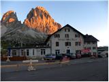
Starting point: Rifugio Passo Sella (2183 m)
| Latitude/Longitude: | 46,50944°N 11,75730°E |
| |
Route name: Via Ferrata Oskar Schuster
Walking time: 4 h 45 min
Difficulty: extremely difficult marked way
Via ferrata: B/C
Elevation gain: 786 m
Elevation difference along the route: 1220 m
Map: Tabacco 05 1:25.000
Recommended equipment (summer): helmet, self belay set
Recommended equipment (winter): helmet, self belay set, ice axe, crampons
Views: 6.019
 | 1 person like this post |
Access to starting point:
From Kranjska Gora over the Korensko sedlo pass to Austria, where at the first larger intersection we continue left towards Podklošter / Arnoldstein and Trbiž / Tarvisio. At the end of the village Podklošter, signs for Šmohor / Hermagor direct us right onto a regional road, along which, past the mentioned village, we drive to the end of the Gailtal valley, or more precisely to the village Kötschach-Mauthen, where we turn right towards the village Oberdrauburg. The road ahead leads us over the alpine pass Gailbergsattel (982 m), after which we descend into the mentioned village. After crossing the bridge over the river Drau, we continue left towards the village Lienz. In the main roundabout in Lienz we continue "left" in the direction of the village Sillian and Italy. Further, we cross the border between Austria and Italy, and we follow the main road past the villages Dobbiaco / Toblach, Villabassa / Niederdorf, Monguelfo - Tesido / Welsberg - Taisten, Brunico / Bruneck. Just a little after the last-mentioned village, past which a bypass runs, we turn left into the Alta Badia valley. Further, we drive along the mentioned valley and in the village La Villa we turn right towards the pass Passo Gardena. We then follow the ascending road following the Passo Gardena signs. From the pass Passo Gardena we descend to the other side and then continue left towards the pass Passo Sella. At the pass Sella we park at the hut Rifugio Passo Sella or at one of the smaller parking lots along the road. The parking lot at the hut is payable (July 2012 – 4€).
Route description:
At the Rifugio Passo Sella hut we head across the parking lot to the lower cable car station, which leads towards the Demetz hut at the Forcella Sassolungo notch. We continue along a wide footpath and at the first intersection signposts direct us left onto a macadam road. After a few dozen meters we are again at a junction and continue right. The road then turns into a path and begins to ascend towards the scree below the precipitous peaks of the Sassolungo group. The path further turns slightly to the right and brings us to the slopes below the cable car. Here we start to ascend in zigzags through the scree towards the Forcella Sassolungo notch. From the path we have a very nice view all the time towards the precipitous walls of the nearby peaks in the Sassolungo group, and the view towards the Sella group and Marmolada is also very nice. The path then runs near the cable car all the time and continues ascending in zigzags up the steep scree. Such a path continues all the way to the Rifugio Toni Demetz hut.
From the hut we continue towards the northwest and start descending the valley between the peaks Sassolungo and Piza de Dantersasc. The path here descends on scree all the time and then turns slightly left towards the Rifugio Vicenza / Langkofel Hütte hut. From the Forcella Sassolungo notch we descend over 400 meters of altitude.
At the hut we continue left following the signs »Oskar Schuster Via Ferrata« into the Conca del Sassopiatto cirque. The path then starts to ascend and initially runs along the left side of the valley below the slopes of the peak Piza de Dantersasc. Higher the path turns right and follows a somewhat steeper ascent on the scree, which brings us below the wall of the peak Sassopiatto where the start of the climbing path is.
In the initial part of the climbing path we ascend through and along a relatively steep gully upwards. On this part the path, with the exception of a short cable right at the beginning, is not secured and therefore considerable caution is required. On the unsecured part grade 1-2 climbing is required.
Higher the path is well secured and ascends up the wall to the left. Further we ascend very steeply along the cable several times, so some strength in the arms is also needed. The increasingly panoramic climbing path then brings us to the notch where the path turns right and then ascends vertically with the help of numerous brackets and a ladder. Further we steeply ascend along the cable for some time, after which the protections end. The path here turns right and then ascends along a relatively steep gully upwards. On this part the path is not secured and grade 1-2 climbing is again required.
From the gully we then reach the ridge where a view opens towards the west. On the ridge, where we join the easier path that runs along the western slopes of the mountain, we continue right and only a short ascent along the ridge to the summit follows.
We descend along the easier path on the western slopes to the Rifugio Sasso Piatto hut and then along path 557 back to the Passo Sella pass. For the descent we will need a good 3 hours.

Photos:
 1
1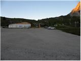 2
2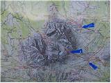 3
3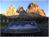 4
4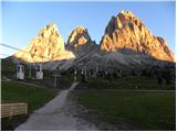 5
5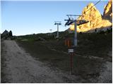 6
6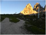 7
7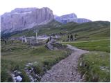 8
8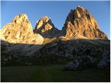 9
9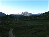 10
10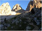 11
11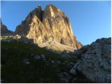 12
12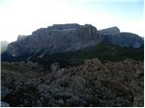 13
13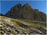 14
14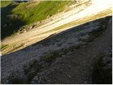 15
15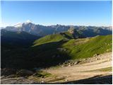 16
16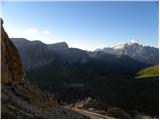 17
17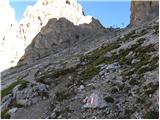 18
18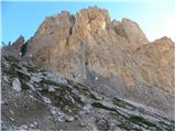 19
19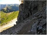 20
20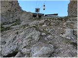 21
21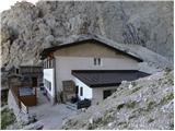 22
22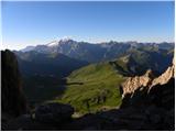 23
23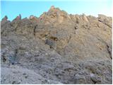 24
24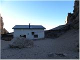 25
25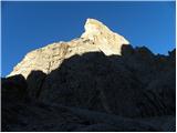 26
26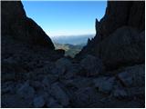 27
27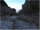 28
28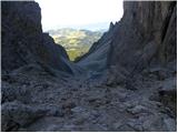 29
29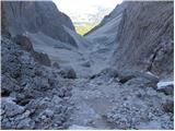 30
30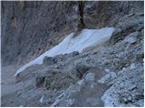 31
31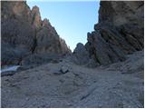 32
32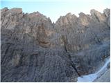 33
33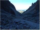 34
34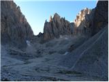 35
35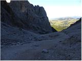 36
36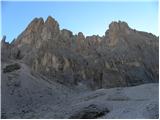 37
37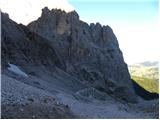 38
38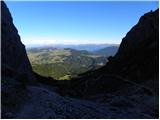 39
39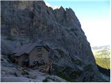 40
40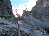 41
41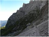 42
42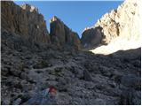 43
43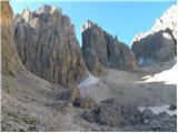 44
44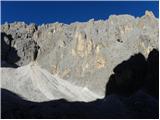 45
45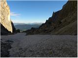 46
46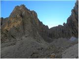 47
47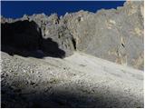 48
48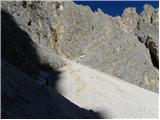 49
49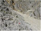 50
50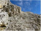 51
51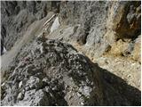 52
52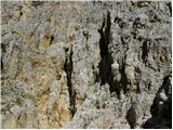 53
53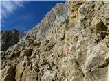 54
54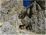 55
55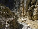 56
56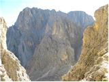 57
57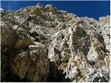 58
58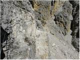 59
59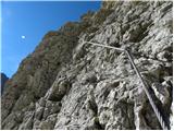 60
60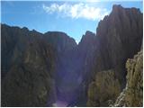 61
61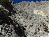 62
62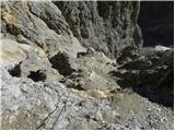 63
63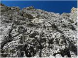 64
64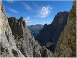 65
65 66
66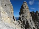 67
67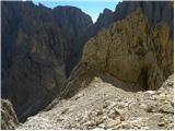 68
68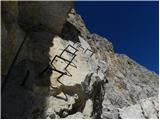 69
69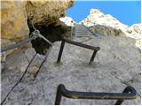 70
70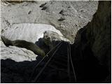 71
71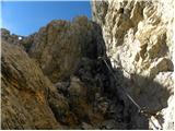 72
72 73
73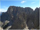 74
74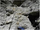 75
75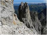 76
76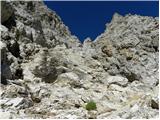 77
77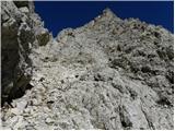 78
78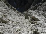 79
79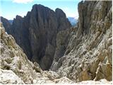 80
80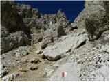 81
81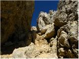 82
82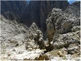 83
83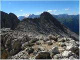 84
84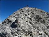 85
85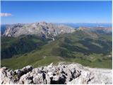 86
86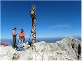 87
87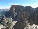 88
88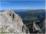 89
89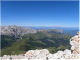 90
90
Discussion about the trip Rifugio Passo Sella - Sassopiatto / Plattkofel (Via Ferrata Oskar Schuster)
To post a comment you must log in:
If you do not yet have a username, you must first
register.