Rifugio Pederü - Piz dles Conturines
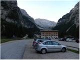
Starting point: Rifugio Pederü (1548 m)
| Latitude/Longitude: | 46,63867°N 12,04140°E |
| |
Walking time: 6 h 30 min
Difficulty: very difficult marked way
Elevation gain: 1516 m
Elevation difference along the route: 1760 m
Map: Tabacco 07 1:25.000
Recommended equipment (summer): helmet, self belay set
Recommended equipment (winter): helmet, self belay set, ice axe, crampons
Views: 1.469
 | 3 people like this post |
Access to starting point:
A) From Kranjska Gora via Korensko sedlo to Austria, where at the first major intersection we continue left towards Podklošter / Arnoldstein and Trbiž / Tarvisio. At the end of the settlement Podklošter signs for Šmohor / Hermagor direct us right onto a regional road, along which past the mentioned settlement we drive to the end of the Gailtal valley, or more precisely to the settlement Kötschach-Mauthen, where we turn right towards the settlement Oberdrauburg. The route ahead leads us over the Alpine pass Gailbergsattel (982 m), after which we descend into the mentioned settlement. After crossing the bridge over the river Drau, we continue left towards the settlement Lienz. In the main roundabout in Lienz we continue "left" in the direction of the settlement Sillian and Italy. Further, we cross the state border between Austria and Italy, and we follow the main road past the settlements Dobbiaco / Toblach, Villabassa / Niederdorf, Monguelfo - Tesido / Welsberg - Taisten, Brunico / Bruneck. Just a little after the last-mentioned settlement, past which a bypass road leads, we turn left into the Val Badia valley. Further, we drive through the mentioned valley and in the settlement Longega we turn left towards the settlement San Vigilio. In San Vigilio, at the intersection, we turn left following the signs »Pederü«. After approximately 200 meters we then turn right also following the signs »Pederü«. We follow this road all the way to the large parking lot in front of the hut Rifugio Pederü.
B) From Nova Gorica we drive to Italy and further on the highway towards Venice / Venezia. Near the town Portogruaro we leave the highway towards Venice and continue right on the highway towards Pordenone. At the next highway junction near Conegliano we continue right towards Belluno. Near Belluno the highway ends, and at the next intersections we continue in the direction of Cortina d'Ampezzo. When we arrive in Cortina d'Ampezzo, we follow the signs for the Alpine pass Passo Falzarego. On the pass Passo Falzarego (2105 m) we turn right in the direction of the pass Valparola and further towards Alta Badia. In the settlement La Villa we turn right towards the settlement Brunico. We then follow the road to the settlement Longega where we turn right towards the settlement San Vigilio. In San Vigilio, at the intersection, we turn left following the signs »Pederü«. After approximately 200 meters we then turn right also following the signs »Pederü«. We follow this road all the way to the large parking lot in front of the hut Rifugio Pederü.
Route description:
From the parking lot we continue to the junction for the hut. Signposts direct us slightly right onto the footpath towards the Lavarela and Fanes huts, left the path leads towards the Fodara Vedla hut. The gently sloping path first crosses a stream and a road, then starts to ascend somewhat steeper through scrub. After the initial somewhat steeper section the path ahead becomes flatter, on a shorter section it also descends somewhat. The path also joins the road several times for a short while, then continues mostly through scrub on the right side of the valley.
Further the path turns slightly right and increasingly beautiful views of the surrounding peaks begin to open up. Later we rejoin the mountain road that runs along the Rü dal Plan stream. The slightly ascending road then brings us to a junction.
Left the road leads towards the Rifugio Fanes hut (5 minutes), we continue right towards the Rifugio Lavarela hut. The road continues to lead along the stream and pastures and soon brings us to the hut.
At the hut we continue right and after a short ascent on the grassy slope we come to a junction. We continue left along the lower path (path no. 12), which leads towards the Ju dla Crusc saddle and Forcela de Medesc, right the upper path (path no. 7) leads, which later joins the lower path and also leads towards the mentioned saddles.
From the junction the path still leads for a short time along the grassy slope past a shepherd hut, then starts to ascend through sparse mostly pine forest. Here the path runs westwards along a smaller stream. Later the trees become sparser and the path brings us to an indistinct saddle from where a view opens towards the peaks Sasso delle Dieci and Sasso delle Nove.
Here the panoramic path starts to descend slightly and leads us past the Le Parom lake, which is located somewhat left of the path below the slopes of the Lavarella peak. The path then turns slightly right and brings us into a small valley, where the upper path (path no. 7) joins from the right.
We continue left through the grassy small valley and soon we are again at a junction. Straight the path leads towards the Ju dla Crusc saddle and further towards the Sasso delle Dieci peak, we head left towards the Forcela de Medesc notch. Further the path is relatively flat and runs southeast. When we approach the slopes of the Piz de Medesc peak the path ascends somewhat steeper and brings us to a junction where the path from the Ju dla Crusc saddle joins from the right.
At the junction we continue left along path 12b and along the path that ascends gently we soon reach the Forcela de Medesc notch.
At the saddle where the path through the Val Medesc valley joins from the right, we continue slightly left following the La Varella signs. The path through scree soon brings us to the somewhat steeper slopes of the La Varella peak. Further the path becomes more demanding and runs along the steep western slopes of the mountain. At some places the path ascends steeply, then follows an ascent along a fairly wide ledge on which there is a lot of scree. The path is not secured and considerable caution is required. Particular caution is needed on the descent, as the path is dangerous for slipping. From the ledge the path turns slightly left and ascends steeply along the rocky slope. The path then becomes less demanding again and brings us to a junction just below the Lavarella summit.
Left the path leads to the eastern summit of Lavarella to which it is only a few minutes' walk, we continue right and descend slightly to the notch between the eastern and western summit. At the notch we continue left and start to descend even somewhat steeper along the southern slopes of the mountain. Further we walk on scree, which brings us to a smaller saddle. At the saddle we continue straight and start to ascend again. The path leads us past a smaller lake and after a somewhat steeper ascent brings us to the entry into the climbing section of the path.
At the beginning of the climbing path we first ascend over a steep ladder, then follows a somewhat less steep path along a steel cable. Further the path becomes somewhat easier for a short time, then follows a steep ascent over a ladder again. Later the path ascends once more over a ladder, then along the steel cable soon brings us onto the ridge.
On the ridge we continue left and along a somewhat easier but unsecured path soon reach the panoramic summit.

Photos:
 1
1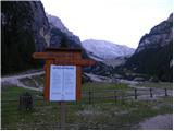 2
2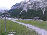 3
3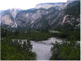 4
4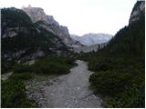 5
5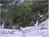 6
6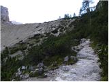 7
7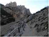 8
8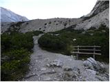 9
9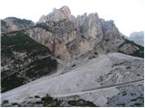 10
10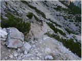 11
11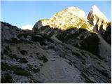 12
12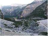 13
13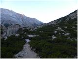 14
14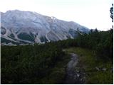 15
15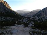 16
16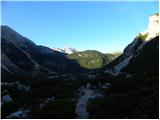 17
17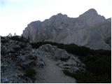 18
18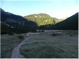 19
19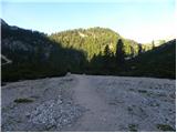 20
20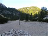 21
21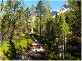 22
22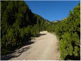 23
23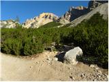 24
24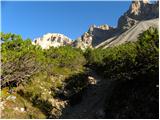 25
25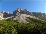 26
26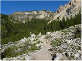 27
27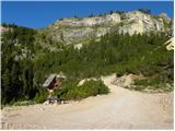 28
28 29
29 30
30 31
31 32
32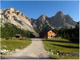 33
33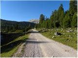 34
34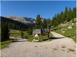 35
35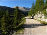 36
36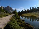 37
37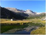 38
38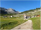 39
39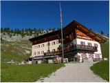 40
40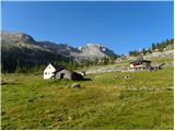 41
41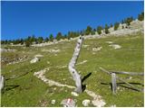 42
42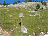 43
43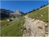 44
44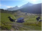 45
45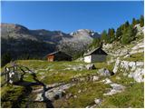 46
46 47
47 48
48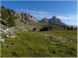 49
49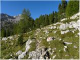 50
50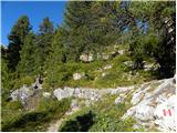 51
51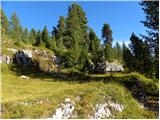 52
52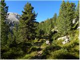 53
53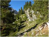 54
54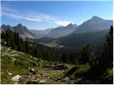 55
55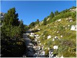 56
56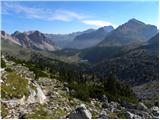 57
57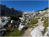 58
58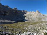 59
59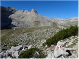 60
60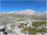 61
61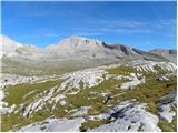 62
62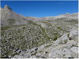 63
63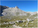 64
64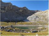 65
65 66
66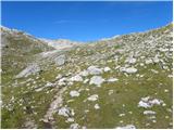 67
67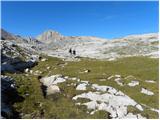 68
68 69
69 70
70 71
71 72
72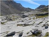 73
73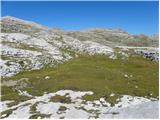 74
74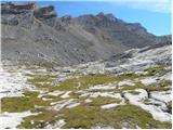 75
75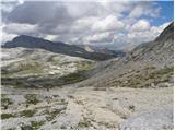 76
76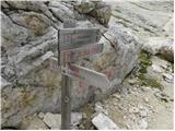 77
77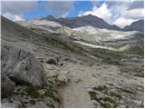 78
78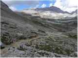 79
79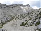 80
80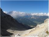 81
81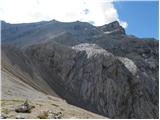 82
82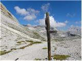 83
83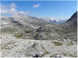 84
84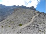 85
85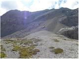 86
86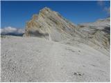 87
87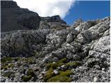 88
88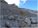 89
89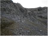 90
90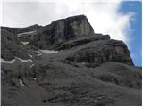 91
91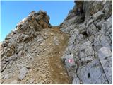 92
92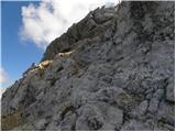 93
93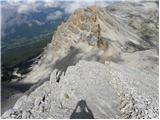 94
94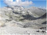 95
95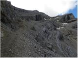 96
96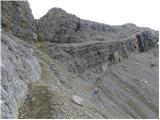 97
97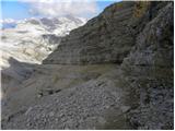 98
98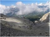 99
99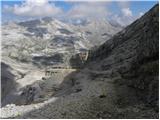 100
100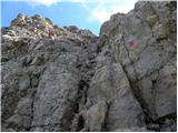 101
101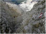 102
102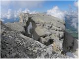 103
103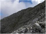 104
104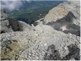 105
105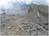 106
106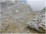 107
107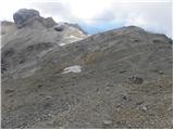 108
108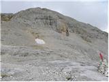 109
109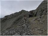 110
110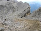 111
111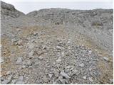 112
112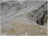 113
113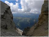 114
114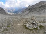 115
115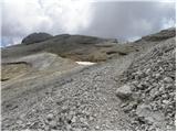 116
116 117
117 118
118 119
119 120
120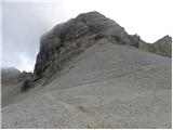 121
121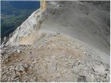 122
122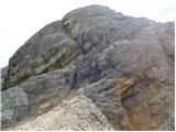 123
123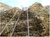 124
124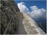 125
125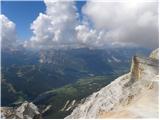 126
126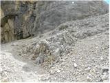 127
127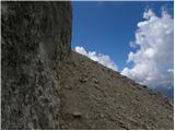 128
128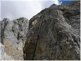 129
129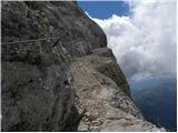 130
130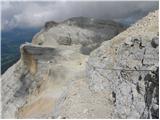 131
131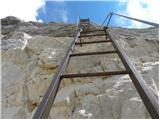 132
132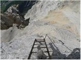 133
133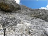 134
134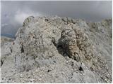 135
135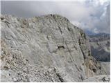 136
136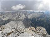 137
137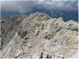 138
138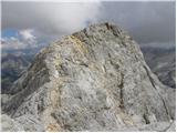 139
139 140
140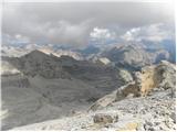 141
141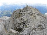 142
142 143
143
Discussion about the trip Rifugio Pederü - Piz dles Conturines
To post a comment you must log in:
If you do not yet have a username, you must first
register.