Rifugio Valparola - Les Pizades
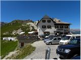
Starting point: Rifugio Valparola (2175 m)
| Latitude/Longitude: | 46,53169°N 11,98868°E |
| |
Walking time: 1 h 45 min
Difficulty: easy pathless terrain, easy marked way
Elevation gain: 90 m
Elevation difference along the route: 300 m
Map: Tabacco 07 1:25.000
Recommended equipment (summer):
Recommended equipment (winter): ice axe, crampons
Views: 2.254
 | 2 people like this post |
Access to starting point:
Access from Gorenjska: Through the border crossing Rateče or Predel to Trbiž / Tarvisio and then on the highway in the direction of Vidma / Udine to the exit Tolmezzo. From Tolmezzo we follow the road in the direction of the settlement Ampezzo and mountain pass Passo della Mauria. The road then descends and brings us to a crossroad, where we continue left (possible also right) in the direction of Cortina d'Ampezzo. At all next crossroads, we follow the signs for Cortina d'Ampezzo.
In Cortina d'Ampezzo then we follow the signs for the alpine pass Passo di Falzarego. This ascending road we then follow to the mentioned pass, and then we continue right towards the pass Passo Valparola. On the pass, we park on one of the parking lots near the hut Rifugio Valparola.
From the Primorska side: We drive on the highway towards Venice / Venezia. At the place Portogruaro we leave the highway towards Venice and continue right on the highway towards the place Pordenone. At the next highway junction near the place Conegliano, we continue right towards the place Belluno. Near Belluno the highway ends, and at the next crossroads we continue in the direction of Cortina d'Ampezzo. Further, follow the upper description.
Route description:
From the hut Rifugio Valparola we continue towards the southwest following the signs »Settsass«. The path then crosses grassy slopes on the right side of the lake Lago di Valparola and brings us to a junction. We continue right on path no. 24, which leads towards the summit Setsas.
The path then begins to ascend slightly on still mostly grassy slopes on the south side of the peak Piz Ciampei. Such a path then brings us to an indistinct saddle where we cross a grazing fence.
The path is then somewhat flatter for a while and brings us below the slopes of Le Pale de Gerda, where there are some ruins from the time of the First World War. Further on, the path turns slightly to the right and first ascends slightly a few times, then follows a somewhat longer descent and crossing below the northern slopes of the peak Setsas. Here we have a very nice view from the path towards the Val Badia valley and the mountain groups Puez and Lavarella. The path, which descends approximately 200 elevation meters, then brings us through a short belt of larch forest to grassy slopes on the northwestern side of the peak Setsas. Here the path begins to ascend more steeply again and brings us to a junction.
Left the path leads towards the summit Setsas, but we continue right following the signs »Pralongia«. From the junction we ascend slightly more and the path brings us to a saddle from which a view opens towards the Sella group.
A few meters before the saddle we leave the marked path and head right onto pathless terrain. From the marked path only a relatively short ascent along the ridge to the summit Les Pizades follows.

Along the route: Lago di Valparola (2140m)
Photos:
 1
1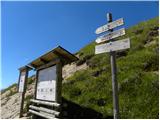 2
2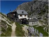 3
3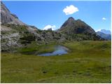 4
4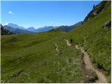 5
5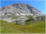 6
6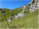 7
7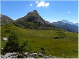 8
8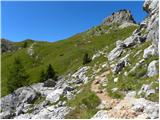 9
9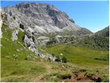 10
10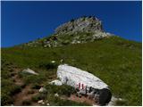 11
11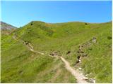 12
12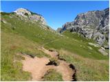 13
13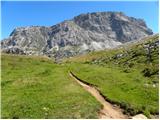 14
14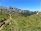 15
15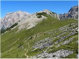 16
16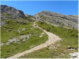 17
17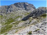 18
18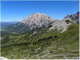 19
19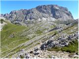 20
20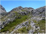 21
21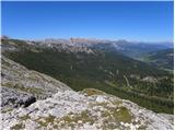 22
22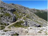 23
23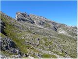 24
24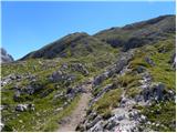 25
25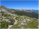 26
26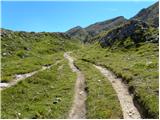 27
27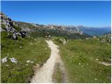 28
28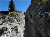 29
29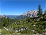 30
30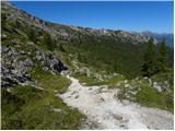 31
31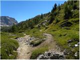 32
32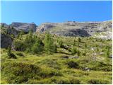 33
33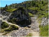 34
34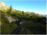 35
35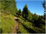 36
36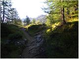 37
37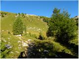 38
38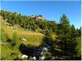 39
39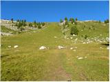 40
40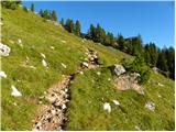 41
41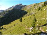 42
42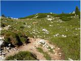 43
43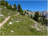 44
44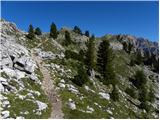 45
45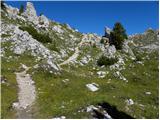 46
46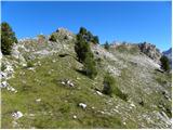 47
47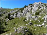 48
48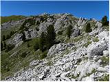 49
49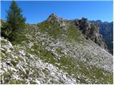 50
50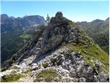 51
51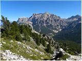 52
52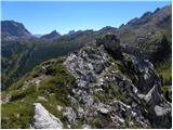 53
53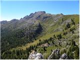 54
54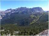 55
55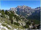 56
56
Discussion about the trip Rifugio Valparola - Les Pizades
To post a comment you must log in:
If you do not yet have a username, you must first
register.