Rifugio Valparola - Setsas
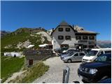
Starting point: Rifugio Valparola (2175 m)
| Latitude/Longitude: | 46,53169°N 11,98868°E |
| |
Walking time: 2 h 30 min
Difficulty: easy marked way
Elevation gain: 396 m
Elevation difference along the route: 600 m
Map: Tabacco 07 1:25.000
Recommended equipment (summer):
Recommended equipment (winter): ice axe, crampons
Views: 4.498
 | 2 people like this post |
Access to starting point:
Access from Gorenjska: Via the Rateče or Predel border crossings to Trbiž / Tarvisio and then continue on the highway in the direction of Vidma / Udine to the Tolmezzo exit. From Tolmezzo we follow the road in the direction of the village Ampezzo and mountain pass Passo della Mauria. The road then descends and brings us to a crossroad, where we continue left (also possible right) in the direction of Cortina d'Ampezzo. At all next crossroads, we follow the signs for Cortina d'Ampezzo.
In Cortina d'Ampezzo we then follow the signs for the alpine pass Passo di Falzarego. We then follow this ascending road to the mentioned pass, and then we continue right towards the pass Passo Valparola. On the pass we park on one of the parking lots near the hut Rifugio Valparola.
From Primorska: We drive on the highway towards Venice / Venezia. At Portogruaro we leave the highway towards Venice and continue right on the highway towards Pordenone. At the next highway junction near Conegliano, we continue right towards Belluno. Near Belluno the highway ends, and at the next crossroads we continue in the direction of Cortina d'Ampezzo. Further, we follow the description above.
Route description:
From the hut Rifugio Valparola we continue towards the southwest following the signs »Settsass«. The path then crosses grassy slopes on the right side of the lake Lago di Valparola and brings us to a junction. We continue right on path no. 24, which leads towards the summit Setsas.
The path then starts slightly ascending on still mostly grassy slopes on the south side of the peak Piz Ciampei. Such a path then brings us to an indistinct saddle where we cross a pasture fence.
The path is then for some time somewhat flatter and brings us below the slopes of Le Pale de Gerda, where there are some ruins from the time of the First World War. Further, the path turns slightly to the right and first ascends slightly a few times, then follows a somewhat longer descent and crossing below the northern slopes of the peak Setsas. Here from the path we have a very nice view of the valley Val Badia and the mountain groups Puez and Lavarella. The path, which descends approximately 200 elevation meters, then through a short stretch of larch forest brings us to grassy slopes on the northwestern side of the peak Setsas. Here the path again starts to ascend more steeply and brings us to a junction.
To the right the path leads towards the hut Pralongia, we continue left following the signs »Setsas«. The path then from the junction ascends slightly parallel to the ridge and runs on mostly grassy terrain towards the south. When we reach the ridge we continue left, from the right another path from the hut Pralongia joins us. Here a very nice view also opens up on the mountain groups Marmolada and Sella. For some time we still ascend slightly on wide grassy terrain, then the path brings us to rocky slopes. Further, the path moves away from the ridge to the north side and mostly ascends traversely towards the east. Soon we will also see the cross on the summit of the mountain and only a short ascent follows to the summit from which wonderful views open up on all sides.

Along the route: Lago di Valparola (2140m)
Photos:
 1
1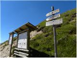 2
2 3
3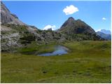 4
4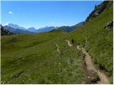 5
5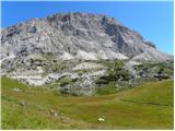 6
6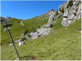 7
7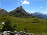 8
8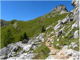 9
9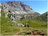 10
10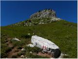 11
11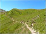 12
12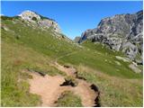 13
13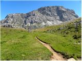 14
14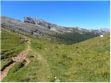 15
15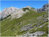 16
16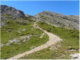 17
17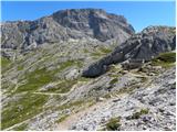 18
18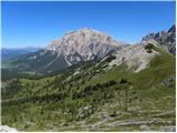 19
19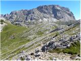 20
20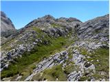 21
21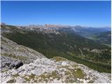 22
22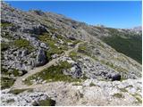 23
23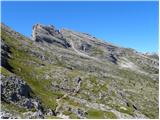 24
24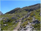 25
25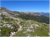 26
26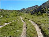 27
27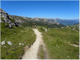 28
28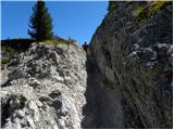 29
29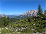 30
30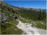 31
31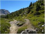 32
32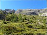 33
33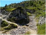 34
34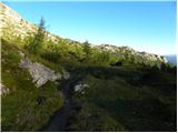 35
35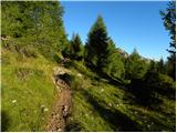 36
36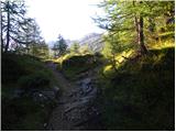 37
37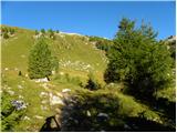 38
38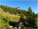 39
39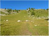 40
40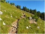 41
41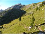 42
42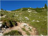 43
43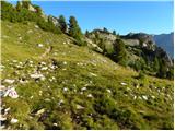 44
44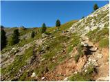 45
45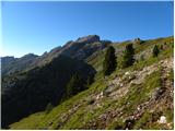 46
46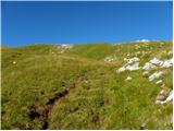 47
47 48
48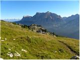 49
49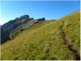 50
50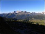 51
51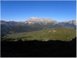 52
52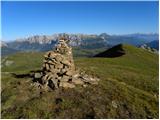 53
53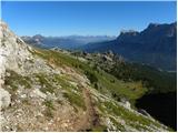 54
54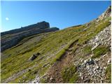 55
55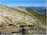 56
56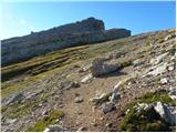 57
57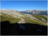 58
58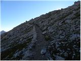 59
59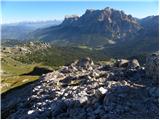 60
60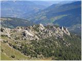 61
61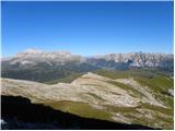 62
62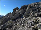 63
63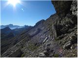 64
64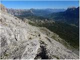 65
65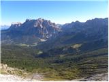 66
66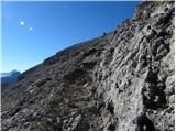 67
67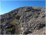 68
68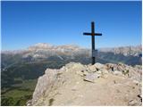 69
69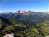 70
70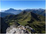 71
71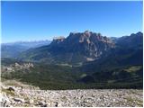 72
72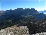 73
73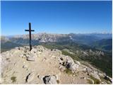 74
74
Discussion about the trip Rifugio Valparola - Setsas
|
| Savinja1120. 07. 2024 10:19:27 |
Parking at Passo Valparola is free, prices in the hut similar to ours. The path to the mountain is easy considering its altitude and offers wonderful views in all directions. Worth visiting.
|
|
|
|
| jprim20. 07. 2024 16:07:01 |
Yes, I agree that the prices are comparable to ours, the only difference is what they offer for that price. A few years ago I spent two nights in this hut, I know our mountain conditions well, so this statement by @savinja is irrelevant.
Just compare staying in this hut and dining room with Planika. 
LP!
|
|
|
|
| mirank20. 07. 2024 20:46:21 |
You are comparing a roadside inn with a high mountain hut. But the fact is there is a difference in quantity, quality and more. For example, last June with a colleague we drank a coffee and shared a schnapps at K podih for 10eur. A month later in the Marinelli hut for three cappuccinos, a beer and a glass of iced tea or something like that 11eur. Here you can at least compare by location, it's similar.
|
|
|
|
| dprapr21. 07. 2024 06:06:12 |
The situation with prices is exactly as mirank wrote.
|
|
|
|
| gor_nik21. 07. 2024 13:18:45 |
I was recently in the Dolomites and I'm still under their impressions. Like it or not, one compares their prices, services and conditions with ours. Generally, there are more people every year in these places. I conclude due to prices, services and beauties they can get there compared to other places (including ours).
Although Italians are also setting up more barriers/parking lots, these are organized, often asphalted parking lots with painted markings. Parking prices there are significantly cheaper than in Vršič or Bohinj. But you can easily park a couple of dozen meters further or before without being in violation.
Beer (0.5 l) is usually 6€. Even where they have to bring it by helicopter (e.g. Lago Sorapis etc.). The price of good coffee is comparable to ours. Paths are well maintained and marked, not to mention the roads. I also noticed many local buses connecting places in the Dolomites and lots of people using them. I didn't use these services myself, but judging by the number of passengers on buses and stops, it seems convenient and useful.
Regarding the discussion in the Valparola – Setsas thread: The huts at Valparola and Planika really can't be compared. Neither for better nor worse, since the first is by the asphalt road, the second under Triglav. On the way to Setsas and at the summit there is no hut. If there were one, hm, hm, then we could say something about services, facilities, sanitation etc. Actually, parking at the Valparola starting point for Setsas is free, as Savinja11 wrote, while the starting points for Planika/Kredarica/Dolič are another story, discussed in other threads on this forum.
|
|
|
To post a comment you must log in:
If you do not yet have a username, you must first
register.