Rimska trdnjava (Lanišče) - Grčarevec (via Razgledišče)
Starting point: Rimska trdnjava (Lanišče) (635 m)
| Latitude/Longitude: | 45,87270°N 14,21320°E |
| |
Route name: via Razgledišče
Walking time: 2 h
Difficulty: easy marked way
Elevation gain: -159 m
Elevation difference along the route: 100 m
Map: Srnjak
Recommended equipment (summer):
Recommended equipment (winter):
Views: 1.150
 | 1 person like this post |
Access to starting point:
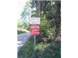
A) From Postojna, Logatec or Godovič we drive to Kalc pri Logatcu, and from there we continue driving in the direction of Podkraj. A few hundred meters further from the left hairpin turn, from the main road a macadam road branches off to the left, by which there are signs for the Roman fortress on Lanišče. We park on a suitable place near the crossroad.
B) From Ajdovščina, Predmeja or Črni Vrh above Idrija we drive to Col, and from there we continue driving towards Podkraj and further towards Logatec. When we already arrive in the Municipality of Logatec, on the part where the road descends and turns slightly to the left, we arrive at a smaller crossroad, where a macadam road branches off to the right, by which we notice signs for the Roman fortress on Lanišče. We park near the crossroad.
Route description:
At the starting point the red sign points towards the fortress, and from there we follow wooden arrows for Razgledišče to the right. Below the power line there are two cart tracks, and we go on the left one. (The right path is the themed trail to Hrušica and the old post office in the direction of Vipava). Already after three steps on the cart track an arrow on the tree points to a footpath on our right. After a short ascent through the forest it flattens and ends with stairs, which bring us onto macadam. When we step on the macadam, in front of us there are rocks, and on them an arrow, which points left. After the turn on the right we notice another, a little more rocky path upwards. Both paths are marked, but also without signs, and by both we get to Razgledišče pod Srnjakom. We will take less time if we go straight on the macadam, where after a turn or two on the rock there will be an image of a white deer, which is a sign that we are at Razgledišče pod Srnjakom. We go past this Razgledišče and ahead through the forest. On the right we will soon come across a sandy area for parking or turning. This is the starting point for a gentle (right) and steep (left) path to Srnjak. Again we go past, steep turn-offs to Srnjak on the right are now constant. The steep slope on the left is in places a precipice (min 200 m). After a longer descent a macadam road joins us from the left. A wooden arrow from the tree points back to Razgledišče, but we already follow the turn of our road to the right. We descend until we come to a clearing. Not far from the monument from the 2nd World War on the rock there is an arrow which points sharply to the left, and there is a cart track. This cart track leaves the macadam for a short time, then returns to it. We don't walk long when the arrow again points left to a cart track, which then splits after a few minutes. We choose the less visible left one and while walking watch for roots or rocks. The goal is near and we will reach it by any path (from then only downhill). The marked cart track will become a path, along which we come to asphalt. A couple more steps downhill and we are already standing before the road from Grčarevec to Planina on the edge of Planinsko polje. Near B & B Žigon or as they say Pr' Žigon there is a box with a stamp.

Along the route: Srnjak (919m)
Photos:
 1
1 2
2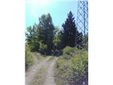 3
3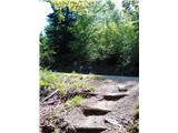 4
4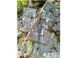 5
5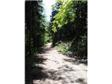 6
6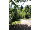 7
7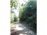 8
8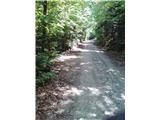 9
9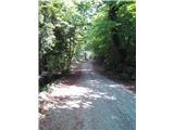 10
10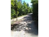 11
11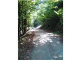 12
12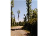 13
13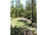 14
14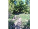 15
15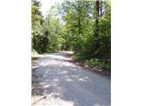 16
16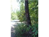 17
17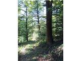 18
18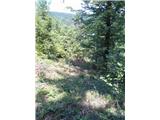 19
19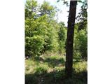 20
20 21
21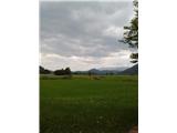 22
22 23
23
Discussion about the trip Rimska trdnjava (Lanišče) - Grčarevec (via Razgledišče)
To post a comment you must log in:
If you do not yet have a username, you must first
register.