Rimske Toplice - Stražnik (via Borovo)
Starting point: Rimske Toplice (213 m)
| Latitude/Longitude: | 46,12080°N 15,20070°E |
| |
Route name: via Borovo
Walking time: 1 h 20 min
Difficulty: easy marked way
Elevation gain: 435 m
Elevation difference along the route: 445 m
Map: Posavsko hribovje - zahodni del 1:50.000
Recommended equipment (summer):
Recommended equipment (winter): ice axe, crampons
Views: 2.840
 | 1 person like this post |
Access to starting point:
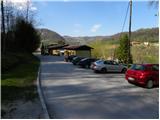
A) From the Ljubljana - Maribor highway take the Celje - center exit, then continue driving in the direction of Laško and later Rimske Toplice. At the end of the Rimske Toplice settlement (immediately after the crossroad where left over the bridge the road branches off towards the village Globoko and railway station Rimske Toplice) we turn sharply right in the direction of Rimske terme. We drive further for a few tens of meters and then arrive at the next crossroad by which we park (near the starting point there is a Tuš store).
B) From Zasavje we first drive to Hrastnik, then continue driving towards Celje. When we arrive in Rimske Toplice we turn right at the main crossroad in the direction of Zidani Most. At the end of the Rimske Toplice settlement (immediately after the crossroad where left over the bridge the road branches off towards the village Globoko and railway station Rimske Toplice) we turn sharply right in the direction of Rimske terme. We drive further for a few tens of meters and then arrive at the next crossroad by which we park (near the starting point there is a Tuš store).
C) From the Posavje direction we first drive to Zidani Most, then continue driving towards Celje. When we arrive in Rimske Toplice we pay attention, as at the beginning of the settlement we turn left in the direction of Rimske terme (we leave the main road only a few meters before the place where right over the bridge the road branches off to the village Globoko). We drive further for a few tens of meters and then arrive at the next crossroad by which we park (near the starting point there is a Tuš store).
Route description:
From the starting point, we head onto the road with signs for Kopitnik, which continues along a smaller stream. The road quickly brings us to the nearby residential house, behind which it changes into a moderately steep mountain path. We continue for a short time still along the stream, then the blazes direct us right onto the slope over which we start to ascend more steeply. A little higher, the path brings us out of the forest, then past a cross and the next residential house brings us to the asphalt road. We follow the road uphill, then at the next crossroad turn right in the direction of Kopitnik. We continue on the road for a few minutes, then arrive at a marked junction, from which we proceed straight on the road toward Stražnik and the Kopitnik peak (right Koča na Kopitniku and Kopitnik peak). After the nearby house, the asphalt ends, and we go left in the direction of Kopitnik. After the meadow, another path from Rimske Toplice joins from the left, and we follow the signs for Aškerčevo and Kopitnik and past an older house return to the forest. Through the forest, we follow the blazes, mostly ascending transversely to the left. Higher, a path branches off to the left toward Aškerčevo, and to Lukovški preval saddle we follow the signs for Stražnik and Kopitnik, from the saddle, where the path over Senožeti also joins, we go left in the direction of Stražnik (right Kopitnik).
We continue past a holiday cottage, and we ascend along a cart track. Higher, the signs for the peak direct us left from the cart track, and then we steeply ascend to the nearby peak which is located on the left side.
From the stamping box, we return a few steps and ascend also to the "right" peak, from it we descend to the cart track, and from there in a few dozen steps we reach the cross on Kopitnik.
Rimske Toplice - Lukovški preval 1:05, Lukovški preval - Stražnik 0:15.

Along the route: Lukovški preval (578m)
Photos:
 1
1 2
2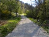 3
3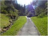 4
4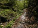 5
5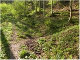 6
6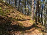 7
7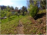 8
8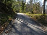 9
9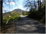 10
10 11
11 12
12 13
13 14
14 15
15 16
16 17
17 18
18 19
19 20
20 21
21 22
22 23
23 24
24 25
25 26
26 27
27 28
28 29
29 30
30 31
31 32
32 33
33 34
34 35
35 36
36 37
37 38
38 39
39 40
40 41
41 42
42 43
43 44
44 45
45
Discussion about the trip Rimske Toplice - Stražnik (via Borovo)
To post a comment you must log in:
If you do not yet have a username, you must first
register.