Rimske Toplice - Vrhe (at Gore) (via Ogeški potok)
Starting point: Rimske Toplice (213 m)
| Latitude/Longitude: | 46,12080°N 15,20070°E |
| |
Route name: via Ogeški potok
Walking time: 2 h 50 min
Difficulty: easy marked way
Elevation gain: 568 m
Elevation difference along the route: 740 m
Map: Posavsko hribovje - zahodni del 1:50.000
Recommended equipment (summer):
Recommended equipment (winter): ice axe, crampons
Views: 245
 | 1 person like this post |
Access to starting point:
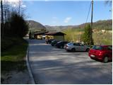
A) From the Ljubljana - Maribor highway, take the Celje - center exit, then continue driving towards Laško and later Rimske Toplice. At the end of the settlement Rimske Toplice (immediately after the junction where the road branches left over the bridge towards the village Globoko and Rimske Toplice railway station), turn sharply right towards Rimske terme. Drive a further 10 m or so, then arrive at the next junction where you park (near the starting point there is a Tuš store).
B) From Zasavje, first drive to Hrastnik, then continue towards Celje. Upon arriving in Rimske Toplice, turn right at the main junction towards Zidani Most. At the end of the settlement Rimske Toplice (immediately after the junction where the road branches left over the bridge towards the village Globoko and Rimske Toplice railway station), turn sharply right towards Rimske terme. Drive a further 10 m or so, then arrive at the next junction where you park (near the starting point there is a Tuš store).
C) From the Posavje direction, first drive to Zidani Most, then continue towards Celje. When arriving in Rimske Toplice, pay attention as you will turn left at the start of the settlement towards Rimske terme (leave the main road just a few meters before the point where the road to the village Globoko branches right over the bridge). Drive a further 10 m or so, then arrive at the next junction where you park (near the starting point there is a Tuš store).
Route description:
From the starting point, head onto the road marked for Kopitnik, which continues along a smaller stream. The road quickly leads to a nearby residential house, behind which it turns into a moderately steep mountain path. Continue along the stream for a short time, then the blazes direct you right onto the slope, over which you begin to ascend more steeply. A little higher, the path leads out of the forest, then past a cross and the next residential house to an asphalt road. Follow the road uphill, then at the next junction go right towards Kopitnik. Continue on the road for a few more minutes, then arrive at a marked junction.
At the junction, leave the asphalt road and continue right on the footpath towards "Kopitnik - koča" (straight to Kopitnik and Stražnik). The path ahead ascends transversely to the right, soon levels out and joins a poorer forest road, which you follow to its end.
From the end of the road, continue on a well-trodden path that begins to ascend moderately to occasionally steeply through the forest. Higher up, the path leads past patches of wild garlic, then joins a cart track, which you follow to the right. The cart track soon turns sharply right and ascends transversely onto a less steep slope, where you reach the edge of the forest. Here the path turns left and gradually widens into a macadam road. A little further on, the path from Šmarjeta joins from the right, but continue straight to the nearby homestead on Izeri.
At the homestead, the road becomes asphalt; walk on it for just a few meters, then a sign on a tree "koča" directs you left into the forest. Ascend through the forest for a short time, then join the path from the villages Marno and Turje. From the junction, exit the forest; a gentle path continuing across a larger meadow brings you to the Koča na Kopitniku in a few minutes.
From the Koča na Kopitniku, continue right towards Gore, Mrzlica and Šmohor; walk a few steps on the road, then the mountain signs direct you slightly right into the forest, where the path leads along a cart track. Soon return to the road from the cart track, and at several junctions follow the signs for Gore. The path ahead gradually turns into a poorer road, leading past a solitary house; behind it, it enters the forest and gently descends to a junction by a concreted spring, where a chapel once stood.
Here continue straight (right downhill to Marno on the NOB path); a little further, upon leaving the forest, a beautiful view opens to the right side, reaching to Uršlja gora and further to Golica / Koralpe in neighboring Austria. A bit further, reach a macadam road, and a few steps later an asphalt road. After a short descent, arrive at a junction where the road to Fračji dol branches right; a few steps further, a marked path from Zidani Most - the path over Širje - joins from the left.
The path ahead leads along the asphalt road, mostly descending gently to moderately; lower down, also take some marked shortcuts.
Return to the asphalt road at a marked junction, where a path from the settlement Marno towards Dom v Gorah joins from the right.
A few minutes further, leave the forest, and from the right the path from Dol pri Hrastniku joins. Continue straight and after a short ascent arrive at Dom v Gorah.
From the hut, continue past the sports fields towards the nearby church of St. Jurij, located on a hill slightly west to northwest of the mountain hut. The marked path bypasses the hill with the church on the right side; follow the marked path towards the railway station in Hrastnik to the point where the path turns left downhill from the road. Here continue straight to near two weekend cottages, between which you proceed; the path, still marked with blazes, returns to the forest and ascends to the indistinct summit of Vrhe. The highest point of the summit is just a few steps right of the path.
Rimske Toplice - Koča na Kopitniku 1:40, Koča na Kopitniku - Dom v Gorah 1:00, Dom v Gorah - Vrhe 0:10.

Photos:
 1
1 2
2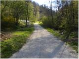 3
3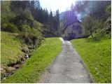 4
4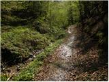 5
5 6
6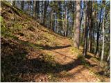 7
7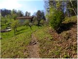 8
8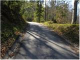 9
9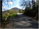 10
10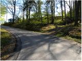 11
11 12
12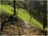 13
13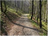 14
14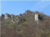 15
15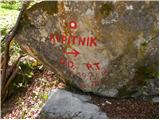 16
16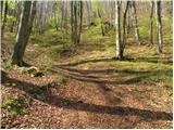 17
17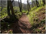 18
18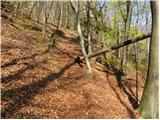 19
19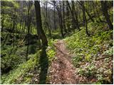 20
20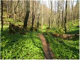 21
21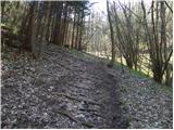 22
22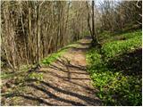 23
23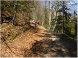 24
24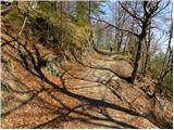 25
25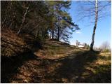 26
26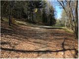 27
27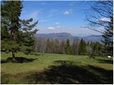 28
28 29
29 30
30 31
31 32
32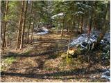 33
33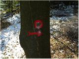 34
34 35
35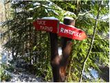 36
36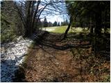 37
37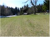 38
38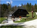 39
39 40
40 41
41 42
42 43
43 44
44 45
45 46
46 47
47 48
48 49
49 50
50 51
51 52
52 53
53 54
54 55
55 56
56 57
57 58
58 59
59 60
60 61
61 62
62 63
63 64
64 65
65 66
66 67
67 68
68 69
69 70
70 71
71 72
72 73
73 74
74 75
75 76
76 77
77 78
78 79
79 80
80 81
81 82
82 83
83 84
84
Discussion about the trip Rimske Toplice - Vrhe (at Gore) (via Ogeški potok)
To post a comment you must log in:
If you do not yet have a username, you must first
register.