Starting point: Bele vode (989 m)
| Latitude/Longitude: | 46,40840°N 13,53400°E |
| |
Walking time: 2 h 30 min
Difficulty: partly demanding marked way
Elevation gain: 805 m
Elevation difference along the route: 884 m
Map: Julijske Alpe - zahodni del 1:50.000
Recommended equipment (summer):
Recommended equipment (winter): ice axe, crampons
Views: 12.015
 | 2 people like this post |
Access to starting point:
A) From Kranjska Gora over the border crossing Rateče we drive to Trbiž/Tarvisio. In Trbiž we continue left in the direction of Bovec and follow the road to the intersection near Rabeljsko Lake. Here we continue right in the direction of Nevejski preval/Sella Nevea. We follow this road, which is mostly ascending, to the bridge where the road crosses the stream Beli potok/Rio Bianco. Just a few meters behind the bridge (just before the second bridge) we will notice signposts for Jerebica/Cima del Lago on the left side of the road. Here we turn left, slightly descend and then park on the parking lot by extensive gravel areas.
B) From Bovec we drive to the border crossing Predel, from which we descend to the Italian side. Just a little after Rabeljsko Lake we come to an intersection, where we continue left in the direction of Nevejski preval/Sella Nevea. Further we follow the above description.
Route description:
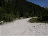
From the parking lot we continue on a macadam road which gently descends over extensive gravel areas. After approximately 5 minutes of walking we come to the next signposts which direct us over a smaller gravel area into the forest. The path then immediately turns right and insignificantly ascends along torrent deposits of sand and stones. After a few minutes of additional walking we come to a completely rutted cart track which we follow left upwards. Further we ascend on the mentioned cart track which in the left bend brings us to an unmarked junction (a cairn is usually here).
We continue right (left on the steep cart track to Jerebica) on an initially poorly visible path (fallen trees) which continues on the cart track for only a short time. The path ahead transitions into dense forest where it steeply ascends for a short time. After a few minutes the steepness eases and the path brings us to an old military mule track which turns slightly to the right. We continue the ascent on the mentioned mule track from which beautiful views of the surroundings occasionally open up. Higher the forest is gradually replaced by bushes and the path turns even more to the right and even slightly descends. After a few steps of descent the path turns sharply left and passes below the steep walls of Bohnica (1946 m) where it then ascends transversely over increasingly panoramic slopes. Further on an occasionally quite overgrown path we quickly ascend to the limestone pavement area where beside the path we notice the first smaller military trenches. The blazes higher direct us slightly left and the path brings us to an area full of karst sinkholes. Because the path in places runs exactly above the edge of the sinkholes there is a danger of slipping at certain spots. The path ahead steeply ascends for a short time and after a few minutes of additional walking brings us to a marked junction located directly near the state border. Here slightly to the left we will notice an indistinct summit on which we ascend in a few steps of additional walking (the path to the summit is not marked).

Photos:
 1
1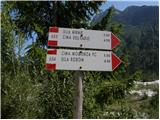 2
2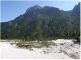 3
3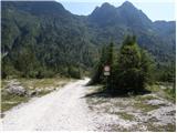 4
4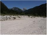 5
5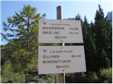 6
6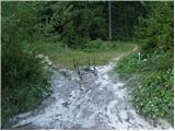 7
7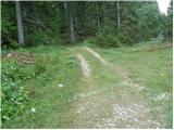 8
8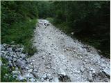 9
9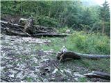 10
10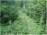 11
11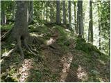 12
12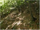 13
13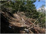 14
14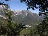 15
15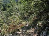 16
16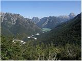 17
17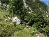 18
18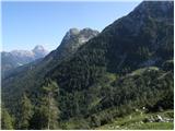 19
19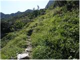 20
20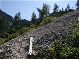 21
21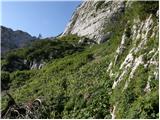 22
22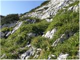 23
23 24
24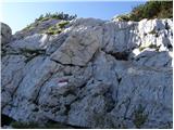 25
25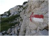 26
26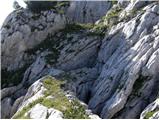 27
27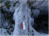 28
28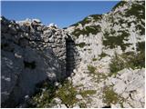 29
29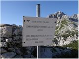 30
30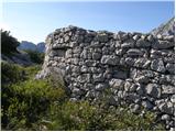 31
31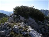 32
32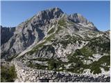 33
33
Discussion about the trip Bele vode - Škraplja
|
| esther10. 09. 2009 |
Nice  Next time I'll join too Next time I'll join too 
|
|
|
|
| klm29. 10. 2012 |
The bulge you describe is not Škraplja at all, but rather the hump above the pass (Sella Jama). Škraplja is actually an indistinct little hill northeast towards Snežni vrh.
|
|
|
|
| margu5014. 07. 2018 |
Is ascent to Černelsko špico possible from this side, judging by the picture it looks not too difficult 
|
|
|
To post a comment you must log in:
If you do not yet have a username, you must first
register.