Rjavi bg - Sveta Katarina above Novokračine
Starting point: Rjavi bg (547 m)
| Latitude/Longitude: | 45,49540°N 14,29870°E |
| |
Walking time: 40 min
Difficulty: easy unmarked way
Elevation gain: 128 m
Elevation difference along the route: 140 m
Map: Snežnik 1:50.000
Recommended equipment (summer):
Recommended equipment (winter):
Views: 2.152
 | 2 people like this post |
Access to starting point:
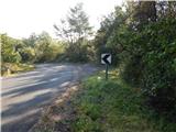
First, we drive to Ilirska Bistrica, then we continue driving towards the border crossing Jelšane. After the settlement Jelšane we leave the main road towards Croatia and we continue left in the direction of the settlement Novokračine. Next follows a little more than 1.5 km of driving on an asphalted and ascending road, and then we get to a smaller pass, where we notice signs for Sv. Katarina. From here we continue on the road which starts descending, and we drive along it for good 500 more meters, after that the forest road branches off to the right. Here as well, we go straight ahead, then a few 10 meters ahead, at the beginning of the left turn, we park in an appropriate place by the road.
Route description:
If we've parked at the beginning of the left turn, we return on the road a little back, then we continue left (direction south to southwest) on a macadam road, on which we quickly get to the nearby bee house. A little further, the road splits into three parts, and we continue on the middle one, which then leads us by the right edge of a larger clearing. The road quickly returns into the forest, through which it ascends gently to moderately. A little higher another road branches off slightly to the left, and we continue slightly right, on the road which gradually turns more and more to the right. Further, the road leads us through a little more rocky terrain, from where some views open up temporarily. A quite gentle path then turns even more to the right and at the cross (11th station of the Way of the Cross) joins the path from Jelšane (in the description starting point Branček).
We continue on a somewhat wider road which a little further brings us out of the forest. Next follows a somewhat flatter and partly panoramic path, which quickly brings us to the hunting cottage.
From the hunting cottage only a short ascent follows on the road or on the nearby footpath and we already reach the chapel of St. Katarina, which is situated on a panoramic summit.
Description and pictures refer to the condition in the year 2014 (September).

Photos:
 1
1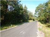 2
2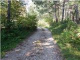 3
3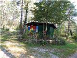 4
4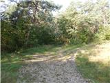 5
5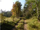 6
6 7
7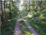 8
8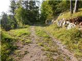 9
9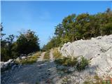 10
10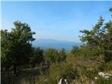 11
11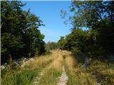 12
12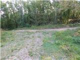 13
13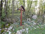 14
14 15
15 16
16 17
17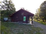 18
18 19
19 20
20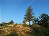 21
21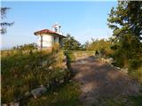 22
22 23
23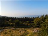 24
24
Discussion about the trip Rjavi bg - Sveta Katarina above Novokračine
|
| ana30. 01. 2019 |
On the map, Koča na Sv. Katarini is marked, next to it is a sign for accommodation. Please, can someone help me if it is possible to sleep in the hut, as I am planning multi-day hiking trips in these areas this summer. Sincere thanks for the answer.
|
|
|
|
| marco31. 01. 2019 |
The hut currently does not yet offer overnight stays, but work is underway on this.
You can get more information from the local tourist association ŠTEK.
|
|
|
To post a comment you must log in:
If you do not yet have a username, you must first
register.