Cesta na Zaplano - Strmica
Starting point: Cesta na Zaplano (566 m)
| Latitude/Longitude: | 45,94940°N 14,23890°E |
| |
Walking time: 10 min
Difficulty: easy unmarked way
Elevation gain: 60 m
Elevation difference along the route: 60 m
Map:
Recommended equipment (summer):
Recommended equipment (winter):
Views: 1.610
 | 4 people like this post |
Access to starting point:
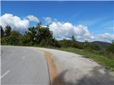
From the old road Vrhnika - Logatec, at the crossroads at the Cesarski Vrh bus stop, we turn in the direction of Zaplana, which is 3 km according to the road sign. We continue driving on the ascending road, from which soon after the right hairpin turn a macadam road branches off to the left. We park at an appropriate place at the crossroads.
Route description:
From the starting point, we continue on the macadam road, which ascends moderately, from which only transiently some views open towards Krim and Ljubljanski vrh. A little higher, at the smaller crossroads we continue right, then past the holiday cottage we arrive below the peak of Strmica, from where a nice view opens up mainly towards the east.
Access to the very peak is impossible because of the military area.
Description and pictures refer to the condition in the year 2015 (September).
Photos:
 1
1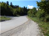 2
2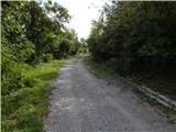 3
3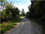 4
4 5
5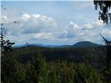 6
6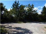 7
7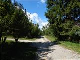 8
8 9
9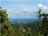 10
10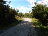 11
11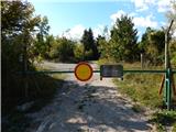 12
12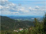 13
13
Discussion about the trip Cesta na Zaplano - Strmica
To post a comment you must log in:
If you do not yet have a username, you must first
register.