Robanov kot - Lučki Dedec (via Kocbekov dom)
Starting point: Robanov kot (650 m)
| Latitude/Longitude: | 46,39480°N 14,70300°E |
| |
Route name: via Kocbekov dom
Walking time: 5 h
Difficulty: difficult marked way, partly demanding unmarked way
Elevation gain: 1373 m
Elevation difference along the route: 1535 m
Map: Kamniške in Savinjske Alpe 1:50.000
Recommended equipment (summer): helmet
Recommended equipment (winter): helmet, ice axe, crampons
Views: 4.070
 | 2 people like this post |
Access to starting point:
Through the Volovljek pass (Kranjski Rak) or from Mozirje we drive to Luče, and then we follow the signs for Solčava and Logarska dolina. When we arrive in the settlement Robanov Kot, signs for the alpine valley Robanov kot direct us to the left onto a side road, along which we drive to the parking lot near the Roban farm, where we park. We can also park already 500 m lower, where there is another organized parking lot, but we must not park on the parking lot of the pension Govc-Vršnik, because consequently there is no space for the guests of the pension.
Route description:
If we have parked on the lower parking lot we continue along the road to the parking lot at the Roban farm, just a few meters ahead from the last parking lot we arrive at a junction, where we continue straight ahead along the road where there is a barrier (right Strelovec).
The road towards Robanova planina then goes into the forest and brings us to a fork, where we continue straight ahead, further along the road (left partisan hospital 45 min).
The road then brings us out of the forest onto Robanov travnik, where a nice view opens up onto the surrounding rock faces. On the other side of the meadow the road goes back into the forest and ascends somewhat more steeply. This is followed by crossing a grazing fence and soon thereafter we emerge from the forest onto the panoramic Robanova planina.
From the mountain pasture we continue following the signs "Korošica, Ojstrica" and the wide path brings us into the forest already after a few meters. After a short ascent the path turns left and crosses several torrent beds. We ascend again through the forest and soon reach a small waterfall below the slopes of Molička peč and Velika Zelenica. Here the path turns right and begins to ascend quite steep slopes with the aid of a fixed cable and some pitons. This is followed by another short ascent through the forest on somewhat gentler slopes, after which we reach a somewhat more rocky section of the path. The path then ascends for quite some time along steep slopes above the torrent gully. The path here is routed along fine passages and is very well secured with a fixed cable, so the ascent does not cause major difficulties. The path is also aided by numerous pitons and steps carved into the rock. This is followed by a few more steeper ascents with the aid of the fixed cable and pitons, after which the path brings us onto level slopes covered with dwarf pines. The path then leads us through the dwarf pines in a short descent to a fork, where we continue straight in the direction of Korošica (right Molička planina 10 minutes). This is followed by a short ascent and we join the path from the Podvežak mountain pasture, which after a further short traversing ascent brings us to Sedelce.
From Sedelce we descend towards the Korošica plain (slightly left shortcut that bypasses Kocbekov dom). After this descent only a ten-minute walk to the hut remains.
From Kocbekov dom we continue left in the direction of Podvolovljek and Kamniška Bistrica, along the path that first ascends gently, then moderately towards the Prag pass, where the aforementioned shortcut joins from the left. After approximately 15 minutes of walking we step onto the mentioned pass, but we follow the marked path for another 10 m or so, to the point where the signs for Lučki Dedec direct us right onto an unmarked path.
At the point where we notice the signs for Lučki Dedec we leave the marked path and continue the ascent along an initially clearly visible trail. The path ahead continues along a small valley, then turns right and ascends steeply. Further on the trail, along which there are numerous cairns, begins to fade, but in fine weather this does not cause orientation problems. This is followed by an ascent over a small rocky terrain, after which the path transitions onto grassy slopes surrounded by dwarf pines. Here we will already notice one of the three peaks of Lučki Dedec on the right, but we continue straight along the path that brings us onto the main ridge. On the ridge we continue slightly left and the path quickly brings us past the second subpeak onto a large meadow, along which we ascend to the sheer summit in a few steps.
Robanov kot - Robanova planina 1:00, Robanova planina - Korošica 3:00, Korošica - Lučki Dedec 1:00.

Photos:
 1
1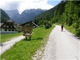 2
2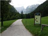 3
3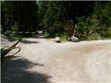 4
4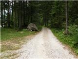 5
5 6
6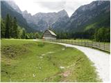 7
7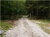 8
8 9
9 10
10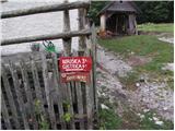 11
11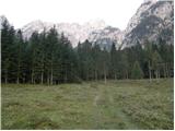 12
12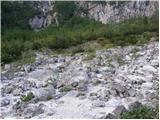 13
13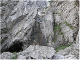 14
14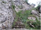 15
15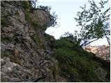 16
16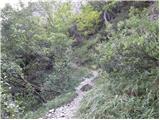 17
17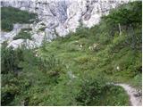 18
18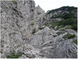 19
19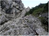 20
20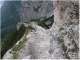 21
21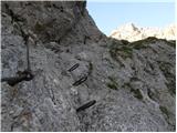 22
22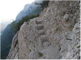 23
23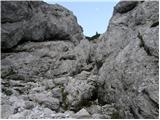 24
24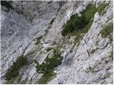 25
25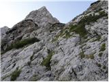 26
26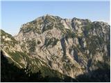 27
27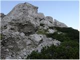 28
28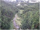 29
29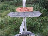 30
30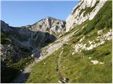 31
31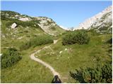 32
32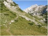 33
33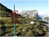 34
34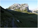 35
35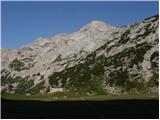 36
36 37
37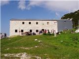 38
38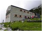 39
39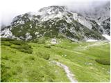 40
40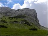 41
41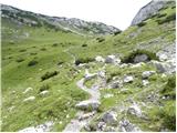 42
42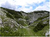 43
43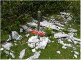 44
44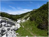 45
45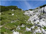 46
46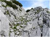 47
47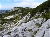 48
48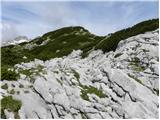 49
49 50
50 51
51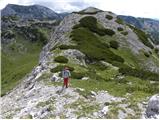 52
52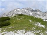 53
53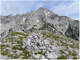 54
54
Discussion about the trip Robanov kot - Lučki Dedec (via Kocbekov dom)
|
| lino5. 11. 2016 |
There is probably a mistake with the photos of Kocbekov dom. We all know that Kocbekov dom on Korošica has a new modern makeover.
|
|
|
|
| garmont5. 11. 2016 |
@lino, the moderator merged two older path descriptions into a new trip. And, as you'll notice, he has used this "technique" many times before.
|
|
|
|
| lukad96. 10. 2018 |
Yesterday 5.10.2018 I was up there. Around 17 degrees, clear sky and sunshine. At the top of Dedec there is snow only for decoration, the trail is passable. Just from Robanov kot towards Molička peč be careful, because some pegs with the fixed cable are broken, and the trail is slippery in places despite plenty of sun, because it is on the shady side
|
|
|
|
| kiht20. 06. 2021 10:43:03 |
Has anyone by chance walked the mentioned path recently? What are the conditions like at this time? Thanks in advance for answers and greetings!
|
|
|
|
| Robie4. 11. 2024 15:11:28 |
Enough water on the path, no need to stock up - the last place to refill water is at Molička planina...
|
|
|
To post a comment you must log in:
If you do not yet have a username, you must first
register.