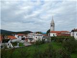
Starting point: Rodik (579 m)
| Latitude/Longitude: | 45,62340°N 13,98010°E |
| |
Walking time: 40 min
Difficulty: easy unmarked way
Elevation gain: 225 m
Elevation difference along the route: 225 m
Map:
Recommended equipment (summer):
Recommended equipment (winter):
Views: 3.880
 | 1 person like this post |
Access to starting point:
A) From the Ljubljana–Koper highway, take the Divača exit, then from the roundabout continue to the exit towards Kozina and Škocjan Caves. We then drive through the underpass under the highway along the main road towards Kozina to the crossroads, where the road to the settlement Rodik branches off to the left. When we arrive in Rodik, at the crossroads by the house with house number Rodik 2, we continue left, then drive on a narrower road which leads us between numerous houses. Through the village we follow the "feeling" that we have to arrive above the village, where the cycling path (macadam road) starts, which leads towards Artvižam (there are signs in Rodik for the mentioned cycling path). We park above the village in an appropriate place near the pumping station Rodik 2. Further driving is forbidden.
B) From the Koper–Ljubljana highway, take the Kozina exit, then continue driving towards Ilirska Bistrica. From the traffic-light crossroads in Kozina, continue straight (left Trst, right Ilirska Bistrica) onto Rodiška Road, along which we continue to the settlement Rodik. When we arrive in Rodik, at the crossroads by the house with house number Rodik 2, we continue left, then drive on a narrower road which leads us between numerous houses. Through the village we follow the "feeling" that we have to arrive above the village, where the cycling path (macadam road) starts, which leads towards Artvižam (there are signs in Rodik for the mentioned cycling path). We park above the village in an appropriate place near the pumping station Rodik 2. Further driving is forbidden.
Route description:
From the pumping station Rodik 2 we continue on the macadam road, which is closed to public traffic and leads towards Artvižam. Initially the road ascends quite steeply, then brings us to a smaller crossroads, where we continue sharply right (straight Artviže). We continue the ascent on the still steep road, which ascends the slopes of the peak Ajdovščina. Higher, the road turns more and more to the left, meanwhile changing into a cart track. When we arrive at the indistinct ridge Čuk, we pay attention, because soon we leave the wider cart track and continue the ascent to the left on a narrower cart track, which ascends moderately (if we arrive at the nearby hunting cottage, we are already too far). A few minutes of moderate ascent follow, then the path brings us to the top of Ajdovščina, where a metal container stands.
Description and pictures refer to the condition in the year 2015 (September).
Photos:
 1
1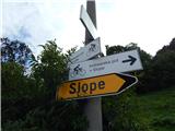 2
2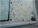 3
3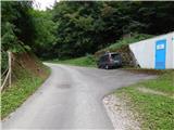 4
4 5
5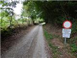 6
6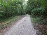 7
7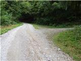 8
8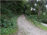 9
9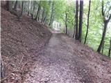 10
10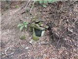 11
11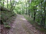 12
12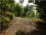 13
13 14
14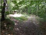 15
15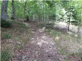 16
16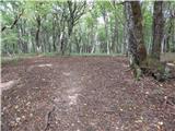 17
17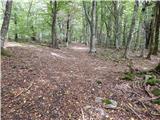 18
18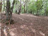 19
19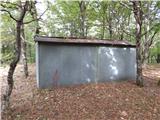 20
20 21
21 22
22
Discussion about the trip Rodik - Ajdovščina
To post a comment you must log in:
If you do not yet have a username, you must first
register.