Rogarjev rovt - Frauenkogel/Dovška Baba (via Rožca and Hruški vrh)
Starting point: Rogarjev rovt (1175 m)
| Latitude/Longitude: | 46,46400°N 14,01110°E |
| |
Route name: via Rožca and Hruški vrh
Walking time: 2 h 30 min
Difficulty: easy unmarked way
Elevation gain: 716 m
Elevation difference along the route: 780 m
Map: Karavanke - osrednji del 1:50.000
Recommended equipment (summer):
Recommended equipment (winter): ice axe, crampons
Views: 5.860
 | 2 people like this post |
Access to starting point:
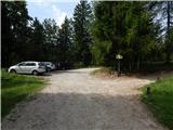
A) From the highway Ljubljana - Jesenice, take the exit Jesenice - east (Lipce), then continue driving towards Jesenice. At the traffic-light intersection in Slovenski Javornik continue left towards the center of Jesenice and Kranjska Gora, while we drive along the main road to the intersection where signs for Golica and Planina pod Golico direct us right onto the ascending road. Follow the road towards Planina pod Golico to the sharp right turn, where we turn left towards Plavški Rovt. Above Plavški Rovt the asphalt ends, and the road temporarily even descends a little. A little higher we arrive at an intersection, where signs for Dovje 9 km direct us sharply left onto a steeper macadam road. From the intersection onwards, follow the road for a good 2 km, or more precisely to Rogarjev rovt, which we recognize by some holiday cottages. Park at an appropriate place next to the smaller intersection, where an unmarked and worse forest road branches off to the right towards Hruška planina.
B) First, drive to Kranjska Gora, then continue driving towards Jesenice. At Dovje leave the main road and turn left towards the village center, from where follow the signs for Dovška Baba. The road soon after the village brings us to an intersection, where we continue on the right road (sharply left Kepa and Borovje). Further on, drive quite a while to the next intersection, where the road towards mountain pasture Dovška Rožca branches off to the left (in descriptions starting point Ravne), while we continue straight towards Plavški Rovt. Soon after the intersection we cross stream Presušnik, then the road ascends a little more. When the road levels out, it continues crossing the slopes to the right, then brings us to a smaller saddle, after which it starts descending transversely. Next comes the crossing of stream Dobršnik, then pay attention, as we will soon arrive at Rogarjev rovt, which we recognize by a larger hay meadow, smaller parking lot and branch-off of a cart track to the left.
Route description:
From the starting point, head onto the poor macadam road, which first gently ascends over Rogarjev rovt. On the other side of the rovt the road goes into the forest and after the barrier starts steeply ascending. Higher, the road brings us onto the ridge north of the lesser-known Suhi vrh (1339 m), from where for a short time a view opens towards Stol, Vajnež and Struška. The road quickly returns into the forest, through which we walk for a few minutes, then we arrive at the extensive pastures of Hruška planina. From here continue on the fairly gentle road, along which with a view of Hruški vrh we walk to the nearby shepherd hut on Hruška planina (also Hruščanska planina).
From the hut continue right past the larger watering place for animals and across the larger pasture to the edge of the forest, where for a short time we still continue on the wide cart track. Immediately after the path enters the forest, leave the cart track and continue the ascent on the well-beaten but still unmarked path, which branches left from the cart track. Ahead the path starts traversing upwards through the forest and quickly brings us to a larger gully, which we cross and then on the other side of it start ascending more steeply. A little higher we step out of the forest and turn slightly right, then ascend over increasingly panoramic grassy slopes. Higher the trail levels out and brings us to the hut on Rožca.
From the hunting hut continue on one of the small paths which in a traversing ascent climbs to the border ridge between Slovenia and Austria.
Once on the ridge continue on the well-beaten path, which proceeds westwards (right Klek). Along the path, which continues along the border ridge, instead of Slovenian markers we will notice Austrian ones (markers in the colors of the Austrian flag). Follow this increasingly panoramic and easy path, which occasionally ascends quite steeply, all the way to Hruški vrh, on which stands a small chapel.
From Hruški vrh, where the chapel of St. Izidor is located, we start descending along the ridge; when the descent ends, a marked path joins from the left which bypasses Hruški vrh, a few steps further a marked Austrian path also joins from the right, leading over the summit of Koprivnjak. Walk only a few steps on the marked path, then continue slightly right onto the unmarked path which continues along the ridge (the path which leaves the ridge slightly to the left leads towards mountain pasture Dovška Rožca).
Further on we mainly moderately ascend along the relatively wide ridge overgrown with brushwood on some sections. Higher, as we approach Baba (1849 m) - Baba is the eastern forepeak of Dovška Baba -, the path leaves the ridge slightly to the left, crossing a shorter steeper and especially when wet slippery-dangerous slope. When the crossing ends, the path returns to the ridge, and we ascend to the summit of Dovška Baba in a few minutes of further walking.
Rogarjev rovt - Hruška planina 30 minutes, Hruška planina - Rožca 40 minutes, Rožca - Hruški vrh 30 minutes, Hruški vrh - Dovška Baba 50 minutes.

Photos:
 1
1 2
2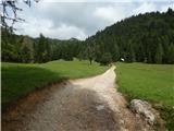 3
3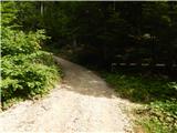 4
4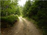 5
5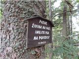 6
6 7
7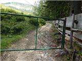 8
8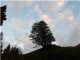 9
9 10
10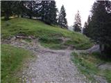 11
11 12
12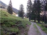 13
13 14
14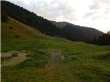 15
15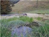 16
16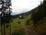 17
17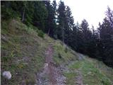 18
18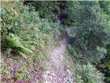 19
19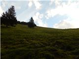 20
20 21
21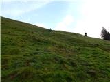 22
22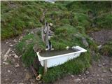 23
23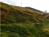 24
24 25
25 26
26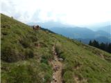 27
27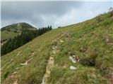 28
28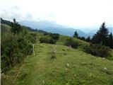 29
29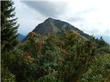 30
30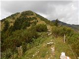 31
31 32
32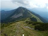 33
33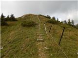 34
34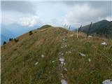 35
35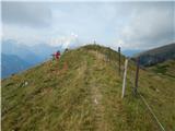 36
36 37
37 38
38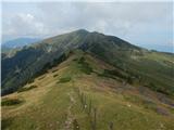 39
39 40
40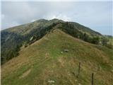 41
41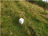 42
42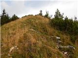 43
43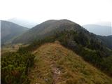 44
44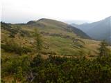 45
45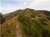 46
46 47
47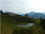 48
48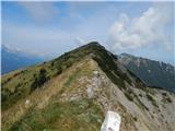 49
49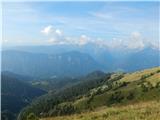 50
50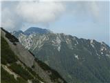 51
51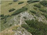 52
52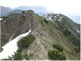 53
53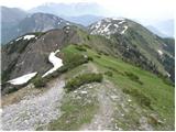 54
54 55
55
Discussion about the trip Rogarjev rovt - Frauenkogel/Dovška Baba (via Rožca and Hruški vrh)
|
| Majdag10. 06. 2019 |
8.6.... Hruški vrh, Dovška Baba, sedlo Rožca... the paths are nicely decorated with flowers, no more snow.. But it's a bit annoying, new electric shepherds are strung up, they buzz. No wooden crossings over the wires. Old wires are in the grass and you can get tangled in them.. Livestock is already grazing on Hruški planina.
https://jelenkamenmajdag.blogspot.com/2019/06/gori-doli-vrhovi-in-planine.html
|
|
|
To post a comment you must log in:
If you do not yet have a username, you must first
register.