Rogarjev rovt - Rosenkogel/Hruški vrh (via Hruška planina)
Starting point: Rogarjev rovt (1175 m)
| Latitude/Longitude: | 46,46400°N 14,01110°E |
| |
Route name: via Hruška planina
Walking time: 1 h 35 min
Difficulty: easy unmarked way
Elevation gain: 601 m
Elevation difference along the route: 601 m
Map: Karavanke - osrednji del 1:50.000
Recommended equipment (summer):
Recommended equipment (winter): ice axe, crampons
Views: 12.283
 | 2 people like this post |
Access to starting point:
From the Ljubljana-Jesenice highway, we take the Lipce exit and follow the road towards Jesenice, where signs for Planina pod Golico direct us onto an ascending road (third traffic-light intersection from the center or the railway station). The steep road takes us to an intersection, where we turn left over the bridge towards Plavški Rovt. When we arrive in the village, we follow the road further to the spot where the asphalt ends. After the village, the road descends slightly; we encounter its right fork, but continue straight ahead. When we reach a smaller hamlet, at the intersection we notice a wooden direction sign "Dovje 9 km". Here we turn sharply left and continue along the winding forest road for another 3 km, after which we arrive at a larger rovt with holiday cottages on the left. On the right, at a larger right bend, we notice a cart track that leads across the meadow, uphill towards the north. We park in an appropriate place nearby.
Route description:
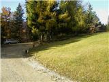
We start on the mentioned cart track similar to a road (almost unfit for driving with a personal car), uphill towards the north. It quickly brings us into the forest, where it starts quite steeply ascending. When the path turns a little to the right and splits, we continue on the right increasingly steep uphill. The path increasingly takes on the appearance of an arranged forest road. After a few hairpin turns, the steepness gradually starts decreasing; finally, when a view opens on the right towards the saddle Rožca and Klek, the road finally flattens. After a short time the path again ascends a little, and soon we run into a fence with a gate or barrier. We enter the mountain pasture, where immediately, when we notice Hruški Vrh, we step off the path to the left into a small gully on the pasture, and continue in the northerly direction towards a larger spruce with some sort of (small) bench.
From here onwards, in the same direction we look for a path uphill towards the forest, keeping to the right edge of an initially indistinct forest ridge. Here the uphill path apparently occasionally disappears, but it is not hard to track it down, because it runs all the time along the mentioned ridge (pasture on the right). When we come out of the forest, we continue upwards along a small valley between Hruški vrh and the ridge of Črničje (nameless on maps) on the left, near whose summit the path turns left to the fence. We cross the latter and continue on a poorly visible path to the right, steeply uphill (straight ahead the path to the mountain pasture Dovška Rožca). There follows approx. 15 min. of steep ascent over grassy terrain (on descent when wet there is danger of slipping) along the fence, after which, when the steepness eases and we have crossed the mountain path (Via Alpina), we arrive at "Izidorjevo znamenje" on the summit, from where we continue a few more meters to the right to the bench with stamp and logbook.

Photos:
 1
1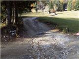 2
2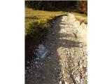 3
3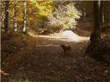 4
4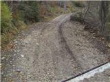 5
5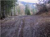 6
6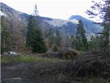 7
7 8
8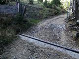 9
9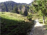 10
10 11
11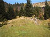 12
12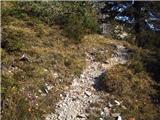 13
13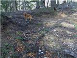 14
14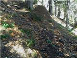 15
15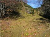 16
16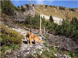 17
17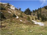 18
18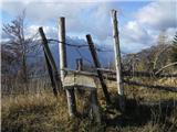 19
19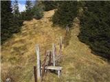 20
20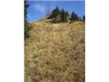 21
21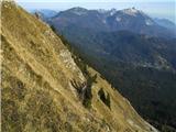 22
22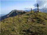 23
23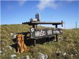 24
24
Discussion about the trip Rogarjev rovt - Rosenkogel/Hruški vrh (via Hruška planina)
|
| gmajna28. 10. 2009 |
"unnamed ridge on the left"
This ridge on the left has a name, Črničje, we also call the summit Črničji vrh (1610m). But it's true that on the map only the elevation is marked.
|
|
|
|
| heinz28. 10. 2009 |
I agree, or rather believe and am convinced that the summit has its name (namely Črničje), but this name we don't actually find on "any" map, and even (some) locals unfortunately don't know it. That's why I marked it as unnamed ridge. Sorry then; the ridge of Črničji vrh.
Good luck, heinz!
|
|
|
|
| Edina16. 04. 2014 |
Today I ascended Hruški vrh via the mentioned path, descended via sedlo Rožca. Due to new snow, some caution was needed above the saddle connecting Črničji vrh and Hruški vrh, above the hunting stand I bypassed avalanche remains on the right side and reached the side ridge somewhat above the mentioned saddle. Crampons were useful only at the start of the descent from the summit towards sedlo Rožca. Clouds had a special day today... http://stezeinsledi.blogspot.com/2014/04/hruski-vrh-iz-rogarjevega-rovta.html
|
|
|
To post a comment you must log in:
If you do not yet have a username, you must first
register.