Rogljev mlin - Rogatec (via Lepenatka)
Starting point: Rogljev mlin (590 m)
| Latitude/Longitude: | 46,30970°N 14,77260°E |
| |
Route name: via Lepenatka
Walking time: 3 h 45 min
Difficulty: very difficult marked way
Elevation gain: 967 m
Elevation difference along the route: 1230 m
Map: Kamniške in Savinjske Alpe 1:50.000
Recommended equipment (summer): helmet
Recommended equipment (winter): helmet, ice axe, crampons
Views: 19.711
 | 4 people like this post |
Access to starting point:
From the Kranj side we drive towards Gornji Grad. At the chapel approximately 100 m before Gornji Grad we turn left towards Sveti Lenart.
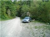
From the Štajerska side we drive through Gornji Grad and approximately 100 m after Gornji Grad we also turn right towards Sveti Lenart. We then drive just under 3 km on the asphalt road and then just under 1 km on macadam to the decaying Rogljev mlin on the right side of the road and park there.
Route description:
We park the car a few meters before the decaying Rogljev mlin by the stream Kanolščica. Then we go ahead on the road towards Sveti Lenart, but only for a short time. A little further from the bridge, over which the road to farmer Rogelj leads to the right, at the power line pole we turn left onto a footpath. The footpath, which a little higher brings us back onto the road, is quite overgrown in places. We continue on the road all the way to the church of Sveti Lenart. In front of the church we go left towards Lepenatka. Immediately above the church, the path crosses the road and ascends quite steeply until we reach the road again. After a few meters, we go left on the more driven road. On this road we continue to the hunting observatory on a smaller clearing. Past the hunting observatory we can go left or right. Immediately after it, the path goes a few steps upwards through the forest, then ahead on the pasture all the way to the top of Lepenatka. This part of the path is very nice in spring, when many species of mountain flowers are blooming. In all seasons it offers us wonderful views.
From the top of Lepenatka we then descend down the grassy slope to Kal. While descending we have Rogatec in front of us all the time. On Kal left among the trees we notice a bivouac.
From Kal we go ahead on a very demanding path towards V. Rogac (other name for V. Rogatec). The path goes from the pasture into the forest and after a short flat part immediately begins a very demanding steep exposed section of the path. To those who use poles I recommend that they put them in the backpack, as with improper use they can be more dangerous than useful. After the lower climbing section the path in the upper section becomes easier and safe use of poles is already possible. When we reach the summit of Rogatec we are rewarded with a truly fantastic view. For the descent there is a nice variant past Zg. and Sp. Špeh, Kokalj and Rogelj to Rogljev mlin.

Photos:
 1
1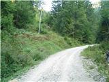 2
2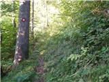 3
3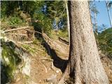 4
4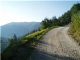 5
5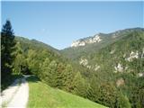 6
6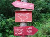 7
7 8
8 9
9 10
10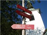 11
11 12
12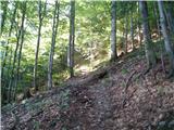 13
13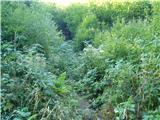 14
14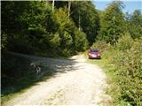 15
15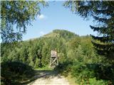 16
16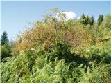 17
17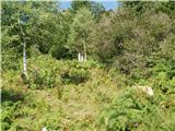 18
18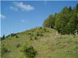 19
19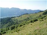 20
20 21
21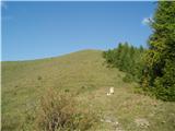 22
22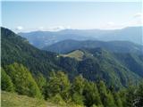 23
23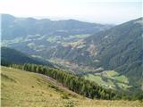 24
24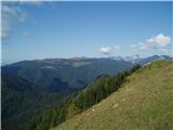 25
25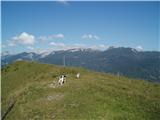 26
26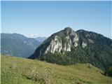 27
27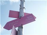 28
28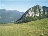 29
29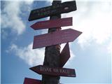 30
30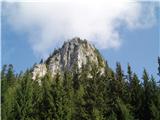 31
31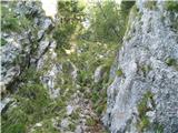 32
32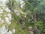 33
33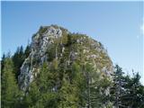 34
34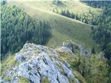 35
35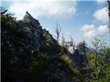 36
36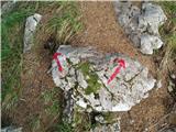 37
37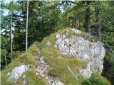 38
38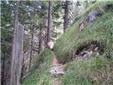 39
39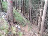 40
40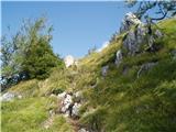 41
41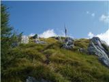 42
42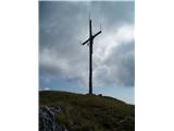 43
43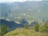 44
44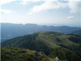 45
45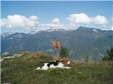 46
46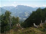 47
47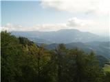 48
48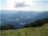 49
49
Discussion about the trip Rogljev mlin - Rogatec (via Lepenatka)
|
| Matjaz_6510. 10. 2010 |
pleasant autumn hike ... I shortened it by driving to the junction in picture 6 
some more of my photos 
|
|
|
|
| lepenatka11. 10. 2010 |
There was no crowd at all...
|
|
|
|
| petruša16. 05. 2012 |
On Saturday we would like to head to Rogatec, now something interests me. We would like to do a circular tour. Can we drive to Sveti Lenart and go to Lepenatka-Kal-Rogatec, then down to Zg. Špeh and back to Sv. Lenart. I'm interested if everything is well marked. And if you can start from Sv. Lenart or if we have to go from Rogljev mlin. Thanks in advance. lp
|
|
|
|
| geppo16. 05. 2012 |
I drive to the bend where I also park (cca. 200m from the church). There is also the signpost - photo no. 6. Starting point for circular tour.
Lp
|
|
|
|
| areh19. 10. 2012 |
Petruša, or whoever knows... how is it with this circular path Sv Lenart - Lepenatka - Kal - Rogatec, then down to Zg. Špeh and back to Sv. Lenart. How long does it take at a moderate pace? In between, as I see, there is no hut..
|
|
|
|
| areh19. 10. 2012 |
Thanks Geppo. I hope there will still be time for this tour this year.
|
|
|
|
| Bandzo23. 10. 2012 |
On Sunday, 21.10.2012 I visited this beauty again and I must warn that the sign in picture 7 is no longer present in vertical form - due to logging, the sign lies on the ground. Wonderful walk with a wonderful circular path! Even regarding the very demanding part, it's nothing special and can be crossed very nicely. The problem is only if it's frozen. Then be careful!
LP
|
|
|
|
| katja8717. 06. 2013 |
On Saturday, 15.6.2013, we went on this path to the summit of Rogatec. First we conquered the summit of Lepenatka, then climbed via the ridge climbing path to Veliki Rogatec.
The climbing path is very nice and on the ridge quite adrenaline-pumping  Climbing gear is not necessary, but I recommend a helmet as there is a risk of falling rocks. It's definitely easier to ascend than descend it. Climbing gear is not necessary, but I recommend a helmet as there is a risk of falling rocks. It's definitely easier to ascend than descend it.
I would also like to praise the markers, as the marks are new and quite frequent. At the same time, the paths are well signposted, so the chance of getting lost is very small.
Pictures from the hike can be viewed on the website of Planinsko društvo Matica Murska Sobota: http://www.mojalbum.com/pdmaticams/20130616-debela-pec/foto/20865894
|
|
|
|
| valerija1125. 06. 2014 |
Hello! I'm asking experts of this path if the path from Kala to Pl. Zg.Špeh is marked. We would like to avoid the climbing part of the path this way. Thanks for the answer.
|
|
|
|
| garmont5. 06. 2014 |
It is marked. During the descent from Lepenatka towards Kala you encounter direction signs that lead you right slightly downhill towards Špeh (climbing section is straight ahead). Regards
|
|
|
|
| valerija1127. 06. 2014 |
Today we visited Lepenatka and Rogatec, some more courageous via the demanding trail, others via Pl.Zg.Špeh. It was a wonderful day, we met only pleasant people. Once again thanks to the two (Dolenjka and Korošec) for the kindness and best regards.
|
|
|
|
| sasgittariusvz3. 12. 2016 |
What is the condition of the road to the church of St. Lenart?
Or is it better by car only to Rogljev Mlin?
|
|
|
|
| geppo3. 12. 2016 |
As for snow - it's dry
The road is like the usual mountain road. Some potholes/bumps, but slow driving presents no problems.
lp
|
|
|
|
| cico3. 12. 2016 |
When going one-way to Lepenatka, I use
the road through Krnica to Zg. Špeh! A couple of weeks
ago they surprised me with new asphalt
to Zg. Klinar, where the largest enclosure
with Indian deer is, so only another
500m of gravel to the starting point!
|
|
|
|
| franca19. 07. 2019 |
in winter there were fresh tracks on Kranjska reber, if the bear still walks around here, I don't know
|
|
|
|
| Hribovc9120. 06. 2021 11:06:40 |
The first part of the path (through the forest) from Rogljev mlin is quite overgrown so we went to the church of Sv. Lenart constantly along the road. This somewhat lengthens the path, which is otherwise nice, occasionally we can also see Veliki Rogatec, which looks very imposing from below. Only the dust rising behind passing cars on the road to Sv. Lenart disturbs.
|
|
|
To post a comment you must log in:
If you do not yet have a username, you must first
register.