Rosstratte - Dobratsch / Dobrač (by road)
Starting point: Rosstratte (1732 m)
Starting point Lat/Lon: 46.5929°N 13.7113°E 
Path name: by road
Time of walking: 1 h 20 min
Difficulty: easy marked way
Difficulty of skiing: easily
Altitude difference: 434 m
Altitude difference (by path): 450 m
Map:
Access to starting point:
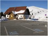
First, we drive to Kranjska Gora, then continue driving towards Rateče. When we arrive at Podkoren, we leave the main road and continue driving right towards Korensko sedlo. From the saddle, we descend to the Austrian side, where in the valley we turn right towards Beljak / Villach. Further, we drive through the village Ločilo / Hart to Beljak, where signs for Spittal direct us to the bypass road past the town. The road then soon brings us to Judendorf (area of Beljak), and only a little further we notice signs for Beljak alpine road / Villacher Alpenstrasse. Here we turn right and we follow the road to a parking lot, which is located at an altitude of 1732 m (road is payable 14 EUR personal car and 8 EUR motorbike, July 2012).
From Korensko sedlo to the top of Beljak road is approximately 32 km.
Path description:
From the parking lot, we continue on the road closed to traffic. The road, which is groomed in the winter time, at first barely ascends over grassy slopes. After a few minutes of walking, the road starts ascending on a moderately steep slope. The road then turns right and passes onto the panoramic north slopes of the mountain. The road then crosses a smaller hollow and then ascends on the northern slopes of Zwolfernock. On the top of this moderate ascent we will notice a bench and a table by the path. Further, the road slightly descends for a few minutes and then brings us below the main peak of Dobrač. The road then ascends towards the tower, which we have already seen for some time, and right after it brings us to the mountain hut.
From the hut to the top we have only three minutes of walking. The last meters below the summit are in the winter time dangerous for slipping.
Pictures:
 1
1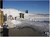 2
2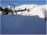 3
3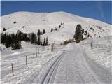 4
4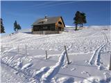 5
5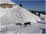 6
6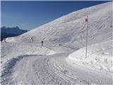 7
7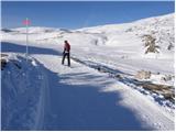 8
8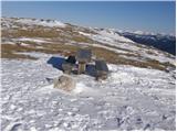 9
9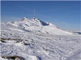 10
10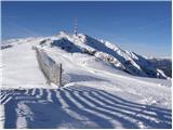 11
11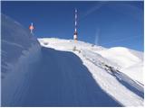 12
12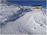 13
13 14
14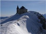 15
15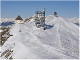 16
16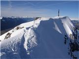 17
17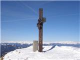 18
18