Starting point: Rotek (968 m)
| Latitude/Longitude: | 46,22720°N 14,03200°E |
| |
Walking time: 1 h 15 min
Difficulty: easy unmarked way
Elevation gain: 340 m
Elevation difference along the route: 340 m
Map: Škofjeloško in Cerkljansko hribovje 1:50.000
Recommended equipment (summer):
Recommended equipment (winter): ice axe, crampons
Views: 1.740
 | 2 people like this post |
Access to starting point:
A) First, we drive to Škofja Loka, then continue driving in the direction of Železniki and Tolmin. A few kilometers after Zali Log we arrive at the crossroad at Podrošt, where we continue straight in the direction of Sorica and Soriška planina (left Petrovo Brdo and Tolmin). When above Sorica the road from Petrovo Brdo joins from the left, we continue right, then towards Soriška planina we drive only to the crossroad, where roads towards Zgornje and Spodnje Danje branch off to the right. We park in an appropriate place by the road. Lately, because of the reconstruction of the road Podrošt - Sorica, it is often closed. In this case, we use the detour, namely by continuing at Podrošt in the direction of Tolmin, then at the first crossroad to the right. Along a quite steep road we arrive in Sorica, where we join back the main road towards Soriška planina.
B) From the direction of Baška grapa we drive to Petrovo Brdo, from there we continue left towards Soriška planina. A little after we join the road from Sorica, we arrive at the crossroad, where roads towards Zgornje and Spodnje Danje branch off to the right. We park in an appropriate place by the road.
C) From Bohinjska Bistrica we continue driving towards Soriška planina, from there we start descending towards Sorica. When after a few kilometers of descent roads towards Zgornje and Spodnje Danje branch off to the left, we park in an appropriate place by the road.
Route description:
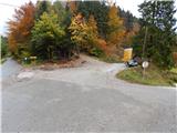
From the starting point, we continue on the road in the direction of Zgornje Danje and Ratitovec, from which at first a view opens up towards the church of St. Marko in Spodnje Danje, after crossing the power line the road passes into the forest, through which it ascends diagonally. After a few minutes from the road a wide cart track branches off slightly to the left, on which we continue the diagonal ascent. At first the cart track runs completely by the road, then it distances itself somewhat from it. At a few crossings we continue straight or stick to the diagonal ascent towards the right. A little higher, on a short somewhat more panoramic part, from the right also joins a cart track which leads from the village Spodnje Danje, and we continue in the same direction. After the mentioned crossing the cart track becomes somewhat steeper, and it also passes to a steeper slope. In the continuation the cart track turns increasingly to the left, then quickly passes into a smaller valley, through which we reach the forest road which leads from Soriška planina towards Valantov rob.
When we reach the road we follow it to the left, along it we start first gently, then moderately ascending. After a longer left bend the road temporarily straightens, but not levels out. At the beginning of the right serpentine a cart track branches off straight ahead, on which we continue the path. A little further, on a smaller ridge an overgrown cart track branches off to the right, which leads towards the summit Tonderškofel, and we continue straight, about a minute further straight again. When higher the cart track ends we continue right on a worse but traceable footpath, on which in two minutes of further walking we ascend to panoramic Erbelc.
Description and pictures refer to the condition in the year 2015 (October).

Photos:
 1
1 2
2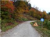 3
3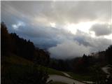 4
4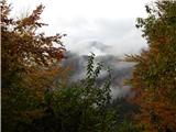 5
5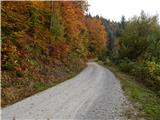 6
6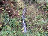 7
7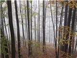 8
8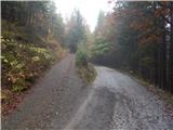 9
9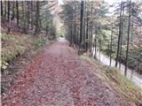 10
10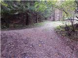 11
11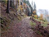 12
12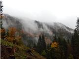 13
13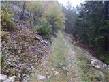 14
14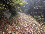 15
15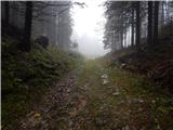 16
16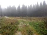 17
17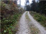 18
18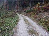 19
19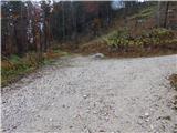 20
20 21
21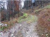 22
22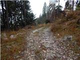 23
23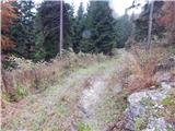 24
24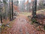 25
25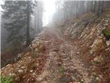 26
26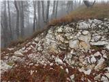 27
27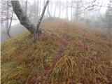 28
28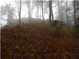 29
29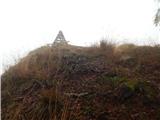 30
30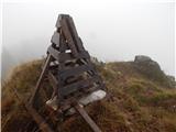 31
31 32
32
Discussion about the trip Rotek - Erbelc
To post a comment you must log in:
If you do not yet have a username, you must first
register.