Rovte - Sveti Urh (Zavratec) (via Kamnikov Grič)
Starting point: Rovte (596 m)
| Latitude/Longitude: | 45,98690°N 14,15160°E |
| |
Route name: via Kamnikov Grič
Walking time: 1 h 30 min
Difficulty: easy marked way
Elevation gain: 128 m
Elevation difference along the route: 180 m
Map:
Recommended equipment (summer):
Recommended equipment (winter):
Views: 930
 | 1 person like this post |
Access to starting point:
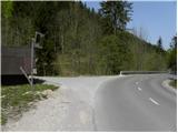
A) First, we drive to Škofja Loka, and then we continue driving towards Gorenja vas and Žiri. From Žiri we continue driving on a somewhat more winding road towards Rovte and Logatec, which we follow to the road sign between 13 and 12.5 km, or to the spot where a narrower asphalt road branches off to the right, by which there is a bus stop and signposts for Medvedje Brdo. Here we turn right and then we park at an appropriate place by the road (most appropriate place is immediately after a smaller bridge).
From Žiri (from the crossroad, where a road towards Idrija branches off to the right) to the starting point, there is approximately 9 km.
B) From the highway Ljubljana - Koper we take the Logatec exit and then we continue driving to Logatec. From the roundabout, where we reach the old road Vrhnika - Postojna, we continue right (direction Vrhnika) and we continue driving on the old road towards Vrhnika, but we drive on it only a few hundred meters, then we turn left onto the road in the direction of Rovte and Žiri. Further, we drive on a gradually more winding road to the road sign between 12.5 and 13 km. Here we will notice a bus stop on the left side and a smaller crossroad, by which there are mountain signposts for Medvedje Brdo and Vrh Svetih Treh kraljev. Here we turn left and then we park at an appropriate place by the road (most appropriate place is immediately after a smaller bridge).
C) We drive to Idrija, and then we continue driving towards Logatec. Still before the end of Idrija we turn left onto a steep road which starts ascending towards the village Gore. Higher, we reach the plateau, and the road flattens. At the crossroads, we then follow the signs towards the neighbouring settlement Dole and later settlement Zavratec. After the end of the mentioned settlement we start descending towards the valley of Sovre, where we also reach the main road Žiri - Logatec. We follow the mentioned road to the right to the road sign between 13 and 12.5 km or to the spot where a narrower asphalt road branches off to the right, by which there is a bus stop and signposts for Medvedje Brdo. Here we turn right and then we park at an appropriate place by the road (most appropriate place is immediately after a smaller bridge).
From the spot where we reached the road Žiri - Logatec to the starting point, there is approximately 900 m.
Route description:
From the starting point, we continue on the road by which we have parked, and at first it leads by the Globovski potok stream. Higher, we move away from the stream to the right, or we pass into the neighbouring small valley, where the path leads us past two homesteads. At the second homestead (on the map homestead Kamnik) we continue right, still on the asphalt road and in a few turns we ascend to a crossroad at the bench and cross.
From the mentioned crossroad, we continue left (right homestead Luka) and we continue on a gentle macadam road. At the hunting observatory a few minutes away we continue right, and then amid occasional nice views we return into the forest. The road, which is relatively well marked, then leads us past the homestead Nartar to the next crossroad, where we continue slightly left (right homestead Rupe). Further, the path leads us also past old Italian caverns from the time of the Rapallo border, and on a moderately steep road we ascend to a crossroad, where we join the road Medvedje Brdo - Zavratec.
We follow the mentioned road right, that is in the direction of Zavratec (left Medvedje Brdo). There follows a few minutes of somewhat steeper descent, then we reach the village Potok, where the road becomes asphalt again. In the village the road flattens completely, leading us past a few houses and mainly through meadows. On the other side of the village the road enters the forest, where it gently descends alongside the nearby stream for a short time, then before the solitary house it starts ascending. When a few minutes higher the road flattens, we arrive at the sports field, a few dozen steps further also at the village Zavratec. A short descent follows and the road brings us to the church of St. Urh at Zavratec.

Along the route: Potok (730m)
Photos:
 1
1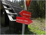 2
2 3
3 4
4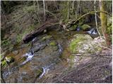 5
5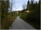 6
6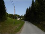 7
7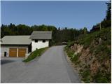 8
8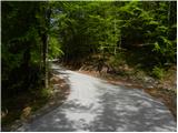 9
9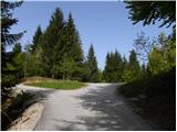 10
10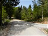 11
11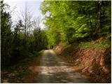 12
12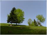 13
13 14
14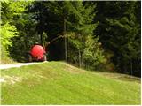 15
15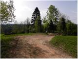 16
16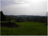 17
17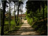 18
18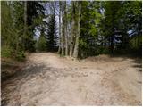 19
19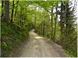 20
20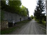 21
21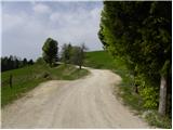 22
22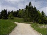 23
23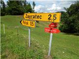 24
24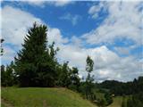 25
25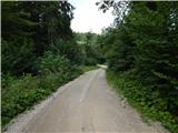 26
26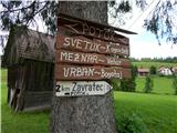 27
27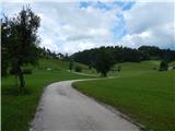 28
28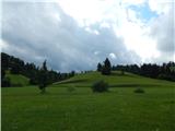 29
29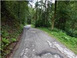 30
30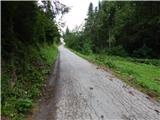 31
31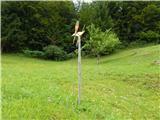 32
32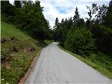 33
33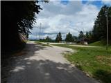 34
34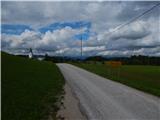 35
35 36
36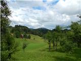 37
37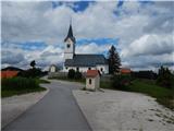 38
38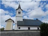 39
39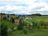 40
40
Discussion about the trip Rovte - Sveti Urh (Zavratec) (via Kamnikov Grič)
To post a comment you must log in:
If you do not yet have a username, you must first
register.