Rudno polje - Ablanca (via Srenjski preval)
Starting point: Rudno polje (1347 m)
| Latitude/Longitude: | 46,34580°N 13,92360°E |
| |
Route name: via Srenjski preval
Walking time: 3 h 30 min
Difficulty: difficult unmarked way
Elevation gain: 657 m
Elevation difference along the route: 700 m
Map: Triglav 1:25.000
Recommended equipment (summer): helmet
Recommended equipment (winter): helmet, ice axe, crampons
Views: 16.341
 | 2 people like this post |
Access to starting point:
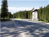
From the Ljubljana - Jesenice highway, take the Lesce exit and follow the road towards Bled. At Bled, signs for Pokljuka direct you right at the traffic lights. Continue through Gorje and past the abandoned Zatrnik ski resort to Rudno polje on Pokljuka (large parking lot, barracks, and shooting range).
Route description:
From the parking lot, head onto the forest road (towards Triglav), and after ten minutes of gentle ascent, reach the Viševnik ski resort. Here, signs direct you right (the path to Triglav continues on the road) onto a marked footpath, which moderately ascends along the edge of the forest and beside the ski lift of the nearby ski resort. Higher up, you step onto the road again, but only cross it, as signs for Viševnik direct you over a pasture fence onto an easy-to-follow path that continues near the lift. At the end of the lift, the path turns left into a strip of forest and then joins a second, somewhat steeper lift. For a while, you continue under the lift, then the path moves onto a ski slope, up which you ascend to the upper part of the ski resort.
The path next enters a small valley, where you ascend among blooming flowers (valid for spring and summer months) to a dilapidated hunting observation post.
Here, or a few dozen meters further (there are two branches), continue right (straight ahead Viševnik) onto a less visible trail, on which you continue the ascent. Higher up, the trail becomes clearer and initially turns slightly to the right, then from sparse forest enters a belt of dwarf pines and gradually turns left. After a while, you cross Kačji rob and the path leads you into high-mountain terrain northeast of Viševnik. For a short time, you continue west and the scenic path quickly brings you to a small grassy hollow, where it turns right. From the hollow, or the intermittent Srenjsko jezerce, the path begins to ascend more steeply and in a few minutes brings you to a marked junction, where a path branches left to Srenjski preval and Viševnik. Continue in the mentioned direction (right Lipanca) and continue the ascent on the path, which in about ten minutes of transverse ascent rises to Srenjski preval. You climb to the right side of the pass to signposts under Mali Draški vrh.
At the signposts, continue for signs »Studorski preval«. The path initially descends slightly, then becomes more demanding and crosses exposed slopes with a cable. When the protections end, the path begins to ascend a bit and continues to cross steep slopes westward. The path is not secured further and requires more caution. When you reach the western side of Mali Draški vrh, a nice view of Triglav opens up. Here the slopes become less steep and a short descent follows to the saddle between Veliki and Mali Draški vrh.
The path turns left here (straight ahead an unmarked trail to Veliki Draški vrh) and crosses slopes under Veliki Draški vrh, mostly walking along the dwarf pines until Studorski preval.
At the pass, where you leave the markings, continue straight on the trail upward (left down Rudno polje and Planina Konjščica, right Vodnikov dom na Velem polju, sharply right another trail to Veliki Draški vrh). The path quickly brings you to crumbly terrain where you can easily trigger stones, so be careful. Then follows a steeper path that brings you to the ridge. Follow this path, which is quite dangerous for slipping (due to sliding sand on the path), to the summit of Ablanca.
Rudno polje - Planinski taborni prostor 0:10, Planinski taborni prostor - Planina Krasca 0:05, Planina Krasca - Zlata voda 0:50, Zlata voda - razpotje nad Srenjskim jezercem 0:45, razpotje nad Srenjskim jezercem - Srenjski preval 0:15, Srenjski preval - Srenjska Krma 0:35, Srenjska Krma - Studorski preval 0:30, Studorski preval - Ablanca 0:20.

Along the route: Planinski taborni prostor (1369m), Planina Krasca (1402m), Zlata voda (1717m), Kačji rob (1809m), Srenjsko jezerce (1864m), Razpotje nad Srenjskim jezercem (1904m), Srenjski preval (1959m), Na kontah (1950m), Srenjska Krma (1945m),
Studorski preval (1892m)
Photos:
 1
1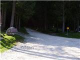 2
2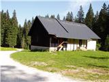 3
3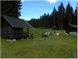 4
4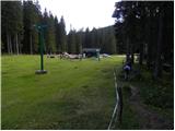 5
5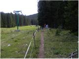 6
6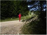 7
7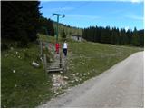 8
8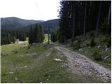 9
9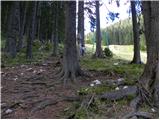 10
10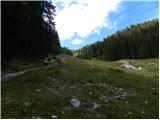 11
11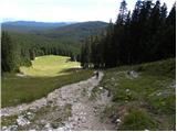 12
12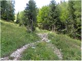 13
13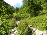 14
14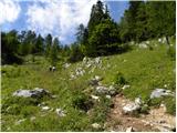 15
15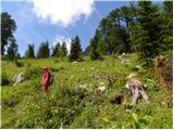 16
16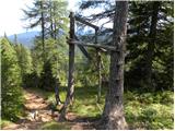 17
17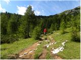 18
18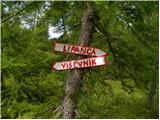 19
19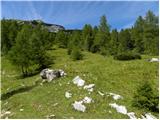 20
20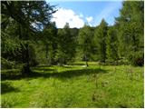 21
21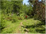 22
22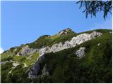 23
23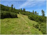 24
24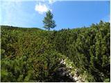 25
25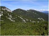 26
26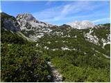 27
27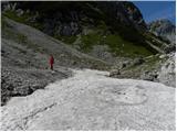 28
28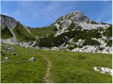 29
29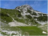 30
30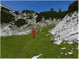 31
31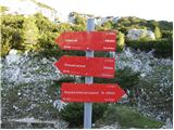 32
32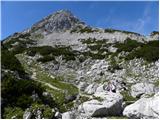 33
33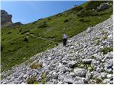 34
34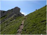 35
35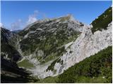 36
36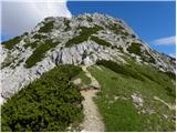 37
37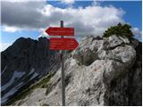 38
38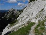 39
39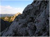 40
40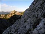 41
41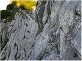 42
42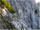 43
43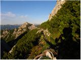 44
44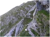 45
45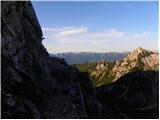 46
46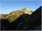 47
47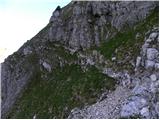 48
48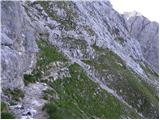 49
49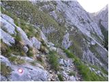 50
50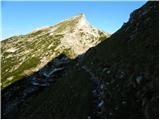 51
51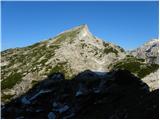 52
52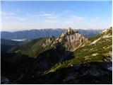 53
53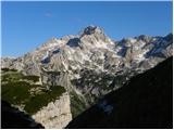 54
54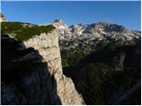 55
55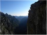 56
56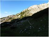 57
57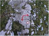 58
58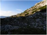 59
59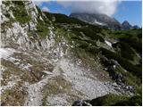 60
60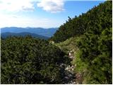 61
61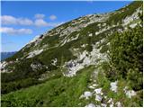 62
62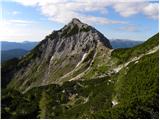 63
63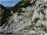 64
64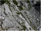 65
65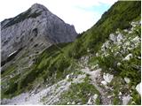 66
66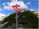 67
67 68
68 69
69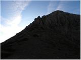 70
70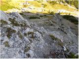 71
71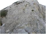 72
72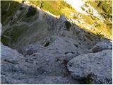 73
73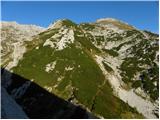 74
74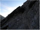 75
75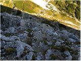 76
76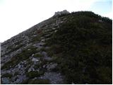 77
77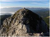 78
78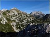 79
79
Discussion about the trip Rudno polje - Ablanca (via Srenjski preval)
|
| sirt122. 08. 2011 |
I think a better variant is, at the Lipanca-Viševnik junction, to turn left to Viševnik and descend from the top to Srenjski preval. That way we conquer another summit along the way (2050m). Good luck
|
|
|
|
| MaksCuzak5. 07. 2024 18:05:22 |
No need to go to Viševnik. Ablanca is quite a “shabby” mountain, but that's why it's uncrowded. If you're crossing Srenjski preval, I recommend the ascent.
|
|
|
To post a comment you must log in:
If you do not yet have a username, you must first
register.