Rudno polje - Blejska koča na Lipanci
Starting point: Rudno polje (1347 m)
| Latitude/Longitude: | 46,34580°N 13,92360°E |
| |
Walking time: 1 h 45 min
Difficulty: easy marked way
Elevation gain: 283 m
Elevation difference along the route: 325 m
Map: TNP 1:50.000
Recommended equipment (summer):
Recommended equipment (winter): ice axe, crampons
Views: 121.543
 | 2 people like this post |
Access to starting point:
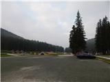
a) From Bled or Jesenice, we drive to Zatrnik, then continue driving towards Pokljuka. When we arrive at Pokljuka, we stick to the main road all the time, and drive along it to the large organized parking lot at Rudno polje.
b) From Železniki or Podbrdo, we drive to Bohinjska Bistrica, then continue driving in the direction of Bled. Shortly after the Petrol gas station, which is located just a little after Bohinjska Bistrica, we continue driving left in the direction of Pokljuka and Jereka. In the continuation, the road first ascends steeply, then gradually flattens after Korita and brings us to the intersection at the bus stop, where we continue right in the direction of Pokljuka, Koprivnik and Jereka (straight Srednja vas). Immediately after the intersection, we arrive in Jereka, and from the intersection in front of the church, we continue straight towards Pokljuka (left Podjelje). After Jereka, the road starts to ascend more steeply again, higher up it flattens and continues along Mrzli potok, where the road to Koprivnik in Bohinj branches off to the left, but we continue straight towards Pokljuka and Gorjuše. After Gorjuše, the road enters the forest, and we drive along it to the intersection, where we join the road from Bled. Here we continue left, then drive along the main road to the large parking lot at Rudno polje.
Route description:
From the parking lot, first carefully cross the road, then continue on the gravel road in the direction of Triglav, Viševnik, and Blejska koča na Lipanci. We walk along the fairly gentle road for about ten minutes, then arrive at the Viševnik ski resort, where we leave the road and continue the path to the right in the direction of Viševnik and Srenjski preval (further along the road Triglav, Vodnikov dom and Studorski preval). The path ahead leads us to the left of the ski resort, along a trail that runs through the edge of the forest. After a short ascent, we return to the gravel road, which we reach at the place where the marked path to Viševnik continues straight up, but we follow the road to the right, so that we cross the ski resort. The road quickly takes us into the forest and to an intersection, where we continue on the lower right road, and at the next intersection again to the right, both times in the direction of Lipanca. After the second intersection, we arrive at the Rudno polje sandpit, just a little further, after a short descent, the signs for Planina Lipanca and Blejska koča direct us left into the forest. Through the forest, at some crossroads, we follow the markings, then a little higher we cross the gravel road. After crossing the road, the path becomes somewhat steeper and mainly ascends transversely to the right. Higher up, the forest begins to thin out, and on the left we notice a watering place for animals (often without water).
From here, a few more minutes of ascent follow, then we arrive at a crossroads, where we continue right downhill (left Viševnik and Mrežce) and in a minute or two of further walking, we descend to Blejska koča na Lipanci.
Rudno polje - Planinski taborni prostor 0:10, Planinski taborni prostor - Planina Krasca 0:05, Planina Krasca - Blejska koča 1:30.
The description and images refer to the condition in 2017 (June).

Along the route: Planinski taborni prostor (1369m), Planina Krasca (1402m), Krucmanove konte (1425m)
Photos:
 1
1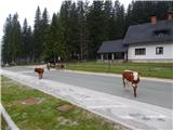 2
2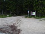 3
3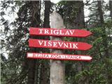 4
4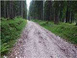 5
5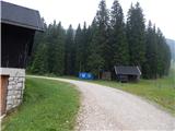 6
6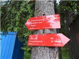 7
7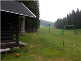 8
8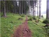 9
9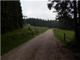 10
10 11
11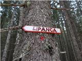 12
12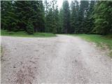 13
13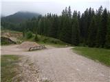 14
14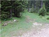 15
15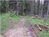 16
16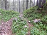 17
17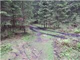 18
18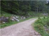 19
19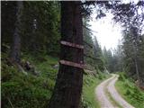 20
20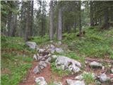 21
21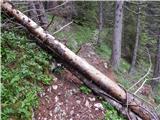 22
22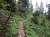 23
23 24
24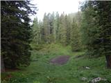 25
25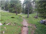 26
26 27
27 28
28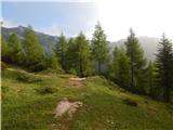 29
29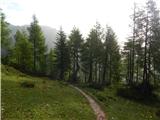 30
30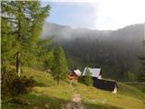 31
31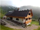 32
32
Discussion about the trip Rudno polje - Blejska koča na Lipanci
|
| natalie25. 08. 2007 |
On Saturday 25.8. we were at Viševnik, on the circular path (Rudno polje, Viševnik, Blejska koča, Rudno polje) back, and we also stopped at Blejska koča. Honestly, we were sorry, especially because of the numerous tourists and other hikers, when we learned that at 11:30 you could only get potica and sausage. Wonderful trip, but this a bit spoiled our mood, and many other guests too. We wish the caretakers better organization in the future!
|
|
|
|
| jankicaa4. 07. 2011 |
On Saturday 2.7.2011 we were at Debelo peč. On the way back we stopped at Blejska koča to refuel. Unbelievable that apparently after 4 years the same caretakers are still there... Available (all day) only beef soup with barley, barley soup, sausage and potica. With such a poor selection we chose barley soup. Unfortunately I've never eaten such bad barley soup in my life. I'm convinced that the specially cooked barley was mixed into very fatty beef soup. Sad, charged 5€! I realized why almost all hikers ate their sandwiches... Otherwise friendly caretaker and reasonably tidy surroundings. I don't understand that right next to the mountain pasture they don't have sour milk with žganci, štruklji, or some stronger food. Doesn't the Mountaineering Association test the cooking skills of caretakers and listen to visitors' criticisms? 
|
|
|
|
| montena23. 08. 2011 |
We also experienced something similar to jankicaa and not for the first time. Yesterday 22.8.2011 at 13:00 there were about 10 people in front of the hut but the caretaker said he had sold the last sour milk half an hour ago, in the offer they only had rice pudding, sausage and potica. Sad, and some still praise them.
|
|
|
|
| zaja23. 08. 2011 |
If you want really good food and a friendly word from the hut keeper, I recommend visiting Dobrča. We were there 14 days ago, the offer is not like that even in the valley, from štruklji, obara, sour milk, beans, and surely five more things, so it's hard to decide what to choose. Delicious to lick your fingers. And they have the most beautiful Gorenjska carnations at the hut-without exaggeration. I'll come back to try what I couldn't then. I'll come back to try what I couldn't then.
|
|
|
|
| temba23. 08. 2011 |
My husband and I were also at Dobrča about three weeks ago and we were very satisfied with the offer in the hut (and with the view and surroundings too ). Just as zaja wrote.
|
|
|
|
| slavi090223. 08. 2011 |
zaja and temba.........I agree with you, at Dobrča they know how to serve things, they deserve a ten and a clean one
|
|
|
|
| micikaa26. 08. 2011 |
In the Blejska koča I experienced a cold shower for the third year in a row. During the week at 10 a.m. they didn't have sour milk, which is extremely strange on a pasture full of cows. And on top of that an unfriendly remark, what am I even asking for. Good thing unfriendly caretakers are more the exception than the rule in our huts and mountain lodges. Besides Blejska koča so far I've only encountered a very unfriendly caretaker last year in Koča pri Krnskem jezeru.
|
|
|
|
| Mojcej20. 03. 2012 |
Unfortunately, the habits of the Blejska koča na Lipanci hut staff haven't changed much. On Saturday my husband and I wanted their herbal brandy, but got literally water with some herbal and brandy taste! I even got warm chestnut water as tea - literally (maybe even overboiled). Sad! Safe steps to all!
|
|
|
|
| Pohodnica5620. 03. 2012 |
It happened to me last year too that in the middle of summer there was no sour milk. So I went to the neighboring mountain hut convinced I'd get it there, but the "hut keepers" told me they weren't allowed to sell it, their "best" neighboring hut warden had forbidden it and even brought inspectors several times. How they could all earn something together. God forbid, the "shenanigans" have no limits, good thing it doesn't burn, Slovenia would have been erased from the maps long ago - one big black hole from which terrible smoke would rise. Lots of going to the mountains, I don't expect hotel service, I'm not a "fussy" guest, I don't expect a five-page menu that doesn't even belong in the mountains, since I don't go to the mountains just to eat, there are plenty of eateries in the valley, but warm water with a few floating juniper berries is not chic and extreme unfriendliness doesn't belong even in a cowshed. So pack a snack in the backpack, sit on the bench and enjoy nature, so the soul is full and batteries charged.
Safe steps.
|
|
|
|
| panda1028. 10. 2012 |
No, I see I'm not the only one with a bad experience at Blejska koča Whenever the path took me there, they only had sausages and ričet... OK, it's not a restaurant. But last weekend the warden tells me "we won't make coffee for at least half an hour because we have to take care of the busload of guests from Preknurje!" Hello???? You only have cooked ričet anyway, sausages cook themselves... Obviously the two bottles of wine the caretaker got were the reason quite a few of us were very dissatisfied. Luckily there are huts where they're glad to see you and offer more than you want. But here you see a bored hillbilly..."why do you come if we then have to WORK!" Whenever the path took me there, they only had sausages and ričet... OK, it's not a restaurant. But last weekend the warden tells me "we won't make coffee for at least half an hour because we have to take care of the busload of guests from Preknurje!" Hello???? You only have cooked ričet anyway, sausages cook themselves... Obviously the two bottles of wine the caretaker got were the reason quite a few of us were very dissatisfied. Luckily there are huts where they're glad to see you and offer more than you want. But here you see a bored hillbilly..."why do you come if we then have to WORK!" 
|
|
|
|
| fravnik8. 11. 2012 |
Now I really don't know which hut is being talked about. I often stop by Planina Lipanca, above Zajavornik, below Mrežce, and I like it there. Also because the caretaker (I think Jože) is friendly and obliging. He really doesn't serve in uniform, doesn't have calamari on the menu, is not very talkative, but you can always satisfy your hunger with him. Seeking gourmet pleasures in the mountains is nonsense, why sweat on the rocks, stay in the valley or hotel at Rudno polje or in the valley. If you're lucky, you'll even get cream slices and/or potica for their club's anniversary, free of course. If you sprain your ankle, he'll take you down in his rugged Lada. To Bohinj of course. I've personally experienced many more similar cases. Mountaineers have our own criteria, arrogance is certainly foreign to us.
Nice mountaineering greeting.
F. Ravnik
|
|
|
|
| savinjcan658. 11. 2012 |
I've also been in these parts many times and never had bad experiences at Blejska koča. l.p.
|
|
|
|
| Laščan9. 11. 2012 |
It seems that two types of hikers go to Lipanca. Some who arrive (we) there with satisfaction and others (as @fravnik says) ... should stay in the valley or hotel at Rudno polje... ! Keeper Jože, many more years !!!
|
|
|
|
| Taurus9. 11. 2012 |
For years my wife and I have been going on winter trips to nearby peaks, where we sleep at the hut and have NEVER encountered unfriendly Jože, who knows the exact weather forecast, has complete information on the current conditions on paths in the area and is full of useful advice. Nor have we ever stayed hungry and thirsty. That's all I personally expect from a keeper. Safe steps.
|
|
|
|
| gorjanci27. 03. 2013 |
I'm curious about the current access. If I remember correctly, there's no avalanche danger to the hut. Am I right?
|
|
|
|
| BrankaM27. 03. 2013 |
On Sunday 17.3.2013 from the Šport hotel across planina Zajavornik it was nicely trodden.
|
|
|
|
| grdksmrt27. 03. 2013 |
I myself visited Blejska koča three times in half a year and was always nicely served and welcomed.
|
|
|
|
| kabe7. 01. 2014 |
Hello
Has anyone been around these parts these days? What are the conditions... I'm mainly interested in the snow and if the trail is passable without snowshoes?
Thanks, best regards
|
|
|
|
| PFranci7. 01. 2014 |
Check the TG Gora website. Since yesterday there are two descriptions of Lipanca-Mrežce.
LP
|
|
|
|
| lumi9. 01. 2014 |
Call 051621021 - g. JOŽE and he will tell you how the snow cover is around Blejska koča LP
|
|
|
|
| borut19742. 03. 2014 |
Can you drive by car on 8.3. to Rudno polje because we want to go to Blejska koča there is biathlon or does anyone know anything
|
|
|
|
| borut19742. 03. 2014 |
I think no ticket is needed
|
|
|
|
| Daaam3. 03. 2014 |
You buy a ticket if you go to the competition venue - For Viševnik or Blejska koča no need - but at least I don't have experience as a few years ago I happened to be around there exactly during the event.. But maybe there will be such a crowd that you have to park on the road before Rudno polje itself..
|
|
|
|
| fonko29. 06. 2014 |
Blejska hut has downright extortionate prices!!! Yesterday we paid an incredible 8.00 EUR for boiled and tasteless veal stew.
|
|
|
|
| vlado88823. 10. 2016 |
Fonko, I sign under your comment
|
|
|
|
| viharnik23. 10. 2016 |
In winter there is no food beyond Komna, except at Ema Srednja vas
|
|
|
|
| tinky25. 10. 2016 |
Fonko, you'd also order a coffee with milk from the bum for 2.5 €.
|
|
|
|
| Branee25. 10. 2016 |
This is really "a bit" too rich for a stew
|
|
|
|
| anazala31. 08. 2017 |
I was at Blejska hut. The path is not demanding. Suitable for older people and small children. Food is tasty. We chose ričet without meat. Yes, price a bit higher. However, if you go to the mountains, you need to let them earn something too. If you don't want to, bring it in your backpack. One euro up or down. Cheap for the seller. Expensive for the buyer. Service was okay.
|
|
|
|
| anazala31. 08. 2017 |
Yes, Zaja. It's true. Dobrča, food and view okay. There's also a shepherd's hut a bit further on. There good buckwheat žganci, good sour milk.
|
|
|
|
| suzs10. 07. 2020 |
Today on this path - the day was hot (over 30 in the valley), but it mostly runs through the forest, so despite the unwise time (start at 13:00 from Rudno polje) it was an extremely pleasant trip. Highly recommend for a short hike or families with children. With our 7-year-old we did it in an hour twenty, she really enjoyed the beautiful nature. Picturesque alpine pasture, solid offer at the hut. We'll definitely return
|
|
|
|
| Domen33317. 08. 2021 00:14:40 |
Was at Blejska koča at Lipanci and bought water. For
1.5 liters of water charged me "ONLY" 6 EUROS. Of course as usual no 1.5 l bottle, only 0.5 l for 2 euros per bottle.
|
|
|
|
| Aljoman17. 08. 2021 13:54:50 |
And how much is the beer?
|
|
|
|
| potpodnoge17. 08. 2021 15:11:23 |
Don't worry about prices. This hut has always had such high prices, people should be used to it. Either buy or bring what you need. If you buy, you agree to the price because you need it and don't want to carry it. Problem is only that before the hut you don't see the price list and assume same as other huts. Anyway, seems they're doing well, otherwise prices would drop. But that's how it is and it works. Don't forget wallet at home, filled of course! 
|
|
|
|
| Data21. 08. 2021 14:27:32 |
Incredible that in 2021 the situation is still so bad. At the hut at 14:00 only bean soup and store-bought potica were available. Not to mention the price, which was absurdly high for what you get. I haven't been to a hut yet that offers so little and even that for such a high price. Definitely the worst hut I've visited so far.
|
|
|
|
| tinky21. 08. 2021 20:40:03 |
This hut is the biggest "flop" of all huts.
|
|
|
|
| Tbs14. 08. 2025 16:22:09 |
How is parking for 2 cars at Rudno polje? Will we get free spots tomorrow at 7am? Of course we'll pay...
Thanks
|
|
|
|
| Sujcic20. 09. 2025 11:45:05 |
After 61 years again at Blejska koča (in 1964 we, the youth of PD Opatija, went from here to Triglav). Wife and I are enthusiastic about the hut. We were well served. Excellent ričet. Very friendly caretaker would also prepare dishes on request. Tomorrow continuing towards Srenjski preval. Picturesque walk similar to Premužićeva staza on Velebit
|
|
|
|
| turbo20. 09. 2025 16:43:51 |
Bravo Savo, many happy years, nice tour
|
|
|
To post a comment you must log in:
If you do not yet have a username, you must first
register.