Rudno polje - Mali Draški vrh (via Kačji rob)
Starting point: Rudno polje (1347 m)
| Latitude/Longitude: | 46,34580°N 13,92360°E |
| |
Route name: via Kačji rob
Walking time: 2 h 45 min
Difficulty: difficult unmarked way
Elevation gain: 785 m
Elevation difference along the route: 800 m
Map: Triglav 1:25.000
Recommended equipment (summer): helmet
Recommended equipment (winter): helmet, ice axe, crampons
Views: 21.372
 | 2 people like this post |
Access to starting point:
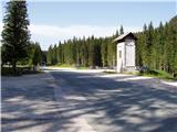
From the Ljubljana - Jesenice motorway, take the Lesce exit and follow the road towards Bled. In Bled, at the traffic lights, signs for Pokljuka direct us to the right. We continue through Gorje and past the abandoned Zatrnik ski resort to Rudno polje on Pokljuka (large parking lot, barracks and shooting range).
Route description:
At the end of the parking lot a macadam road branches off to the right, along which there are signposts for Triglav. We turn onto this road, which ascends gently and brings us to the ski area after ten minutes.
On the other side of the ski area, next to the ski lift, we will notice a marked footpath that continues to the right from the road. We head onto the mentioned path, which in a moderate ascent through a belt of forest brings us to a macadam road (to here also possible by road), which we follow to the right, but only for a few steps. Just before the road crosses the ski slope, a marked footpath branches off to the left, which first crosses a pasture fence, then ascends along the edge of the ski slope. At the top of the first ski lift the marked path turns left and then begins to ascend more steeply along the edge of the second, steeper ski slope. The second ski lift also ends soon, and we continue on the path that turns into a smaller, relatively steep valley. Towards the top of the mentioned valley the path ascends relatively steeply, then suddenly levels out and brings us past an abandoned hunting lookout to a junction.
In this section we leave the usual path to Viševnik and turn right onto a poorly visible path that ascends gently upwards over the meadow. A bit higher the path becomes more noticeable and enters dwarf pine. The path ahead crosses a side ridge of Viševnik called Kačji rob and then enters the high mountain world. A beautiful path with numerous karst phenomena then brings us to a junction, where we continue on the left path towards Srenjski preval (right Blejska koča), which we reach after a few minutes of further walking.
From Srenjski preval we continue right (left Viševnik) on the path that already after a few more steps brings us to the next junction. Here we continue straight upwards (left Studorski preval) on the path that begins to ascend steeply along and beside an indistinct gully. In the lower part the path ascends somewhat to the right of the gully, then for a short time crosses to its left side, viewed from the direction of ascent. Higher up the gully becomes even steeper, the path begins to disappear. We continue ascending straight up the gully steeply (careful due to great friability) and along the "path" we will notice some very old and completely faded markings. After a good 20 minutes of ascent we step onto a precipitous ridge, from which a beautiful view opens to the Krma valley and the peaks that surround it.
From here we can climb to the nearby eastern peak, to which a few meters of easier climbing along the exposed ridge separate us, or to the somewhat more distant but a few meters higher western peak. To reach it we must first descend a little, then ascend in a few dozen steps along a quite exposed ridge to the panoramic summit.
Rudno polje - Planinski taborni prostor 0:10, Planinski taborni prostor - Planina Krasca 0:05, Planina Krasca - Zlata voda 0:50, Zlata voda - razpotje nad Srenjskim jezercem 0:45, razpotje nad Srenjskim jezercem - Srenjski preval 0:15, Srenjski preval - Mali Draški vrh 0:40.

Along the route: Planinski taborni prostor (1369m), Planina Krasca (1402m), Zlata voda (1717m), Kačji rob (1809m), Srenjsko jezerce (1864m), Razpotje nad Srenjskim jezercem (1904m), Srenjski preval (1959m)
Photos:
 1
1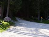 2
2 3
3 4
4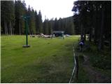 5
5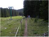 6
6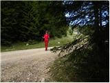 7
7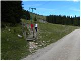 8
8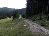 9
9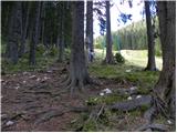 10
10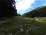 11
11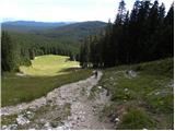 12
12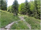 13
13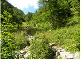 14
14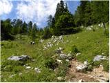 15
15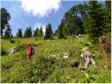 16
16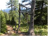 17
17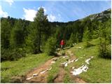 18
18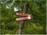 19
19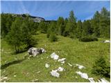 20
20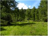 21
21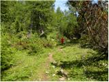 22
22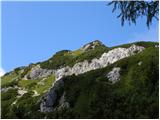 23
23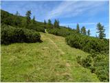 24
24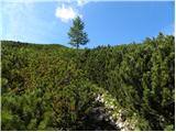 25
25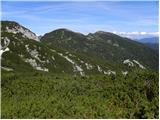 26
26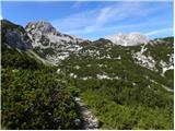 27
27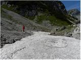 28
28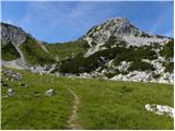 29
29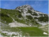 30
30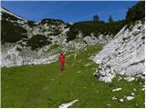 31
31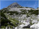 32
32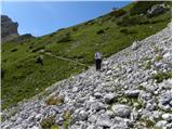 33
33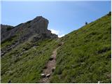 34
34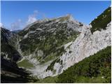 35
35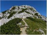 36
36 37
37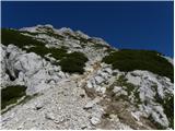 38
38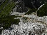 39
39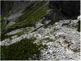 40
40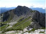 41
41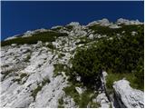 42
42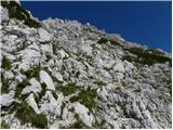 43
43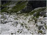 44
44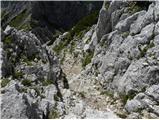 45
45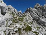 46
46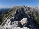 47
47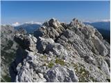 48
48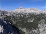 49
49
Discussion about the trip Rudno polje - Mali Draški vrh (via Kačji rob)
|
| limona213. 08. 2011 |
This path to Mali Draški vrh was really to my liking. Easy, picturesque, scenic path via Kačji rob, still in flowers, comfortable access to Srenjski preval. From Srenjski preval to the summit, however, as already described, you need to watch every step and hold (the exact opposite of the approach, I could write that access to Srenjski preval is for everyone, access to MDV only for experienced). With my husband yesterday we didn't meet anyone, but on the neighboring Viševnik there was a crowd. Note: on the Triglav 1:25,000 map, the path to MDV is marked as marked. It is not marked! It's pathless, possible climbing, you find the passages to the summit yourself.
|
|
|
|
| MBevc16. 08. 2011 |
My husband and I were at the summit on Sunday, 14.8. The weather was perfect, the path from Rudno polje over Kačji rob too. Mali Draški vrh offers, in contrast to the nearby Viševnik, beneficial solitude, enchanting views and just the right demanding ascent.
|
|
|
|
| J.P.29. 08. 2021 10:32:25 |
Kačji rob is an exceptionally beautiful corner of nature. Like the summit of MDV, it has somehow retained its wildness... from Srenjski preval to the summit of MDV you need to do some climbing, noting that the terrain is somewhat crumbly and the holds are deceptive. For the return we went via Viševnik, which was deserted this time. We enjoyed this rare event even more.. 
|
|
|
|
| grega_p7. 11. 2024 19:40:42 |
Really excellent viewpoint, visited by few hikers (and many more ptarmigans) despite relatively short time from Rudno polje. Some take Viševnik, some probably the crumbly terrain and "pathless". I would comment a bit on the latter.
The description mentions the path to the ridge, although in the second half of the ascent it is almost nonexistent. Almost straight up (slightly left or west) winds a gully which must be followed and which is good to look at beforehand from the Kačji rob basin. So as not to stray too far right, as I did today. Otherwise you can also climb up through crumbly scree among the bushes, but directly to the eastern summit. To the western one it's then quite airy and tricky.
The description does not mention two summits (eastern 2128m and higher western 2132m - recommend reading - https://sloveniahiking.rocks/hikes/malidraskivrh/). If we come out of the gully onto the ridge and go right, we don't reach the highest. Just a note so no one is confused at the summit which is the real one.
I renewed and also added some cairns for easier orientation in the gully.
Enjoy and safe steps to all!
|
|
|
To post a comment you must log in:
If you do not yet have a username, you must first
register.