Rudno polje - Prevalski Stog
Starting point: Rudno polje (1347 m)
| Latitude/Longitude: | 46,34580°N 13,92360°E |
| |
Walking time: 5 h
Difficulty: partly demanding unmarked way
Elevation gain: 728 m
Elevation difference along the route: 1100 m
Map: Triglav 1:25.000
Recommended equipment (summer): helmet
Recommended equipment (winter): helmet, ice axe, crampons
Views: 718
 | 1 person like this post |
Access to starting point:
a) Drive to Bled, then continue driving towards Pokljuka. On Pokljuka, follow the main road to the large parking lot next to the barracks at Rudno polje. The parking lot is paid.
b) Drive to Bohinjska Bistrica, then continue towards Bled, but only to the turn-off for Pokljuka. Continue in the direction of Pokljuka, at Jereka turn right towards Pokljuka and also follow the signs for Pokljuka at subsequent intersections. When you arrive at Mrzli studenec, continue left and drive to the large paid parking lot next to the barracks at Rudno polje.
Route description:
At the end of the parking lot, a gravel road branches off to the right, next to which there are signposts for Triglav. Head onto this road, which gently ascends and after ten minutes of walking brings us to the Viševnik ski slope. Continue along the road, from which a marked path towards Triglav soon branches off to the left.
Continue towards Triglav and after a few minutes of moderate ascent arrive at a forest road, which we follow for just a few meters (until here it used to be possible by car too). The marked path then heads right and ascends more steeply for a short while, after ten minutes the gradient eases and the path slowly leads onto steep slopes. Across the steep slopes the path mostly gently descends and turns increasingly to the right. A bit further we will notice the Konjščica pasture to our left below us. Our path then stops descending and passes from the forest into the bushes. The ascending path then leads us under steep cliffs and soon to a junction where we join the path from Konjščica pasture.
From here a short ascent follows and the path brings us to a beautiful little valley called Jezerce, where it splits. There are also signposts directing left (right Srenjski preval, Viševnik Blejska koča na Lipanci...) but we continue on the initially level path that leads us to the spring below Studorski preval. Beyond the spring the path gradually steepens, higher up crossing from the left side of the streambed to the right side, onto a grassy slope where the ascending path is still rocky. An ascent in a few switchbacks follows and we climb to Studorski preval, from which a fine view opens onto the mountains above Bohinj.
Here a demanding path from Srenjski preval joins from the right, and from our path unmarked trails to Ablanca and Veliki Draški vrh also branch off.
From the saddle we first descend steeply for a short time, then the path turns rightwards, and we then traverse the slopes to the left for quite a while with some shorter easy ascents and descents. From the slopes of Veliki Draški vrh we gradually arrive at the slopes of the massive Tosc, continuing past the path junction to Tosc and the fork where the path from Uskovnica joins from the left.
At all junctions, including the one where a partly abandoned path via Zgornji Tosc pasture joins us, continue straight; the path gradually leads us onto steeper and even precipitous southwest slopes of Tosc, where there was a landslide some years ago, so some extra caution is needed due to falling rocks. A fairly wide path leads across the precipitous section, so there are no particular difficulties here, and when the slope becomes less steep the path from Stara Fužina or Voje valley joins from the left.
Here continue slightly left towards Velo polje (sharply left Voje, straight Vodnikov dom). The path ahead begins to descend across to the right and soon brings us to an unmarked junction.
Continue on the right marked path (left hunters' hut and also unmarked shortcut to Planina pod Mišelj vrhom), which soon levels out, then continues traversing the slopes below Vodnikov dom. After a few minutes the path turns slightly left and begins descending towards Malo polje and Velo polje. After a short descent we reach a minor pass between Malo polje on the left and Velo polje on the right. Here continue left (right Velo polje) and follow the marked path, which soon descends to planina Malo polje. A few minutes' walk across this pasture follows, then the path turns slightly right and leads us to the seasonal lake on planina pod Mišelj vrhom.
Bypass the small lake on the right (slightly left Voje), then ascend gently to the dilapidated shepherds' huts on planina pod Mišelj vrhom.
From the pasture continue right towards Mišeljski preval and planina v Lazu (straight Jezerski preval) on the path which turns left on the far side of the pasture. The path ahead begins to ascend steadily across several small basins, then leads onto the slopes of Prevalski Stog, where it gradually steepens. Here we notice several cairns marking the start of an unmarked track into Mišeljska dolina, but we continue on the marked path, which turns even further left. The increasingly panoramic path offers fine views of Škednjovec, Mišelj vrh, Vernar and Tosc, and higher up levels briefly to lead us around a small sinkhole on the right. Next we ascend across a short grassy slope, then arrive in rockier terrain where we climb steep scree to Mišeljski preval.
From the pass, which offers fine views of Ograde and Debeli vrh, continue left and keep ascending on a poorly visible unmarked path that steepens up the northwest ridge of Prevalski Stog. The ridge becomes ever narrower, the path steeper, so great care is needed to avoid slipping. After about ten minutes of very steep ascent the path eases and just five minutes of easy walking remain to the summit.
Izhodišče - Taborni prostor 0:10, Taborni prostor - Klanci 1:25, Klanci - Jezerce 0:05, Jezerce - Studorski preval 0:30, Studorski preval - Planina Zgornji Tosc 0:35, Planina Zgornji Tosc - Na Zagonu 0:20, Na Zagonu - Velo polje 0:20, Velo polje - Malo polje 0:05, Malo polje - Presihajoče jezero 0:10, Presihajoče jezero - Planina pod Mišelj vrhom 0:05, Planina pod Mišelj vrhom - Mišeljski preval 1:00, Mišeljski preval - Prevalski Stog 0:15.

Along the route: Taborni prostor (1369m), Klanci (1678m), Jezerce (1719m), Izvir pod Studorskim prevalom (1746m),
Studorski preval (1892m), Planina Zgornji Tosc (1849m), Na Zagonu (1819m), Velo polje (1707m), Malo polje (1660m), Presihajoče jezero (1645m),
Planina pod Mišelj vrhom (1645m), Mišeljski preval (1995m)
Photos:
 1
1 2
2 3
3 4
4 5
5 6
6 7
7 8
8 9
9 10
10 11
11 12
12 13
13 14
14 15
15 16
16 17
17 18
18 19
19 20
20 21
21 22
22 23
23 24
24 25
25 26
26 27
27 28
28 29
29 30
30 31
31 32
32 33
33 34
34 35
35 36
36 37
37 38
38 39
39 40
40 41
41 42
42 43
43 44
44 45
45 46
46 47
47 48
48 49
49 50
50 51
51 52
52 53
53 54
54 55
55 56
56 57
57 58
58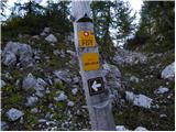 59
59 60
60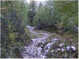 61
61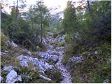 62
62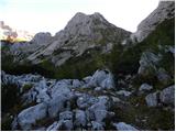 63
63 64
64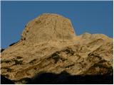 65
65 66
66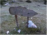 67
67 68
68 69
69 70
70 71
71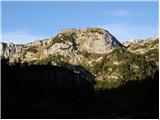 72
72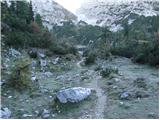 73
73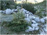 74
74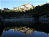 75
75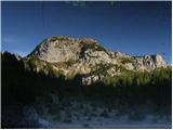 76
76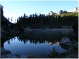 77
77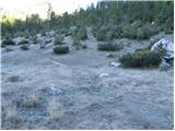 78
78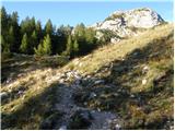 79
79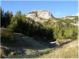 80
80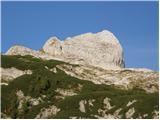 81
81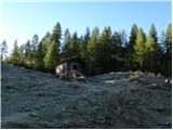 82
82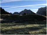 83
83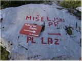 84
84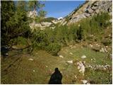 85
85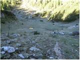 86
86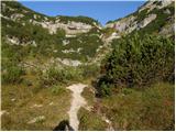 87
87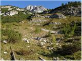 88
88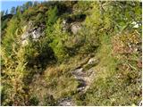 89
89 90
90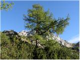 91
91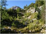 92
92 93
93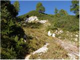 94
94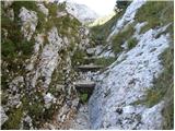 95
95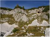 96
96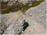 97
97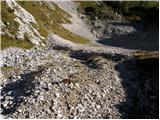 98
98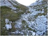 99
99 100
100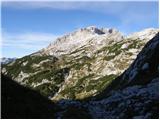 101
101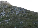 102
102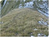 103
103 104
104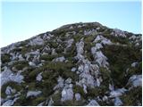 105
105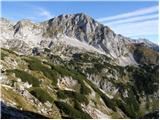 106
106 107
107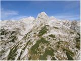 108
108 109
109 110
110 111
111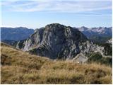 112
112 113
113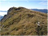 114
114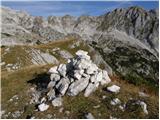 115
115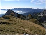 116
116
Discussion about the trip Rudno polje - Prevalski Stog
To post a comment you must log in:
If you do not yet have a username, you must first
register.