Starting point: Rudno polje (1347 m)
| Latitude/Longitude: | 46,34580°N 13,92360°E |
| |
Walking time: 3 h 50 min
Difficulty: easy unmarked way
Elevation gain: 928 m
Elevation difference along the route: 1020 m
Map: Triglav 1:25.000
Recommended equipment (summer):
Recommended equipment (winter): ice axe, crampons
Views: 24.060
 | 1 person like this post |
Access to starting point:
a) Drive to Bled, then continue driving towards Pokljuka. After Pokljuka, follow the main road to the large parking lot next to the barracks at Rudno polje. The parking lot is paid.
b) Drive to Bohinjska Bistrica, then continue towards Bled, but only to the turn-off for Pokljuka. Continue towards Pokljuka; at Jereka, turn right towards Pokljuka and also at the following intersections follow the signs for Pokljuka. When you arrive at Mrzli studenec, continue left and drive to the large paid parking lot next to the barracks at Rudno polje.
Route description:
At the end of the parking lot, a gravel road branches off to the right, next to which there are signposts for Triglav. Head onto this road, which gently ascends and after ten minutes of walking brings us to the Viševnik ski slope. Continue along the road, from which a marked path towards Triglav soon branches off to the left.
Continue towards Triglav and after a few minutes of moderate ascent arrive at a forest road, which we follow for only a few meters (formerly it was possible to drive by car up to here). The marked path then turns right and ascends more steeply for a short while, after ten minutes the steepness eases and the path slowly transitions onto steep slopes. Across the steep slopes, the path mostly gently descends and turns increasingly to the right. A bit further on, we will notice planina Konjščica below us to the left. Our path then stops descending and emerges from the forest into the scrub. The path, which ascends again, leads us under steep cliffs and soon brings us to a junction where we join the path from planina Konjščica.
From here, a short ascent follows and the path brings us to a nice little valley called Jezerce, where it forks. There are also signposts here directing left (right Srenjski preval, Viševnik Blejska koča na Lipanci...), and we continue on an initially gentle path to the spring below Studorski preval. After the spring, the path gradually becomes steeper, from the left side of the torrent it crosses higher to the right side, where we reach grassy slopes; the path we are ascending is still rocky. An ascent in a few switchbacks follows and we climb to Studorski preval, from which a beautiful view opens onto the mountains above Bohinj.
Here, a demanding path from Srenjski preval joins from the right, and from our path unmarked tracks also branch off to Ablanca and Veliki Draški vrh.
From the saddle, we first descend more steeply for a short time, then the path turns to the right direction, and we then traverse the slopes to the left for a long time with some shorter easy ascents and descents. From the slopes of Veliki Draški vrh we gradually arrive at the slopes of the massive Tosc, and with nice views we continue to the marked branch-off to Tosc; the path ahead is unmarked.
Continue on the unmarked but well-traceable path, which begins to ascend ever more steeply across the grassy southeast slopes of Tosc. The increasingly steep path slowly turns somewhat to the right, then sharply turns left and becomes almost completely flat. Crossing a short steep slope follows, then the path brings us to less steep slopes where it begins to gradually fade. The less visible track then turns slightly right and begins to ascend somewhat more steeply. After a few minutes of ascent, we step onto the indistinct Mali Tosc, from which a view of Tosc opens up. A short descent follows and the path past a larger sinkhole, which we bypass on the right side, brings us to the summit ridge of Tosc. The path ahead moderately ascends through pleasant grassy slopes and after a few more minutes of walking brings us to the summit of Tosc.
Orientation in fog is quite difficult.
Starting point - Taborni prostor 0:10, Taborni prostor - Klanci 1:25, Klanci - Jezerce 0:05, Jezerce - Studorski preval 0:30, Studorski preval - Planina Zgornji Tosc 0:35, Planina Zgornji Tosc - Mali Tosc 0:50, Mali Tosc - Tosc 0:15.

Along the route: Taborni prostor (1369m), Klanci (1678m), Jezerce (1719m), Izvir pod Studorskim prevalom (1746m),
Studorski preval (1892m), Planina Zgornji Tosc (1849m), Mali Tosc (2233m)
Photos:
 1
1 2
2 3
3 4
4 5
5 6
6 7
7 8
8 9
9 10
10 11
11 12
12 13
13 14
14 15
15 16
16 17
17 18
18 19
19 20
20 21
21 22
22 23
23 24
24 25
25 26
26 27
27 28
28 29
29 30
30 31
31 32
32 33
33 34
34 35
35 36
36 37
37 38
38 39
39 40
40 41
41 42
42 43
43 44
44 45
45 46
46 47
47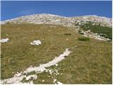 48
48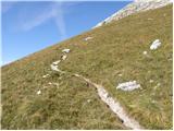 49
49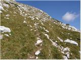 50
50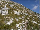 51
51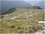 52
52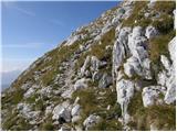 53
53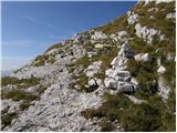 54
54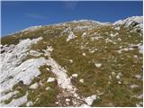 55
55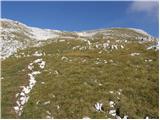 56
56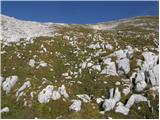 57
57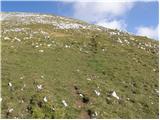 58
58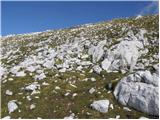 59
59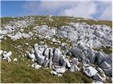 60
60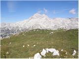 61
61 62
62 63
63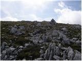 64
64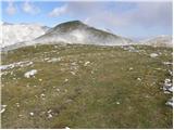 65
65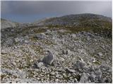 66
66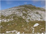 67
67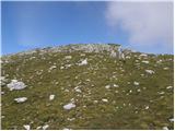 68
68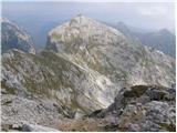 69
69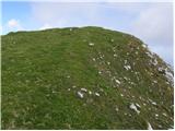 70
70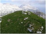 71
71
Discussion about the trip Rudno polje - Tosc
|
| J.P.14. 03. 2022 16:39:28 |
The snow base was excellent over the weekend as was the weather. Path without special features, carefully and with your head. One of the nicer peaks in summer and in winter only in summer set off from the end of the road on Pokljuka. Safe step. Lp
|
|
|
|
| nekdo_nekje10. 10. 2025 18:49:20 |
Does anyone have any information about what the trail is like currently?
|
|
|
To post a comment you must log in:
If you do not yet have a username, you must first
register.