Starting point: Rudno polje (1347 m)
| Latitude/Longitude: | 46,34580°N 13,92360°E |
| |
Walking time: 4 h 40 min
Difficulty: very difficult pathless terrain
Elevation gain: 878 m
Elevation difference along the route: 1025 m
Map: Triglav 1:25.000
Recommended equipment (summer): helmet
Recommended equipment (winter): helmet, ice axe, crampons
Views: 481
 | 1 person like this post |
Access to starting point:
From the Ljubljana - Jesenice motorway, take the Lesce exit and continue along the road towards Bled. In Bled, at the traffic light with signs for Pokljuka, turn right. Continue through Gorje and past the abandoned Zatrnik ski slope to Rudno polje on Pokljuka, where park at the large paid parking lot or the nearby free military parking lot.
Route description:
At the end of the parking lot, a gravel road branches off to the right, next to which there are signposts for Triglav. Head onto this road, which gently ascends and after ten minutes of walking brings us to the Viševnik ski slope. Continue along the road, from which a marked path to Triglav soon branches off to the left.
Continue in the direction of Triglav and after a few minutes of moderate ascent arrive at a forest road, which we follow for only a few meters (until here it used to be possible by car). The marked path then turns right and ascends more steeply for a short time, after ten minutes the steepness eases and the path slowly transitions onto steep slopes. Across the steep slopes the path mostly gently descends and turns increasingly to the right. A bit further we will notice planina Konjščica below us on the left. Our path then stops descending and transitions from the forest into the bushes. The ascending path then leads under steep cliffs and soon brings us to a junction where we join the path from planina Konjščica.
From here follows a short ascent and the path brings us to a beautiful little valley called Jezerce, where it forks. There are also signposts directing us left (right Srenjski preval, Viševnik Blejska koča na Lipanci...) while we continue on the initially level path that leads us to the spring below Studorski preval. After the spring the path gradually becomes steeper, from the left side of the stream higher it crosses to the right side, where we reach grassy slopes, the path we are ascending is still rocky. Follows an ascent in a few switchbacks and we climb to Studorski preval, from which a nice view opens to the mountains above Bohinj.
Here a demanding path from Srenjski preval joins from the right, and from our path unmarked trails to Ablanco and Veliki Draški vrh also branch off.
From the saddle we first descend steeply for a short time, then the path turns to the right direction, and we then for a long time with some shorter easy ascents and descents cross the slopes to the left. From the slopes of Veliki Draški vrh we gradually arrive at the slopes of massive Tosc, and with nice views we continue past the branch of the path to Tosc and the junction where the path from Uskovnica joins from the left.
At all junctions, also the one where the partly abandoned path leading over planina Zgornji Tosc joins, continue straight, the path gradually brings us to steeper and also precipitous southwest slopes of mount Tosc, where there was a landslide a few years ago, so some extra caution is needed due to falling rocks. Across the precipitous part runs a fairly wide path, so there are no special difficulties in this section, when the slope becomes less steep then the path from Stara Fužina or Voje valley joins from the left.
Continue straight on the wider marked path towards Triglav, which continues north, leading us along the western slopes of Tosc, the still easy path across some screes brings us to Vodnikov dom na Velem polju.
At Vodnikov dom head right in the direction of Bohinjska vratca and Krma (straight Triglav), where we first ascend past the botanical garden, then begin steeply ascending the steep, mostly grassy slopes between Vernar on the left and Tosc on the right. Higher we reach an indistinct little valley, through which in a few minutes we ascend to Bohinjska vratca, from where a nice view opens towards Krma.
From Bohinjska vratca continue left onto an unmarked trail leading up the grassy slope. The grassy slope becomes steeper and is especially when wet very dangerous for slipping. Follow the steep trail running slightly left of the ridge all the way to the grassy forepeak at elevation 2183 m.
From the forepeak continue along the ridge and first descend steeply a few meters on the rocky slope. Continue along the ridge which becomes quite narrow and exposed. Walk mostly on the left side of the ridge, which is also indicated by some cairns. Follow a few very short climbing sections (I-II grade) and we are already at the summit of Vernar.
Izhodišče - Taborni prostor 0:10, Taborni prostor - Klanci 1:25, Klanci - Jezerce 0:05, Jezerce - Studorski preval 0:30, Studorski preval - Planina Zgornji Tosc 0:35, Planina Zgornji Tosc - Na Zagonu 0:20, Na Zagonu - Vodnikov dom 0:20, Vodnikov dom - Bohinjska vratca 0:25, Bohinjska vratca - Vernar 0:50.

Along the route: Taborni prostor (1369m), Klanci (1678m), Jezerce (1719m), Izvir pod Studorskim prevalom (1746m),
Studorski preval (1892m), Planina Zgornji Tosc (1849m), Na Zagonu (1819m),
Vodnikov dom (1817m), Bohinjska vratca (1975m)
Photos:
 1
1 2
2 3
3 4
4 5
5 6
6 7
7 8
8 9
9 10
10 11
11 12
12 13
13 14
14 15
15 16
16 17
17 18
18 19
19 20
20 21
21 22
22 23
23 24
24 25
25 26
26 27
27 28
28 29
29 30
30 31
31 32
32 33
33 34
34 35
35 36
36 37
37 38
38 39
39 40
40 41
41 42
42 43
43 44
44 45
45 46
46 47
47 48
48 49
49 50
50 51
51 52
52 53
53 54
54 55
55 56
56 57
57 58
58 59
59 60
60 61
61 62
62 63
63 64
64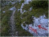 65
65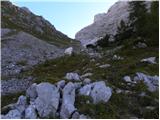 66
66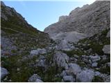 67
67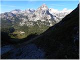 68
68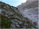 69
69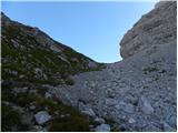 70
70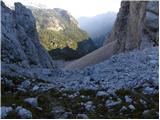 71
71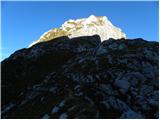 72
72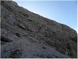 73
73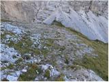 74
74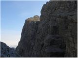 75
75 76
76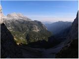 77
77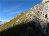 78
78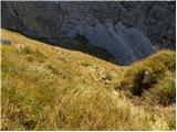 79
79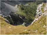 80
80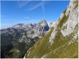 81
81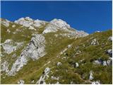 82
82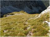 83
83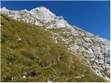 84
84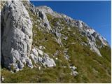 85
85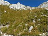 86
86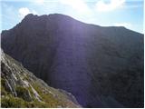 87
87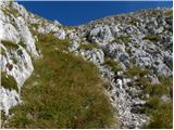 88
88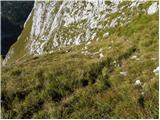 89
89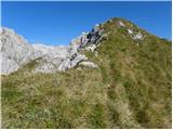 90
90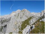 91
91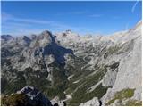 92
92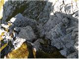 93
93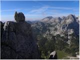 94
94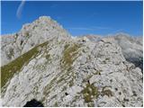 95
95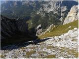 96
96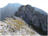 97
97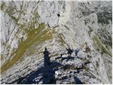 98
98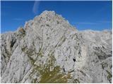 99
99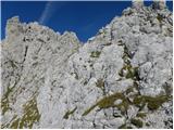 100
100 101
101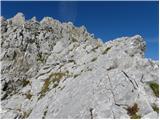 102
102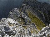 103
103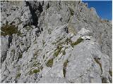 104
104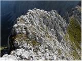 105
105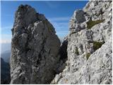 106
106 107
107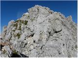 108
108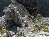 109
109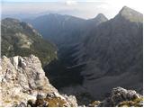 110
110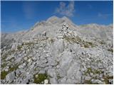 111
111
Discussion about the trip Rudno polje - Vernar
|
| mukica24. 01. 2026 11:43:04 |
Very nice peak and wonderful viewpoint that offers everything that the highest ones have too. I like to return to it.
|
|
|
To post a comment you must log in:
If you do not yet have a username, you must first
register.