Rudno polje - Viševnik (via Gola Ravan)
Starting point: Rudno polje (1347 m)
| Latitude/Longitude: | 46,34580°N 13,92360°E |
| |
Route name: via Gola Ravan
Walking time: 2 h 15 min
Difficulty: easy unmarked way
Elevation gain: 703 m
Elevation difference along the route: 720 m
Map: TNP 1:50.000
Recommended equipment (summer):
Recommended equipment (winter): ice axe, crampons
Views: 6.311
 | 1 person like this post |
Access to starting point:
From the Ljubljana-Jesenice highway, we take the Lesce exit and follow the road ahead towards Bled. In Bled, at the traffic lights, the signs for Pokljuka direct us to the right. We continue driving through Gorje and past the abandoned ski slope Zatrnik to Rudno polje on Pokljuka (large parking lot, barracks and shooting range).
Route description:
From the large parking lot opposite the barracks on Rudno polje, we first cross the road, then look for the beginning of the forest road (at the beginning of the forest road there are also signs for Triglav), which leads towards the ski slope Viševnik. After approximately 10 minutes of walking on the mentioned road, we arrive at the foot of the ski slope, where the marked path splits into two parts. The right path leads towards Viševnik and Blejska koča na Lipanci, while we continue a short time on the road in the direction of Triglav, Vodnikov dom na Velem polju and Studorski preval. When the road returns to the forest, we will notice on the left a marked footpath which starts gently and higher moderately ascends through the forest. After a few minutes, we step back onto the road, which we reach at a medium-sized parking lot, where there is space for about 20 cars (it is possible to drive here by car, which shortens the path by approximately 20 minutes).
When we reach the parking lot, we walk some 10 m on the road, then the signs lead us slightly right onto a marked and well-beaten path which starts ascending through the forest. After a few minutes, the path flattens and gradually transitions to the relatively steep southern slopes of Plesišče (1790 m). A few minutes of traversing follow, then we step onto a sort of ridge of the aforementioned summit. Here the marked path turns right (straight down leads an unmarked but well-beaten path towards Planina Konjščica) and descends a little further.
From the ridge, we follow the marked path only to the crossing of the first gully. At the gully, we leave the marked path and continue the ascent to the right along the gully, initially straight upwards. Soon we notice traces of predecessors, a few more steps higher we spot a nicely traceable little path (to here it is also possible via the path which branches off from the aforementioned ridge into the forest (the start of the mentioned little path is not visible)). Here the path to the right crosses a stream, then behind it slowly turns semicircularly left, leading us across a meadow where the path is not visible. When we approach the stream again, we spot the path again; it crosses the stream and on the other side starts traversing upwards. The path then ascends into a smaller valley, where it disappears again. When the valley flattens, we continue right, where after a few meters we spot the path again, this time more distinct. From the point where we left the valley, we walk only a minute or two, then notice a small cairn by the path, where the path splits into two parts. The left path leads towards the saddle between Viševnik and Plesišče, the path continuing straight joins the marked path Rudno polje - Viševnik at Zlate vode.
From the mentioned junction, we continue on the left path, which starts traversing upwards to the left. For some time, the nicely traceable little path occasionally offers views of Spodnje Bohinjske gore and the surroundings of Planina Konjščica, then the path slowly starts to disappear. We know we are on the right path because we notice some chopped dwarf pine brushwood along it. After crossing the grass-covered gully, the path disappears even more, and the "path" precisely in this section turns in a long semicircular arc to the right, where the path becomes visible again. A few more minutes of traversing or slight ascent to the right follow, and the increasingly traceable path soon brings us to the saddle between Plesišče on the right and Viševnik on the left.
At the mentioned saddle, we reach the marked path Rudno polje - Viševnik, which we follow to the left. The path ahead ascends first moderately, then more steeply through a belt of dwarf pines. Higher up, the dwarf pines end and the path brings us to a mini saddle, from where a nice view opens up. We continue ascending a steeper and panoramic grassy slope, then the path turns slightly right and in a traversing ascent brings us to the ridge of Viševnik, where we also get a nice view towards Rjavina and surrounding mountains. The path continues along and beside the ridge and for some time ascends only moderately. After a short traverse, we arrive below the summit of Viševnik itself, where the path becomes quite steep (in winter this section is often icy) and brings us to the panoramic summit in a few minutes.
Starting point - Planina Konjščica 30 minutes, Planina Konjščica - Viševnik 1:45.
The description refers to the condition in July 2014; all photos are from then.

Photos:
 1
1 2
2 3
3 4
4 5
5 6
6 7
7 8
8 9
9 10
10 11
11 12
12 13
13 14
14 15
15 16
16 17
17 18
18 19
19 20
20 21
21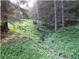 22
22 23
23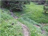 24
24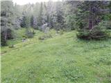 25
25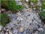 26
26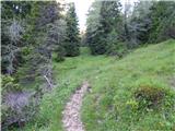 27
27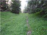 28
28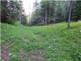 29
29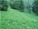 30
30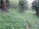 31
31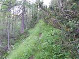 32
32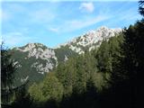 33
33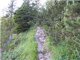 34
34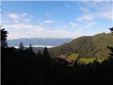 35
35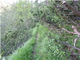 36
36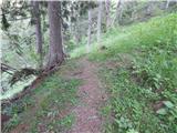 37
37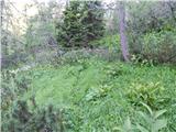 38
38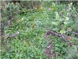 39
39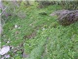 40
40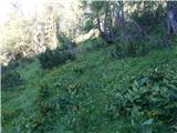 41
41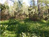 42
42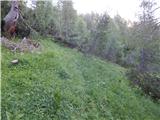 43
43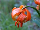 44
44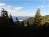 45
45 46
46 47
47 48
48 49
49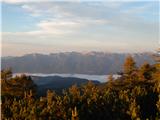 50
50 51
51 52
52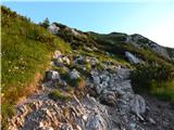 53
53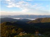 54
54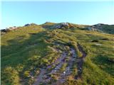 55
55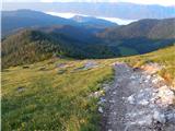 56
56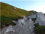 57
57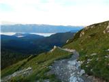 58
58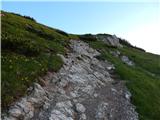 59
59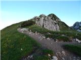 60
60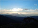 61
61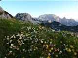 62
62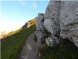 63
63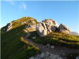 64
64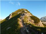 65
65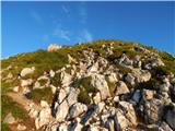 66
66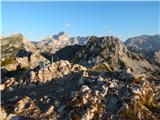 67
67 68
68
Discussion about the trip Rudno polje - Viševnik (via Gola Ravan)
To post a comment you must log in:
If you do not yet have a username, you must first
register.