Ruta - Lobnikov vrh (circular path)
Starting point: Ruta (310 m)
| Latitude/Longitude: | 46,56310°N 15,43130°E |
| |
Route name: circular path
Walking time: 2 h 30 min
Difficulty: partly demanding unmarked way
Elevation gain: 395 m
Elevation difference along the route: 395 m
Map: Pohorje (PZS) 1:50000
Recommended equipment (summer):
Recommended equipment (winter): ice axe, crampons
Views: 4.604
 | 2 people like this post |
Access to starting point:
A) With a car we drive from Maribor in the direction towards Dravograd. Approximately 20 km from Maribor we cross the river Drava towards Lovrenc na Pohorju. After two hundred meters, we turn left, across the stone bridge, over the stream Radoljna. We continue on the asphalt road through the settlement to the railway station Ruta, where we park.
B) First, we drive to Dravograd, and then we continue driving towards Maribor. A few kilometers after the settlement Ožbalt we leave the main road and continue right in the direction of Lovrenc na Pohorju. Immediately behind the bridge over the river Drava we turn left and then we park near the railway station Ruta.
C) To the starting point, we can also arrive by train from Maribor or Dravograd.
Route description:
A pleasant circular walking path above the river Drava, which on the old hunting footpaths leads us over Štiblerjev vrh to Lobnikov vrh. It is most beautiful in early spring and late autumn, when views open onto the Drava valley.
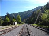
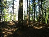
The path starts at the railway station Ruta, where approximately two hundred meters in the direction of Fala we follow the railway track. At the ruins (quarry) we start to ascend on an old hunting footpath right uphill. A gentle path, at an altitude of approximately 400 m, crosses the western slopes below Štiblerjev vrh. After approximately half an hour of walking the path apparently is blocked by a thirty-meter-high granite wall. We continue a little downwards, right by the wall, and then the path rises slightly again all the way to the ridge Predla. Our footpath soon joins a somewhat wider path, which leads from Fala. We turn right onto it. Now we more or less follow the ridge, which higher up levels off somewhat. The path then leads us past Štiblerjev vrh (648 m, GPS N46 34 237' E015 26.882' stone man on the summit), to a smaller saddle (view towards Ruše) right before Lobnikov vrh. At the junction of cart tracks we follow the right, narrower path. After a few meters we turn left and reach the highest point of our path. On the overgrown summit there is only a salt lick for wildlife.
Descent:
From Lobnikov vrh we continue on the path in the southwest direction. The path in a gentle descent follows the ridge. In a few minutes we reach a smaller saddle, from which we continue straight into the denser spruce forest. Soon a cart track crosses our path from the left, which over the ridge leads to the other side of the slope. We descend left along the mentioned cart track. Soon we step out of the forest onto the southern grassy slopes of Lobnikov vrh. We cross the meadows under the power lines where we keep to the cart track somewhat to the right. The path over the southwest forest slopes brings us back into the valley of the Radoljna stream and along it we are soon at the starting point.

Along the route: Štiblerjev vrh (648m)
Photos:
 1
1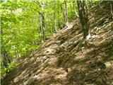 2
2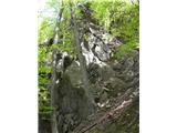 3
3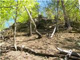 4
4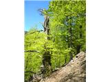 5
5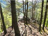 6
6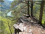 7
7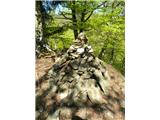 8
8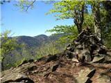 9
9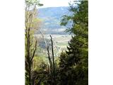 10
1011
 12
12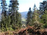 13
13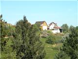 14
14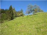 15
15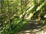 16
16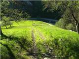 17
17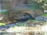 18
18
Discussion about the trip Ruta - Lobnikov vrh (circular path)
|
| pohodnik383. 05. 2019 |
On Wednesday, May 1st, I did the mentioned path, though some pathfinding because I followed the above description. 200 meters from the station by the railway I didn't spot the quarry so I went on my own towards the top of the ridge. At about 400 m altitude I reached a wide hunting path that led me all the way to the top of the ridge. Interesting, I'll go again 
PICTURES and personal impressions from the path
Regards! Tone
|
|
|
To post a comment you must log in:
If you do not yet have a username, you must first
register.