Rutarski gozd - Raskovec (via Rodica)
Starting point: Rutarski gozd (1030 m)
| Latitude/Longitude: | 46,21560°N 13,88950°E |
| |
Route name: via Rodica
Walking time: 3 h 30 min
Difficulty: easy unmarked way
Elevation gain: 937 m
Elevation difference along the route: 1065 m
Map: TNP 1:50.000
Recommended equipment (summer):
Recommended equipment (winter): ice axe, crampons
Views: 1.390
 | 1 person like this post |
Access to starting point:
From Podbrdo we drive towards Tolmin or vice versa, but only to the village of Koritnica. In Koritnica we will notice a sign for the village Rut, which directs us right (from Tolmin sharply left). We then follow the mostly ascending road to the mentioned village, where there is also a smaller intersection. We continue straight (left to the village Grunt) on the road, which soon loses its asphalt surface. The wide macadam road quickly ascends above the village and turns right. Three hairpin turns follow; at the third or second left, a marked path from Stržišče joins from the right, and from here on we need to pay attention to possible parking along the road, because driving from the next intersection onwards is forbidden.
Route description:
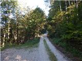
From the parking lot, we continue on the macadam road, then quickly arrive at an unmarked intersection, where we continue on the upper right road, next to which there is a gate and a traffic sign prohibiting further driving.
Behind the gate, the road starts to ascend more steeply, then at the next intersection, where a narrower road branches off to the right, we continue straight ahead along it to the point where the road narrows or splits into two cart tracks.
We continue on the upper wider cart track, alongside which there are signs for Rodica. Further on, we ascend diagonally for some time along a poor road or cart track that leads past a hunting observatory and offers occasional views of the mountains on the other side of Baška grapa. Higher up, a marked path from the village of Grant joins from the left; some 10 meters further, from the cart track we continue right towards Rodica (straight to Koča na planini Razor - path over Hudo stopno).
Behind the junction named Mladinska koča, we begin to ascend along a well-preserved mule track, which after a few minutes turns sharply left, then ascends diagonally to the left for quite some time, first still through forest, then through dwarf pines. During the diagonal ascent, the path also leads across a few gullies, but the crossings are not difficult since the path is wide throughout. Amid nice views of Idrijsko and Cerkljansko hribovje, at the right hairpin we approach very close to the summit of Jehlc, which we see ahead of us throughout the traverse. At this hairpin, a pathless approach to the mentioned summit continues straight ahead (the last section before the ridge is demanding); we continue along the marked path, which continues along the mule track. Two hairpins higher, an easier approach to the aforementioned summit branches off to the left, while we continue ascending through the dwarf pines. A little higher, we reach the ridge stretching from Jehlc to the main ridge of the Spodnje Bohinjske gore; the path avoids it several times, once to the left, then to the right. Higher up, dwarf pines give way to grass and rocks, and finer views open with every step. A few more hairpins follow, where we climb a steeper slope; then the slope levels out and the path brings us to a marked junction, where we join the path from the Bohinj side.
Here we continue right (left to Šija, Ski hotel Vogel and Ribčev Laz) and ascend along a moderately steep ridge to the 1966 m high summit of Rodica in just over 10 minutes of further walking.
From the summit of Rodica, we continue along the ridge towards Črne prsti. The path first descends along the ridge, then moves onto the southern slopes, crossing occasionally quite steep slopes just a few meters below the ridge. The highly scenic path then passes the foot of Suha Rodica (Novi vrh) onto shady slopes, crossing the slopes of the aforementioned summit (a snow patch that persists until early summer). When the path returns to the main ridge, we leave the marked path and continue along the ridge (the southwest ridge of Raskovec), beside which we notice a very faintly visible path that brings us to the summit of Raskovec in 10 minutes of ascent along the summit slope.
Starting point - Rodica 2:30, Rodica - Raskovec 1:00.

Photos:
 1
1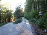 2
2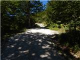 3
3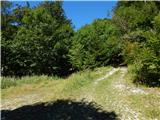 4
4 5
5 6
6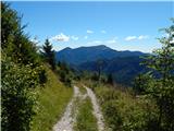 7
7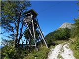 8
8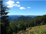 9
9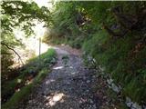 10
10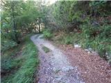 11
11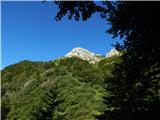 12
12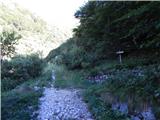 13
13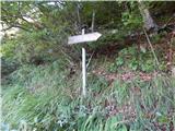 14
14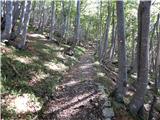 15
15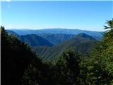 16
16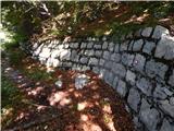 17
17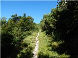 18
18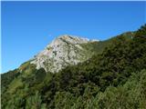 19
19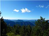 20
20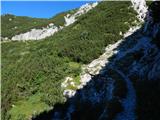 21
21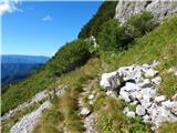 22
22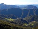 23
23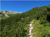 24
24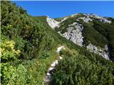 25
25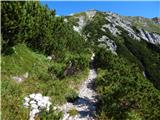 26
26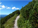 27
27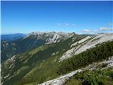 28
28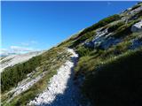 29
29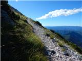 30
30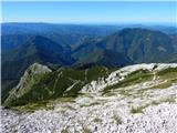 31
31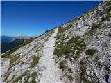 32
32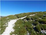 33
33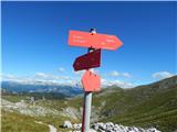 34
34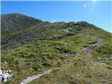 35
35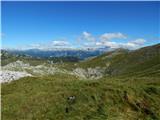 36
36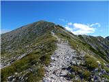 37
37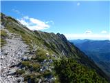 38
38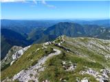 39
39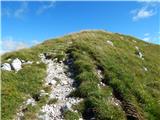 40
40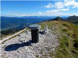 41
41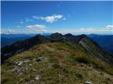 42
42 43
43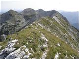 44
44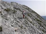 45
45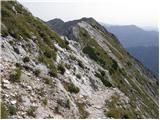 46
46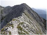 47
47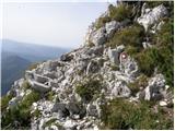 48
48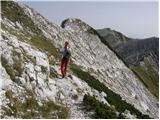 49
49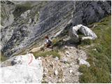 50
50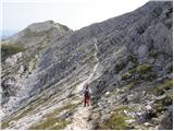 51
51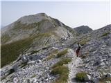 52
52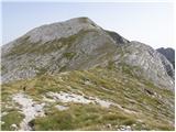 53
53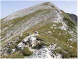 54
54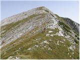 55
55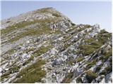 56
56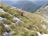 57
57 58
58
Discussion about the trip Rutarski gozd - Raskovec (via Rodica)
To post a comment you must log in:
If you do not yet have a username, you must first
register.