Rute (Zavrh) / Bärental - Barentaler Kotschna/Struška (via Bärensattel)
Starting point: Rute (Zavrh) / Bärental (960 m)
| Latitude/Longitude: | 46,47020°N 14,15640°E |
| |
Route name: via Bärensattel
Walking time: 2 h 45 min
Difficulty: easy marked way
Elevation gain: 984 m
Elevation difference along the route: 984 m
Map: Karavanke - osrednji del 1:50.000
Recommended equipment (summer):
Recommended equipment (winter): ice axe, crampons
Views: 9.984
 | 2 people like this post |
Access to starting point:
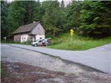
Over the Ljubelj border crossing we descend to the Austrian side, and then in the second roundabout (which is located a little before the bridge over the river Drava) we take the exit Bistrica v Rožu / Feistritz. Further, we drive to the mentioned settlement, and there signs for Rute / Bärental direct us to the left onto an ascending road which after a few km brings us to the mentioned village, where we park on the parking lot by the road (by the parking lot there are hiking signposts for Struška / Barentaler Kotschna).
Route description:
From the parking lot, we go right on an asphalt road in the direction of "Bärensattel". After a few dozen steps, the road brings us to the inn Stouhütte, behind which we leave it and go on a footpath in the direction of "Bärensattel". The path then immediately after smaller steps turns left and a little higher crosses the macadam road. Further, we ascend on a pleasant forest path, which higher brings us to the partly abandoned farm Žnidar, where we turn sharply left. The path goes again into the forest and after a shorter moderate ascent brings us to the hunting observatory (if we ascend to the top, a nice view opens up on the Drava Valley). The path ahead gradually becomes steeper and higher brings us below smaller cliffs, where the pleasant walk is interrupted by scree, on which we must ascend steeply upward (careful especially on the descent). The steepness then eases and the path brings us past an intermittent spring to the saddle Medvedjak / Bärensattel.
Here we continue right along the border ridge in the direction of "Barentaler Kotschna" (straight to mountain pasture Seča 5 minutes) on the path ascending among dwarf pines. A relatively steep path brings us higher to the forepeak of Struška, from which we descend a few dozen steps. After this descent we cross a smaller valley and after a few steep steps ascend to the ridge, which we follow through dwarf pines to the grassy and panoramic summit.
Starting point - Medvedjak 1:45, Medvedjak - Struška 1:00.

Along the route: Medvedjak (1698m)
Photos:
 1
1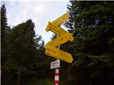 2
2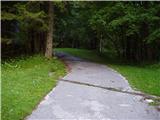 3
3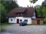 4
4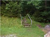 5
5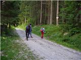 6
6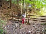 7
7 8
8 9
9 10
10 11
11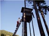 12
12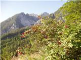 13
13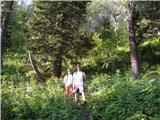 14
14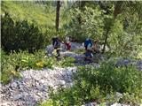 15
15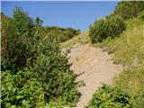 16
16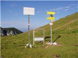 17
17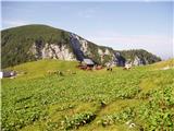 18
18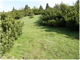 19
19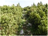 20
20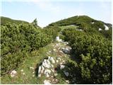 21
21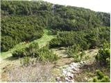 22
22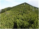 23
23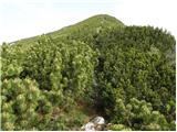 24
24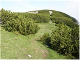 25
25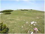 26
26 27
27
Discussion about the trip Rute (Zavrh) / Bärental - Barentaler Kotschna/Struška (via Bärensattel)
|
| heinz6. 11. 2009 |
1. I'm interested in the section of the path over the scree where caution is needed on descent. On the map the path is namely marked with a dashed red line, -as difficult. In the following days I plan to visit Stouhuette from Javorniški rovt.
2. Is there any junction on the path for Geissberg- Kozjak?
Thanks, good luck, heinz!
|
|
|
|
| Tadej6. 11. 2009 |
The path over the scree is not difficult, caution is needed mainly because of the stones that undermine our balance. The fall would be hard, but not fatal (unless you fall directly on your head), as the slope is not overly steep.
Picture 15 http://www.hribi.net/slika.asp?pot=31554
You will get to Celovška koča the fastest if from Medvedji dol (valley on the Austrian side) you continue along the road.
Best regards, Tadej
|
|
|
|
| heinz6. 11. 2009 |
Tadej, thanks! It seemed to me that it can't be bad, since the path Sedlo Belščiča - Celovška koča (easy) is marked in the same way..
For the path to Geissberg I'm still calculating where it's more worthwhile, e.g. Tinčkova koča, Zagon, Belščiča, Cel. koča, or this one - Trilobit, Seča, Medvedji dol, Mačenska pl.
The latter seems longer to me..
Maybe you know where Heider's monument (grave) is located? Apparently somewhere in Zavrh or Rute.
Best regards, heinz!
|
|
|
|
| Gorazd G6. 11. 2009 |
The grave/monument is in front of the church of St. Michael above Stouhütte - at the new church, the old one is much higher.
To Ovcji vrh/Kozjak is the most natural from here. Of course, you have to drive around by car 
|
|
|
|
| Gorazd G6. 11. 2009 |
We went past the monument in summer from Stouhütte to Mačenski vrh. To the Plavc farmstead there is a forest road, from there a nice circular tour on marked paths is offered.
|
|
|
|
| heinz6. 11. 2009 |
O.k. thanks!
How long did it take you from Stouhütte to Mačenski vrh?
There are supposedly nice panoramic views..
LP heinz!
|
|
|
|
| Gorazd G6. 11. 2009 |
Hm, now you've got me The watch with us in the mountains (since we're three now, of course), is no longer the boss and if the weather is stable, we don't even look at it. Before, we often had to make a strict timetable to make it before dark, now we just take nice walks and in between rest, eat, change diapers ... 
But I'll try anyway ... For the circular path from Stouhütte I think four to five hours of mountain pace would suffice - including sightseeing. From the summit meadow you can really see far Up there is an extensive alpine pasture. The southern ridge is quite steep, that's where we went up. The path sometimes goes above a cliff, which you can see well from Struška. The eastern (descent) one is mostly gentler. The trail (in the lower part you have to "hunt" for the markers a bit at the forks of cart tracks and paths) leads to the "old Michael". From this church in the middle of the meadow there is also a nice view of Stol and the surrounding peaks.
|
|
|
|
| heinz6. 11. 2009 |
Many thanks for all the information!
Good luck, heinz!
|
|
|
To post a comment you must log in:
If you do not yet have a username, you must first
register.