Sadnighaus - Sadnig (direct way (path 150))
Starting point: Sadnighaus (1880 m)
| Latitude/Longitude: | 46,95480°N 12,96100°E |
| |
Route name: direct way (path 150)
Walking time: 2 h 45 min
Difficulty: easy marked way
Elevation gain: 865 m
Elevation difference along the route: 910 m
Map: http://www.austria.info/us/interactive-map-austria#
Recommended equipment (summer):
Recommended equipment (winter): helmet, ice axe, crampons
Views: 1.476
 | 1 person like this post |
Access to starting point:
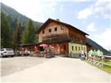
After crossing the border through Karawanks Tunnel, we drive on a highway past Beljak / Villach and Spittal, where we turn from the highway in the direction of Knoten Spittal Millstätter See, Felbertauern, Lienz, Lendorf. Then at the sign for Großglockner we turn right (here we stop following the road towards Lienz). On the road, we then drive through settlements Möllbrücke and Obervellach, until we turn towards the settlement Mörtschach, into which we eventually also turn. From here on we follow the signs for Asten. An asphalted and in parts steep road of length 10 to 11 km leads to a parking lot at the mountain hut Sadnig (in German Sadnighaus), where the asphalt also ends. Here we park. The drive from the national border to the destination is a little less than 2 hours.
Route description:
From the car we head along the asphalt road a few steps down to the signposts Naturlehrweg Astern Moos, Schobertörl and Makernispitze, which direct us to the footpath, on which we lose approximately 20 m of elevation to step onto the lower-lying macadam road. We follow the macadam road for a short time, until the sign for Sadnig, 3h, with marking 150 directs us over the bridge across the small stream Astenbach. On the other side of the bank, the signposts direct us to the right and later through the forest. The occasionally steeper path takes us into the increasingly sparse larch forest, from where increasingly beautiful views open up on the Asten valley. Continuing, we cross the torrent bed and finally reach the junction Kapitzenbühel (2282 m). To here we have walked 1 hour and 15 minutes.
We head towards Sadnig and along the path that is steeper only in places through the high mountain meadows after 45 minutes we reach the pass Sadnigscharte (2484 m). A little below the pass along the path there is a small lake, which is a good spot for a break.
From the pass onwards after a few hairpin turns we reach the scree, which we cross and then steeply ascend towards the secondary summit Vorsadnig (2696 m), which the path skirts a little below the summit on the eastern side. From here the summit is already close. In the last steep section a few meters below the summit, when the path is steepest, the path splits into two branches, one of which offers somewhat easier access to the summit.

Along the route: Sadnighaus (1880m), Naturlehrweg Astern Moos (1860m), Astenbach (1855m), Kapitzenbühel (2282m), Sadnigscharte (2484m)
Photos:
 1
1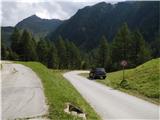 2
2 3
3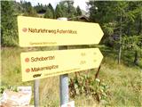 4
4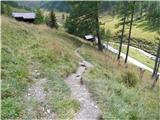 5
5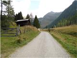 6
6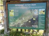 7
7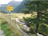 8
8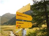 9
9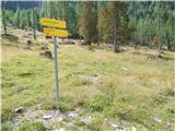 10
10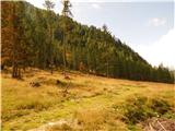 11
11 12
12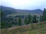 13
13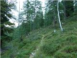 14
14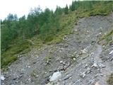 15
15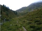 16
16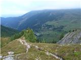 17
17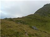 18
18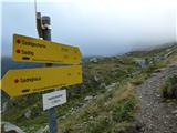 19
19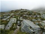 20
20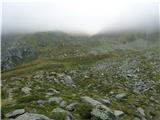 21
21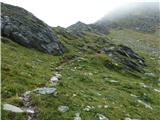 22
22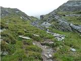 23
23 24
24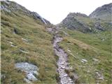 25
25 26
26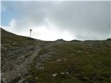 27
27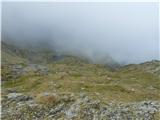 28
28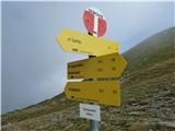 29
29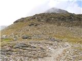 30
30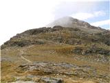 31
31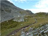 32
32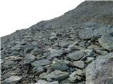 33
33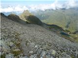 34
34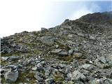 35
35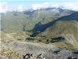 36
36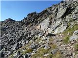 37
37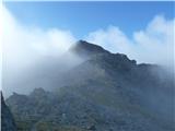 38
38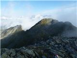 39
39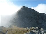 40
40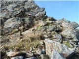 41
41 42
42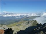 43
43
Discussion about the trip Sadnighaus - Sadnig (direct way (path 150))
To post a comment you must log in:
If you do not yet have a username, you must first
register.