Sankt Ilgen (Der Bodenbauer) - Hochwart (via bivouac Fleischer)
Starting point: Sankt Ilgen (Der Bodenbauer) (884 m)
| Latitude/Longitude: | 47,57979°N 15,11399°E |
| |
Route name: via bivouac Fleischer
Walking time: 4 h 55 min
Difficulty: difficult marked way, easy pathless terrain
Elevation gain: 1326 m
Elevation difference along the route: 1450 m
Map:
Recommended equipment (summer): helmet
Recommended equipment (winter): helmet, ice axe, crampons
Views: 136
 | 1 person like this post |
Access to starting point:
From the border crossing Šentilj we continue driving on the highway towards Graz and further towards Linz and Salzburg. We soon leave highway A9 and continue driving slightly right in the direction of Vienna / Wien, proceeding along the expressway S35. Near the settlement Bruck an der Mur, we reach highway S16 and follow it in the direction of Vienna. A little further beyond the tunnel, we leave the highway and take the exit for Kapfenberg, then follow the signs for the mentioned town. We soon reach the main road 116, and from the nearby intersection, we turn slightly right toward the settlements Thörl and Mariazell. In the settlement Thörl, we turn left toward the settlement St. Ilgen, then follow the road to the inn Der Bodenbauer, which is located at the end of the Alpine valley. We park in a large parking lot just before the inn.
Route description:
From the parking lot, we walk to the inn Der Bodenbauer and bypass it on the right side. Behind the museum (nearby there is also a free public toilet), which is located behind the inn, the path splits for the first time. We continue straight ahead in the direction of the Hochschwab summit and the Häuslalm mountain pasture (left leads to Hainzleralm and Josersee) and follow the gently sloping macadam road that is closed to public traffic.
After a few minutes the road splits again; we continue straight towards the Hochschwab summit (left goes to Häuslalm and to Hochschwab via the mentioned mountain pasture).
Further on we still walk along the gently sloping macadam road. When the road splits a few minutes ahead, we choose the middle road where the blazes continue, and from it we soon turn left onto a footpath that crosses the torrent stream Trawiesbach.
We continue at first gently, then move onto the slope and gradually start ascending more steeply, mostly through the forest. Next follows a diagonal ascent below cliffs, where especially after rain and in spring there is an increased danger of falling rocks. The path then turns right and continues for a while onto the steeper slopes of Schottenkogel.
Behind the mentioned peak (the marked path does not lead to its summit) the path flattens, briefly descends a few steps, and later we cross another torrent stream, after which we gradually reach the grassy plain of the Trawiesalm mountain pasture.
The path ahead leads us along the upper part of the Trawiestal valley, from where increasingly beautiful views open up towards the surrounding mountain walls; for some time we walk beside the torrent. Later the path leaves the torrent and turns left onto a steep and temporarily gravelly slope, where extra caution is needed especially on descent to avoid slipping on the scree; higher up the path continues through dwarf pines.
Higher up the slope becomes steeper and the path splits.
Signposts direct us from the wider and better-trodden path that climbs above the precipice to the left onto a bypass route through dwarf pines. When the slope above the better-trodden path flattens, the two paths rejoin. This is followed by a few more minutes of ascent on a fairly steep slope, but along a wide path; higher up the path and slope temporarily flatten again. Here the path turns left and ascends on still quite grassy terrain to the G'hacktbrunn spring, above which a marked junction with a cross is located.
We continue left towards the Hochschwab summit (right leads to the Trawiessattel saddle) and ascend in a few hairpin turns on increasingly rocky terrain to the beginning of the secured section.
Here we first climb a few steps higher with the help of a chain, then step to the edge of the gully, where metal stairs or a ladder and a chain help us continue more easily. Higher up there are several shorter, even steeper sections where we move right out of the gully; fixed safety cables continue to assist us. Further on we gradually leave the gully and reach a smaller ridge; the fixed safety gear along the path comes in various forms, mostly different from those found in the Slovenian mountains. In the final part of the secured section we traverse onto the slopes below G'hacktstein, where the difficulty of the path gradually ends. We then traverse a small valley and briefly ascend steeply onto the southeastern ridge of G'hacktkogel.
Here the marked path turns right and descends into a small notch, followed by an ascent on a steeper slope to a hill near the bivouac, which we reach in a minute or two of further walking.
At the bivouac we turn left onto the path towards the mountain pasture Häuslalm (right leads to the peak Hochschwab and the mountain hut Schiestlhaus) and ascend diagonally across the slopes of G'hacktkogel, then traverse the northern slopes of the mentioned peak almost at the same altitude. Later the path turns slightly left and leads us into a small valley between G'hacktkogel and Zagelkogel. Here the path gradually moves onto the slopes of Zagelkogel, where we begin to ascend diagonally; higher up the path flattens, then starts descending more steeply towards the saddle Rauchtalsattel, which separates Zagelkogel and Hochwart. From here we continue for a short while on the marked path towards the mountain pasture Häuslalm, then, before the rocky section, we turn right onto pathless terrain, where we first ascend a grassy slope and higher up continue along a partly rocky ridge. After approximately 15 minutes of ascent off-trail we reach the panoramic summit of Hochwart, where a cross stands.
Starting point – bivouac 4:00, bivouac – summit 0:55.
The description reflects the conditions in September 2025; the photographs are from various periods.

Photos:
 1
1 2
2 3
3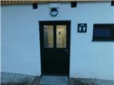 4
4 5
5 6
6 7
7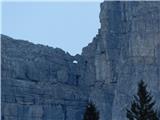 8
8 9
9 10
10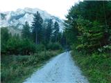 11
11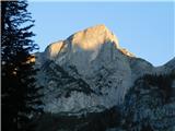 12
12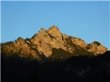 13
13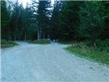 14
14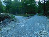 15
15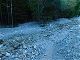 16
16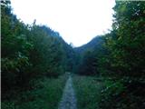 17
17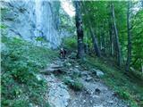 18
18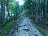 19
19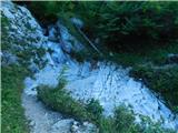 20
20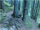 21
21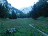 22
22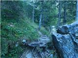 23
23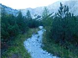 24
24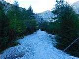 25
25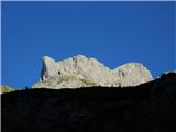 26
26 27
27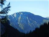 28
28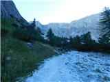 29
29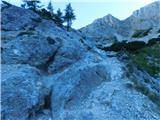 30
30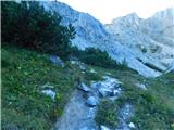 31
31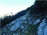 32
32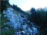 33
33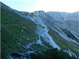 34
34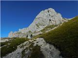 35
35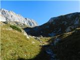 36
36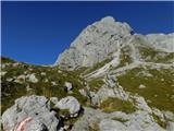 37
37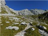 38
38 39
39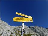 40
40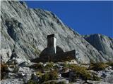 41
41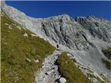 42
42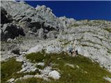 43
43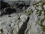 44
44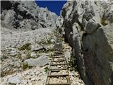 45
45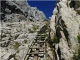 46
46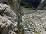 47
47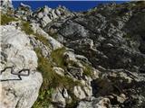 48
48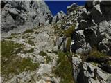 49
49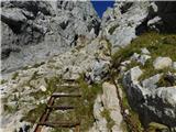 50
50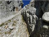 51
51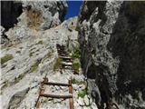 52
52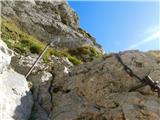 53
53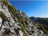 54
54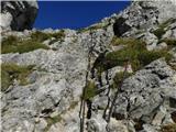 55
55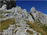 56
56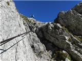 57
57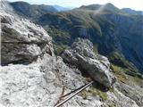 58
58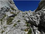 59
59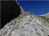 60
60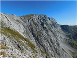 61
61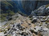 62
62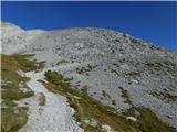 63
63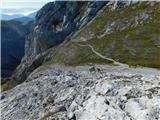 64
64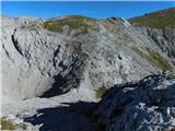 65
65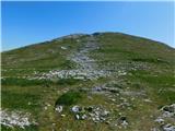 66
66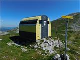 67
67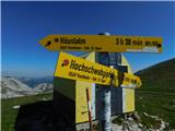 68
68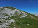 69
69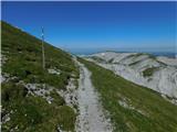 70
70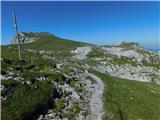 71
71 72
72 73
73 74
74 75
75 76
76 77
77 78
78 79
79 80
80 81
81 82
82 83
83 84
84 85
85 86
86 87
87
Discussion about the trip Sankt Ilgen (Der Bodenbauer) - Hochwart (via bivouac Fleischer)
To post a comment you must log in:
If you do not yet have a username, you must first
register.