Sant'Uberto - Cascata di Fanes (Via Ferrata Giovanni Barbara)
Starting point: Sant'Uberto (1421 m)
| Latitude/Longitude: | 46,60229°N 12,10720°E |
| |
Route name: Via Ferrata Giovanni Barbara
Walking time: 1 h 10 min
Difficulty: very difficult marked way
Via ferrata: B
Elevation gain: 46 m
Elevation difference along the route: 200 m
Map: Tabacco 03 1:25.000
Recommended equipment (summer): helmet, self belay set
Recommended equipment (winter): helmet, self belay set, ice axe, crampons
Views: 4.872
 | 4 people like this post |
Access to starting point:
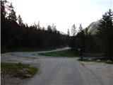
Via the Rateče border crossing we drive to Trbiž / Tarvisio, where we turn onto the motorway in the direction of Udine. We leave the motorway at the Tolmezzo exit and follow the road to the mentioned settlement. From Tolmezzo we continue in the direction of the settlement Ampezzo and mountain pass Passo della Mauria. The road then starts descending and brings us into the Cadore valley, where we continue right (left Belluno and Cortina d'Ampezzo) in the direction of the settlement Auronzo. After a few more km of driving we come to the next major intersection, where we go right in the direction of the settlement Misurina (left Tre Croci pass). From here we descend along the road to a larger intersection where we continue left towards Cortina d'Ampezzo (right Austria). From the mentioned intersection we continue for approximately 10 km towards Cortina d'Ampezzo, and then in a sharp left turn we go right on the road towards the mountain hut Rifugio Ra Stua. We park on the parking lot, which is located at the very beginning of the mentioned road.
Route description:
From the parking lot, we go left on a cart track following the signs »Valle di Fanes« (path no. 10). The cart track from the parking lot starts descending and quickly brings us to a marked junction. At the junction, we go right on a footpath following the signs »Valle di Fanes«. From the junction, the path starts descending through the forest and brings us to an asphalt road.
We continue right on the road and cross a bridge over the stream Rio di Fanes. The road, which runs along the stream, then brings us to an intersection.
To the right leads the path named Sentiero dei Canyons, on which we will return later; now we go left (path no. 10) on the road, which is asphalt for a short time and then becomes macadam. Further on, the road mostly ascends gently through the forest, and occasionally views open up to the nearby peaks.
Later a footpath branches off to the left towards the saddle Posporcora, but we continue on the macadam road. The road then turns slightly to the right and crosses the deep gorge Gola di Fanes over a bridge. We continue on the road, which soon brings us again to a marked junction.
At the junction the road turns left, straight ahead leads the path named Sentiero dei Canyons, but we go right following the signs »Sentiero Attrezzato alla Cascata«. Immediately after the junction there are tables and benches along the path where we equip ourselves with the via ferrata kit and helmet. The secured path Via Ferrata Giovanni Barbara first crosses the exposed slope above the gorge and brings us to the waterfall Cascata di Fanes. The wall over which the waterfall falls is slightly overhanging, so the path runs behind the waterfall.
The path then brings us through a narrow notch into a gully, along which we continue right downwards. This is followed by a descent over a rocky step, which is well secured. A steel cable and pegs assist us. The gully then becomes less steep and brings us below the mighty waterfall Cascata di Fanes di Sotto.
The secured path here otherwise crosses the stream, but the bridge is collapsed. Due to the collapsed bridge below the waterfall, we continue on the path that runs left and crosses the slope along the stream. Later the path turns left and climbs steeply above the gorge in short zigzags.
After the steep ascent the path brings us to a junction where it becomes easy again. To the left it is just a few metres to the viewpoint from which there is a splendid view of the waterfall and the gorge. To the right runs the path by which we descend to the starting point.
The descent path is easy and mostly runs through the forest.
Along the described path we will walk to the waterfall in approximately 1 h 10 min, and for the entire circular path we will need approximately 3 h.
The described circular path can also be walked in the reverse direction. The trip can also be extended by continuing along the Sentiero dei Canyons path to the upper waterfall.

Photos:
 1
1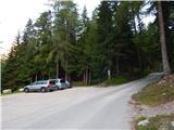 2
2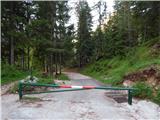 3
3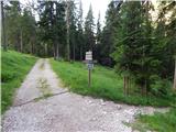 4
4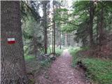 5
5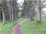 6
6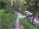 7
7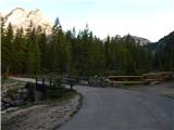 8
8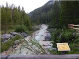 9
9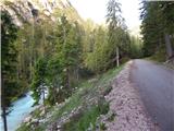 10
10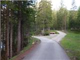 11
11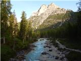 12
12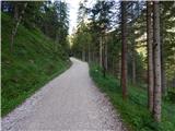 13
13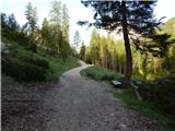 14
14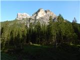 15
15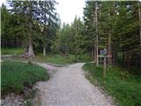 16
16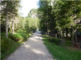 17
17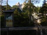 18
18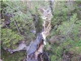 19
19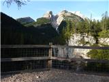 20
20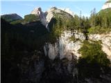 21
21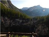 22
22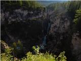 23
23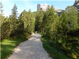 24
24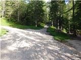 25
25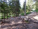 26
26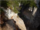 27
27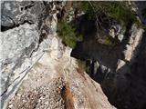 28
28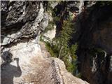 29
29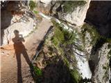 30
30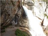 31
31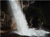 32
32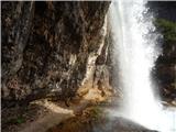 33
33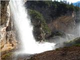 34
34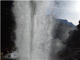 35
35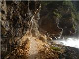 36
36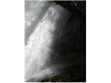 37
37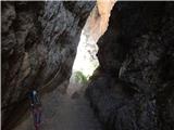 38
38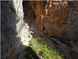 39
39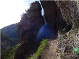 40
40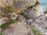 41
41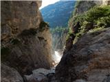 42
42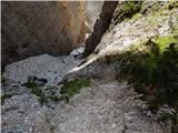 43
43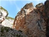 44
44 45
45 46
46 47
47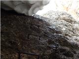 48
48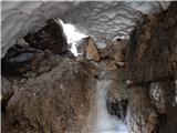 49
49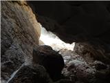 50
50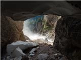 51
51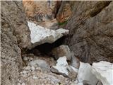 52
52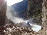 53
53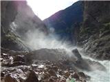 54
54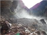 55
55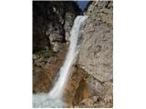 56
56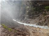 57
57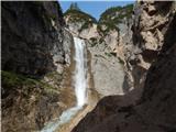 58
58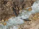 59
59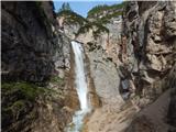 60
60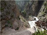 61
61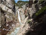 62
62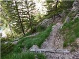 63
63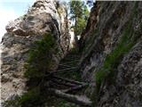 64
64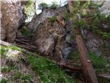 65
65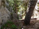 66
66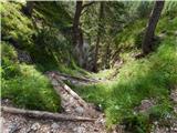 67
67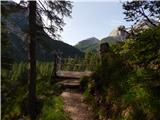 68
68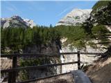 69
69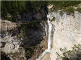 70
70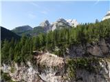 71
71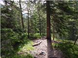 72
72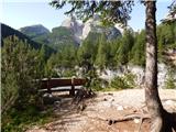 73
73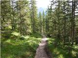 74
74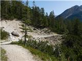 75
75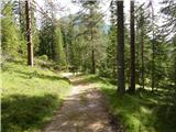 76
76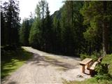 77
77
Discussion about the trip Sant'Uberto - Cascata di Fanes (Via Ferrata Giovanni Barbara)
|
| robi1430. 05. 2015 |
This year I plan to visit this valley and walk among the waterfalls too.
There will also be a two-year-old boy with us, whom I'll carry in a backpack. I'm interested in your realistic assessment of the difficulty of this via ferrata?
If possible, we would walk the entire Sentiero dei Canyons path, then continue towards GrossFanes Hutte.
Lizika, have you perhaps walked the entire path or just the first part (first waterfall)?
Thanks for the reply and have a nice day,
robi
|
|
|
|
| VanSims7. 09. 2020 |
Wow, here two-thirds of the path is secured. That bridge has been newly built; without it, I don't know how one would get to the other side of the river and to that viewpoint, except of course around via the lower bridge.
I didn't find the upper access, or rather, I found the mentioned ramp and path start only on the way out when driving from the parking lot (it's right at its beginning on the left), and probably via it one reaches that asphalt leading to the junction in photo 11.
Otherwise, the official sign for the path (Cascata, Canyons) points along the gravel road that descends slightly left of the paved road to Rifugio Sennes.
Following this approach, we descend the gravel to the first footbridge, from where we see the gorge on the right, through which only a tributary to the main river with waterfalls flows. A bit after the bridge (turn-off to Malga Ra Stua) there's a sign without path marking, but we continue straight for a couple hundred meters until the meadow called 'Pian Di Loa' opens up.
We go to the end of the meadow; there we can go straight to the junction in photo 11, but if we want to do that really steep and annoying zigzag from photo 64 on descent, at the end of the meadow go right and with a slight ascent reach the viewpoint (there are even two) and then down that zigzag, where the ferrata already starts to one side or the other. To the left we reach those benches from the description, to the right to the ferrata for access to the waterfall or behind it, i.e., under flowing water. 
From those benches from the description, we can continue up the gravel road to the upper waterfall (about a good hour's hike uphill). At the next junction from the benches, turn from the gravel into the forest (sign for Sentiero dei Canyons) and continue the ascent along the stream bed. There are two more small waterfalls along the path. At the upper larger one, there's also a circular ferrata (Chengia di Mattia), which takes us under or behind the thundering waterfall. We descend the gravel and reach the mentioned benches again.
The description of the entire path is on bergsteigen.com, though in German:
https://www.bergsteigen.com/touren/klettersteig/sentiero-dei-canyons-e-delle-cascate/
but the picture
https://www.bergsteigen.com/fileadmin/userdaten/import/topos/sentiero_dei_canyons_e_delle_cascate_topo.pdf
says more than a thousand words. 
|
|
|
|
| VanSims7. 09. 2020 |
Aha, only now do I see that the described path is the upper one leading under the waterfall. Yes, the bridge is repaired and we can go directly along the lower ferrata back to the benches and on to the upper waterfall. To the left, we then really reach the viewpoint via the zigzag.
Also @lizika: The 'very demanding' rating is completely appropriate according to this portal's classification (i.e., what is marked with this label on it). From a ferrata perspective, it's really an easy one that an experienced ferratist will be disappointed by, but the point of visiting the waterfalls is not in ferrata pleasures but more in the beauty of nature, the gorge, and the waterfalls themselves.
|
|
|
To post a comment you must log in:
If you do not yet have a username, you must first
register.