Starting point: Sass de Pordoi (2950 m)
| Latitude/Longitude: | 46,48800°N 11,81130°E |
| |
Walking time: 1 h 30 min
Difficulty: partly demanding marked way
Elevation gain: 202 m
Elevation difference along the route: 325 m
Map:
Recommended equipment (summer):
Recommended equipment (winter): ice axe, crampons
Views: 28.113
 | 2 people like this post |
Access to starting point:
First, we drive to Cortina d'Ampezzo (you can get here via the border crossing at Rateče or Predel to Trbiž / Tarvisio and then on the highway in the direction of Udine to the Tolmezzo exit. From Tolmezzo, we follow the road in the direction of the village Ampezzo and the mountain pass Passo della Mauria. The road then descends and brings us to a crossroad, where we continue left (also right is possible) in the direction of Cortina d'Ampezzo. At all following crossroads, we follow the signs for Cortina d'Ampezzo.
In Cortina d'Ampezzo, we then follow the signs for the alpine pass Passo di Falzarego. At the mentioned pass, we come to a crossroad, where we continue on the left road in the direction of Marmolada and the settlement Arabba (right Alta Badia). The road ahead descends for quite some time, then brings us to a crossroad, where we continue right in the direction of the pass Passo Pordoi (left Marmolada). We follow the relatively wide and ascending road all the way to the mentioned pass, where we park on a large parking lot. Then we buy a ticket for the cable car, with which we go to our starting point at 2950 m.
Access from Primorska: We drive on the highway in the direction of Padova, but only to the highway junction, where we continue in the direction of Veneto and Belluno. Near Belluno, the highway ends, and we follow the road ahead in the direction of Belluno, where at a larger crossroad we continue right in the direction of the town Agordo. From the mentioned town onwards, we follow the signs for the settlement Arabba and the alpine pass Passo Pordoi, which is also the starting point for our tour. Then we buy a ticket for the cable car, with which we go to our starting point at 2950 m.
Route description:
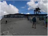
From the upper cable car station on Sass de Pordoi, we head on the path in the direction of the mountain hut Rifugio Forcella Pordoi. The wide and quite frequented path starts to descend noticeably and after approximately 15 minutes of walking brings us to the mentioned mountain hut, where the path from the pass Passo Pordoi joins from the right.
From the hut, we continue straight in the direction of the summit and hut Piz Boe. Further, a very wide and easy path, then for some time crosses the slopes towards the east, after which it brings us into more plateau-like terrain, where we reach a marked junction. We continue slightly right in the direction of the summit Piz Boe (left hut Piz Boe) on the path, which moderately ascends for a short time, then brings us to very flat terrain. Further, we barely ascend on the path, which besides the markers is also marked with numerous larger cairns. The path ahead gradually starts to ascend and quickly brings us to the southwestern ridge of the summit Piz Boe, along and beside which we then ascend. The path ahead becomes steeper and along the path we even encounter some fixed protections (undemanding), which are placed here mainly due to mass visitation (because the cable car brings you high up, on the path we can also notice those who are only wearing sandals and there are quite a few of them). We follow this wide and locally steeper path all the way to the summit Piz Boe, which we reach without major difficulties.

Photos:
 1
1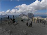 2
2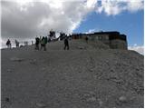 3
3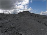 4
4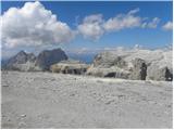 5
5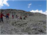 6
6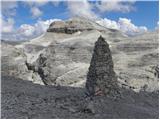 7
7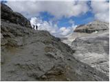 8
8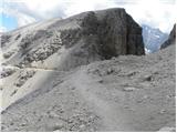 9
9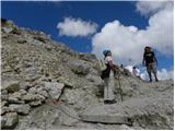 10
10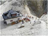 11
11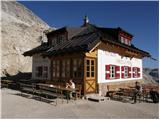 12
12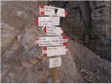 13
13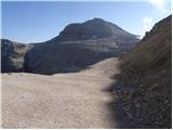 14
14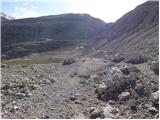 15
15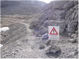 16
16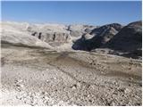 17
17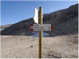 18
18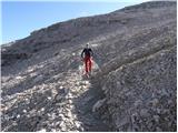 19
19 20
20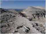 21
21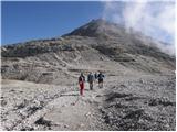 22
22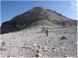 23
23 24
24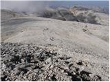 25
25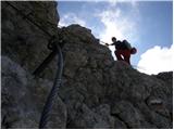 26
26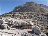 27
27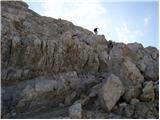 28
28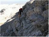 29
29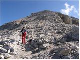 30
30 31
31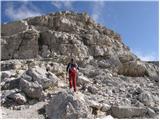 32
32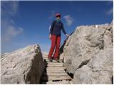 33
33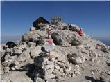 34
34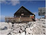 35
35
Discussion about the trip Sass de Pordoi - Piz Boe
|
| dejan6814. 10. 2015 |
How much do the Italians charge for the cable car? Lp
|
|
|
|
| acjom14. 10. 2015 |
This summer 17 EUR return ticket
|
|
|
To post a comment you must log in:
If you do not yet have a username, you must first
register.