Schiestelscharte - Falkert
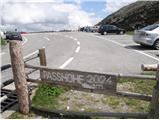
Starting point: Schiestelscharte (2024 m)
| Latitude/Longitude: | 46,89000°N 13,79410°E |
| |
Walking time: 2 h 10 min
Difficulty: partly demanding marked way
Elevation gain: 284 m
Elevation difference along the route: 500 m
Map:
Recommended equipment (summer):
Recommended equipment (winter): ice axe, crampons
Views: 2.889
 | 1 person like this post |
Access to starting point:
A) Through the Karawanks Tunnel, we drive into Austria, then continue driving on the Tauern motorway, which we leave at the Villach bypass and continue towards the town of Feldkirchen. Further, we drive along Ossiacher See to the already mentioned town. In Feldkirchen we continue left in the direction of the Turacher Höhe pass and drive past the towns Himmelberg, Gnesau, Mitterdorf to the town Wiedweg, where the road from Bad Kleinkirchheim joins from the left. From the mentioned intersection we continue towards the Turacher Höhe pass, but follow the mentioned road only a few kilometres, then signs for the alpine pass Schiestelscharte or Passhöhe direct us left onto the toll high mountain road, which we then follow to the parking lot on the already mentioned pass.
B) From Styria or Carinthia, we first drive to Dravograd and then through the Vič border crossing into Austria, where we follow signs for Klagenfurt. Further, we drive on the so-called South motorway, which we leave at Klagenfurt (direction Feldkirchen). Further, we drive on the regional road, by which we arrive at the already mentioned town. In Feldkirchen we continue right in the direction of the Turacher Höhe pass and drive past the towns Himmelberg, Gnesau, Mitterdorf to the town Wiedweg, where the road from Bad Kleinkirchheim joins from the left. From the mentioned intersection we continue towards the Turacher Höhe pass, but follow the mentioned road only a few kilometres, then signs for the alpine pass Schiestelscharte or Passhöhe direct us left onto the toll high mountain road, which we then follow to the parking lot on the already mentioned pass.
Route description:
From the parking lot, we head on the footpath in the direction of peaks Klomnock and Mallnock and lake Falkertsee. The path already at the very beginning crosses a grazing fence, behind which it starts to ascend diagonally on the left side of the mountain. A relatively steep path then leads us across relatively steep slopes, across which safety aids assist us, which are not essential. After the first steep part, the path transitions to moderately steep grassy slopes, across which we then ascend in a moderate diagonal ascent. A little further, the path becomes steeper again and with the help of a steel cable brings us to a junction a little below the summit.
Here we continue left (right Klomnock 1 minute) in the direction of summit Falkert and lake Falkertsee. The path ahead descends along a panoramic grassy ridge, then flattens and brings us to the place where the path from Mallnock joins from the right (path which bypasses Klomnock on the south side). Only a little further we cross a grazing fence and we are already at the next mountain signposts.
We continue in the already known direction towards summit Falkert, on a path which passes onto the slopes of peak Steinnock. We bypass the mentioned peak on the right side, and the still panoramic path, from which beautiful views open up on a larger part of the Nockberge group, leads us ever closer to summit Falkert. Further on, for some time in a gentle ascent we cross grassy slopes, then arrive at the slopes of peak Falkertköpfl, over which we quickly arrive at saddle Hundsfeldscharte, where at the junction we continue right in the direction of summit Falkert. We continue along the ridge as the path leads us past the upper station of the cableway and follows only the last ascent on the grassy slope to the summit.

Photos:
 1
1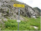 2
2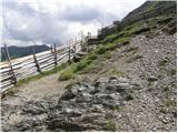 3
3 4
4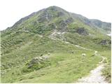 5
5 6
6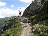 7
7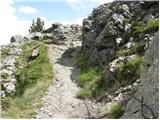 8
8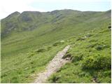 9
9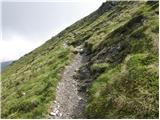 10
10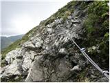 11
11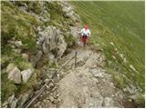 12
12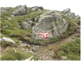 13
13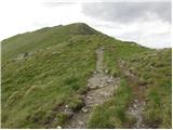 14
14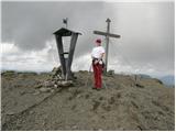 15
15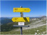 16
16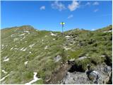 17
17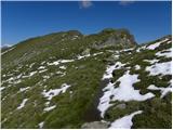 18
18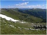 19
19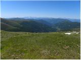 20
20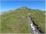 21
21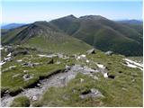 22
22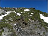 23
23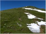 24
24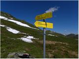 25
25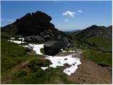 26
26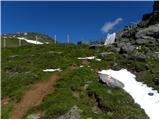 27
27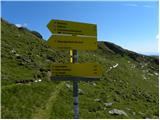 28
28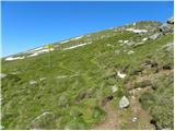 29
29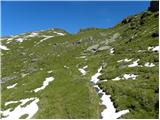 30
30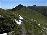 31
31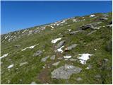 32
32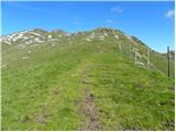 33
33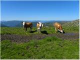 34
34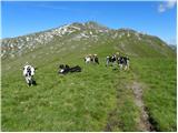 35
35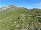 36
36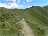 37
37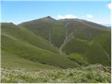 38
38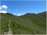 39
39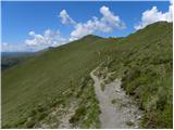 40
40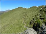 41
41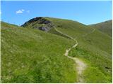 42
42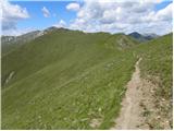 43
43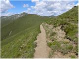 44
44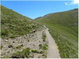 45
45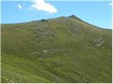 46
46 47
47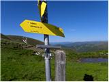 48
48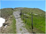 49
49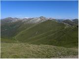 50
50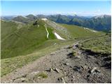 51
51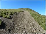 52
52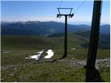 53
53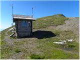 54
54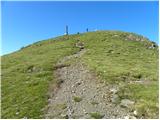 55
55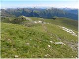 56
56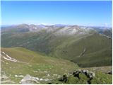 57
57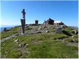 58
58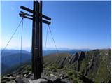 59
59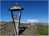 60
60
Discussion about the trip Schiestelscharte - Falkert
To post a comment you must log in:
If you do not yet have a username, you must first
register.