Schiestelscharte - Klomnock
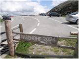
Starting point: Schiestelscharte (2024 m)
| Latitude/Longitude: | 46,89000°N 13,79410°E |
| |
Walking time: 1 h
Difficulty: partly demanding marked way
Elevation gain: 307 m
Elevation difference along the route: 307 m
Map:
Recommended equipment (summer):
Recommended equipment (winter): ice axe, crampons
Views: 5.432
 | 2 people like this post |
Access to starting point:
From Spittal we drive towards Salzburg or vice versa, but only to the settlement Kremsbrücke (from Spittal exit Gmünd, from Salzburg exit St. Peter). In the settlement Kremsbrücke, we notice signs for the alpine road Nockalmstrße, which we then follow through numerous hairpin turns to the pass at 2024 m.
Route description:
From the parking lot, we head onto the footpath in the direction of the peaks Klomnock and Mallnock and lake Falkertsee. The path already at the very beginning crosses a grazing fence, behind which it starts ascending diagonally on the left side of the mountain. A relatively steep path then leads us across relatively steep slopes, across which safety aids assist us, which are not necessarily needed. After the first steep part the path transitions to moderately steep grassy slopes, across which we then ascend in a moderate diagonal ascent. A little further, the path again becomes steeper and with the help of a steel cable brings us to a junction a little below the summit. Here we continue right and on a gentle upper slope of the mountain in a few minutes we reach the summit.
Photos:
 1
1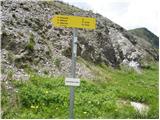 2
2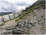 3
3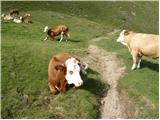 4
4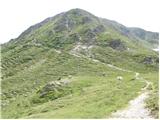 5
5 6
6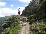 7
7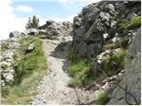 8
8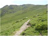 9
9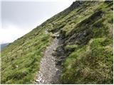 10
10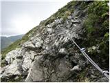 11
11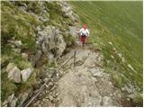 12
12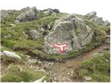 13
13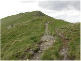 14
14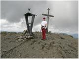 15
15
Discussion about the trip Schiestelscharte - Klomnock
|
| Pi_is_exactly_322. 06. 2017 |
From the pass there's another path to the summit that starts on the right side of the hill - 20 minutes - and then continues 40 minutes along the ridge to the top. I liked it better than the described one. But it's possible to make a nice circular tour.
|
|
|
To post a comment you must log in:
If you do not yet have a username, you must first
register.